[:ja]NASAの地球観測衛星Suomi NPPが撮影したアイスランドのファグラダルスフィヤル火山です。
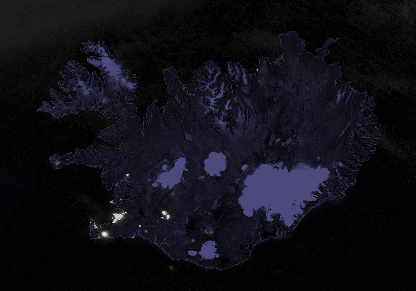
ファグラダルスフィヤルは南西アイスランドのクリースヴィーク-トロラディングヤ火山帯にある活火山で、ユーラシアプレートと北アメリカプレートの発散型境界である大西洋中央海嶺の真上(そもそもアイスランド自体がアイスランド・ホットスポットと呼ばれる活発な湧出帯により形成された陸地です)にあります。直近の噴火は2021年3月19日です。レイキャネース半島での火山噴火は約800年ぶり、ファグラダルスフィヤルの噴火は実に6,000年ぶりのことでした。4月5日にケルティンカタリル火口の北東約1kmに、長さ数百メートルの割れ目火口(メラタリル (Meradalir) 火口)が出現しました。
地上の様子はこちらです。

参考文献: NASA Earth’s Tweet
地球俯瞰画像を見る: LiVEARTH
[Earthview Wonders] No.1511: Fagradalsfjall, Iceland🇮🇸
NASA’s Suomi NPP satellite captured Fagradalsfjall, Iceland.
Fagradalsfjall is a tuya volcano formed in the Last Glacial Period on the Reykjanes Peninsula, around 40km from Reykjavík, Iceland. No volcanic eruption had occurred for 815 years on the Reykjanes Peninsula until March 19, 2021 when a fissure vent appeared in Geldingadalir to the south of Fagradalsfjall mountain. The 2021 eruption was effusive and last emitted fresh lava on 18 September 2021. The eruption was unique among the volcanoes monitored in Iceland so far and is expected to develop into a shield volcano. Due to its relative ease of access from Reykjavík, the volcano has become an attraction for local people and foreign tourists.
The local scenery on the ground is as follows.
Reference: NASA Earth’s Tweet
See earthview photo gallery: LiVEARTH[:]