[:ja]セルゲイ・クド-スべルチコフ宇宙飛行士がISSから撮影したウズベキスタンのアイダール湖(アイダルクル湖)です。
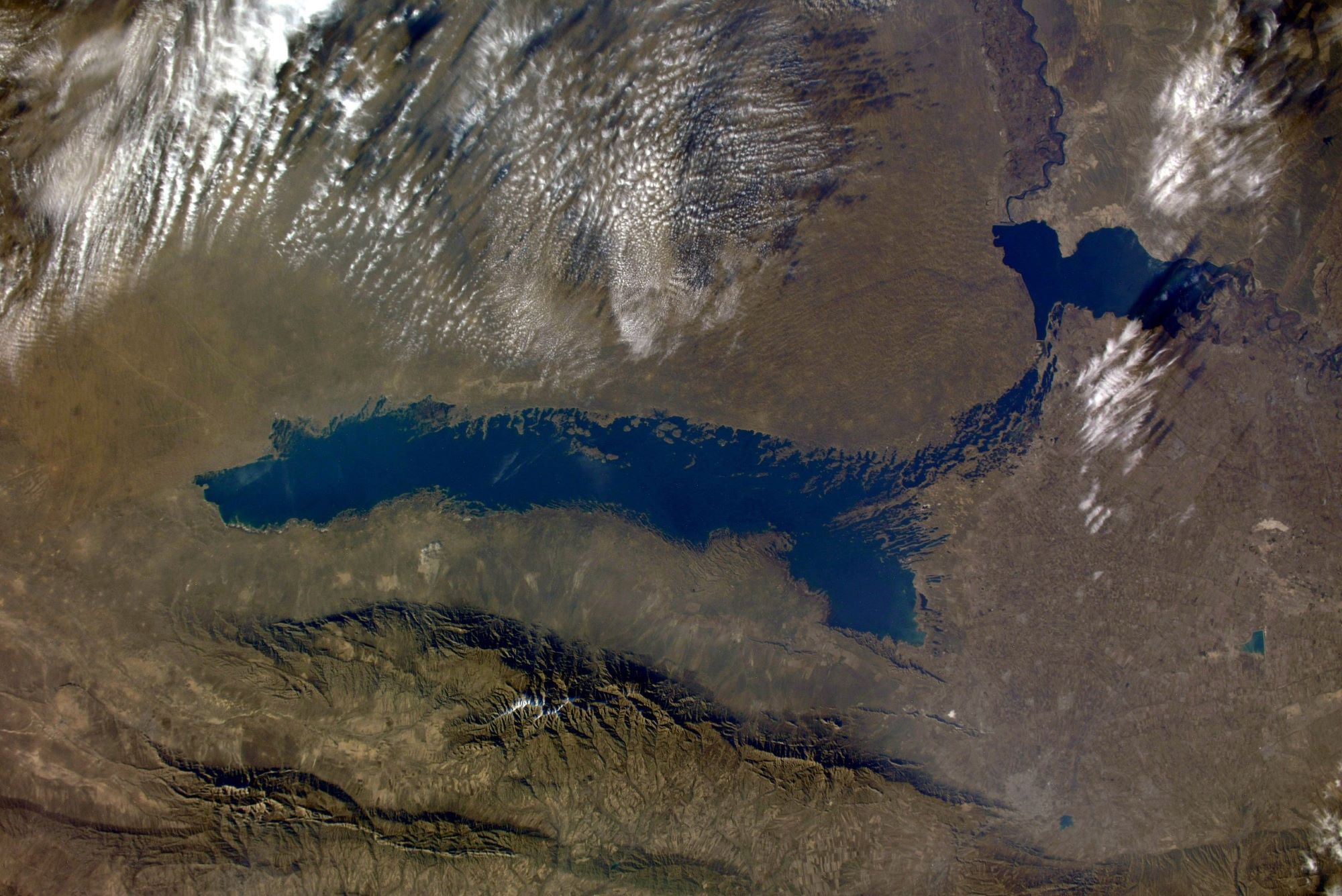
この地域にはアイダール湖、アルナサイ、トゥズカン湖の3つの汽水湖があり、現在はウズベキスタンとカザフスタンにまたがって存在するキジルクム砂漠の南東部に位置しています。アイダール湖はソビエト連邦の灌漑計画の際に副産物として意図せず出来上がったものです。1950年代まではアルナサイは塩分を多く含む干上がった低地であり、春にはトゥズカン・グリスタン湖より少量の水が流れ込むものの、それ以外は気温の高さから水が供給されず、干上がるような土地でした。1960年代前半にシルダリヤ川がせき止められ、そこにチャルダラ灌漑ダムが建設されました。1969年に大規模な洪水が起こり、ダムの許容量を越えて水が溢れ出し、1969年2月からの1年間でシルダリヤ川の年間流水量の約60%がチャルダラ貯水湖よりアルナサイ低地へと流れ込み、アイダール湖は意図せず出来上がりました。湖にはスズキ、ブリーム、ナマズ、コイ、カムルチーなど様々な魚が生息しており、釣りを楽しむこともできます。湖周辺ではキジルクム砂漠で見られる動物相に加えて、アラル海から飛来する鳥類などの様々な動物も観察することができます。
地上の様子はこちらです。

参考文献: Sergey Kud-Sverchkov’s Tweet
地球俯瞰画像を見る: LiVEARTH
[Earthview Wonders] No.1518: Aydar Lake, Uzbekistan🇺🇿
Astronaut Sergey Kud-Sverchkov captured from ISS Aydar Lake, Uzbekistan.
The Aydar Lake (Lake Aydarkul, Lake Aidarkul) is part of the man-made Aydar-Arnasay system of lakes. The lakes are expansive reservoirs of Soviet planning. In the early sixties the Syr Darya was dammed up and the Chardara Dam was constructed. Floodgates were provided in the dam for flood control, opened as in 1969 during a raging flood. In a year from Feb. 1969, almost 60% of the Syr Darya’s average flow was drained from the Chardarya Reservoir into the Arnasay lowland. In such a way new lakes were made. Its many fish include the Sazan, Pike perch originally introduced to the lake, which nowadays works as a source of industrial fishing. In addition to fauna common in the Kyzyl Kum, there are many kinds of water birds migrating from the Aral Sea that make their homes around the lake.
The local scenery on the ground is as follows.
Reference: Sergey Kud-Sverchkov’s Tweet
See earthview photo gallery: LiVEARTH[:]