[:ja]マイケル・ロペス=アレグリア宇宙飛行士がISSから撮影したカナダとアメリカにまたがるナイアガラの滝でです。
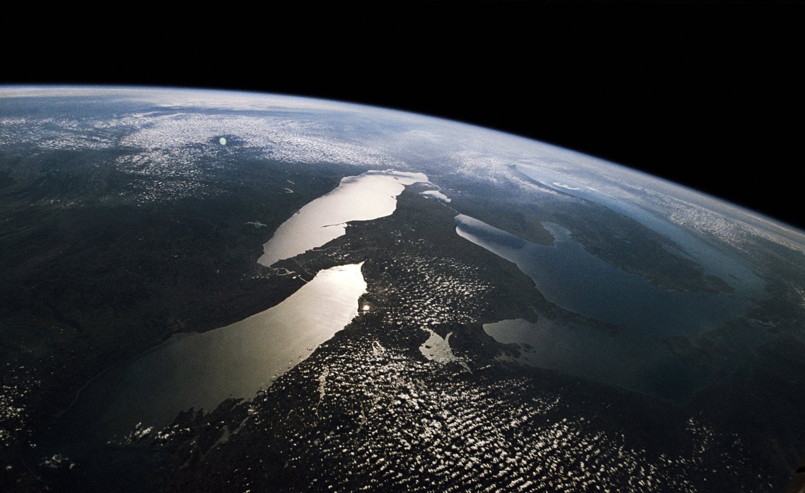
ナイアガラの滝は、エリー湖からオンタリオ湖に流れるナイアガラ川にあり、カナダのオンタリオ州とアメリカのニューヨーク州とを分ける国境になっています。滝はゴート島によって、カナダ側の国境を挟んだカナダ滝とアメリカ側のアメリカ滝およびブライダルベール滝の3つからなり、豊富な水力資源と景観の美しさで知られています。最終氷期(最後の氷河期)の後退期に形成され、五大湖の水流がナイアガラ崖線を経て大西洋に流れ込む過程にあります。
地上の様子はこちらです。

参考文献: Michael López-Alegría’s Tweet
地球俯瞰画像を見る: LiVEARTH
[Earthview Wonders] No.1534: Niagara Falls🇨🇦🇺🇸
Astronaut Michael López-Alegría captured from ISS Niagara Falls on the border of Canada and U.S.
Niagara Falls is the collective name for three waterfalls that straddle the international border between the Canadian province Ontario and the American state of New York. U.S. has the American Falls and the Bridal Veil Falls while The Horseshoe Falls lies on the Canadian side. Niagara Falls was formed when glaciers receded at the end of the Wisconsin glaciation (the last ice age).
The local scenery on the ground is as follows.
Reference: Michael López-Alegría’s Tweet
See earthview photo gallery: LiVEARTH[:]