[:ja]宇宙飛行士がISSから撮影したアフリカ、ガーナのキータ・ラグーン保護区です。
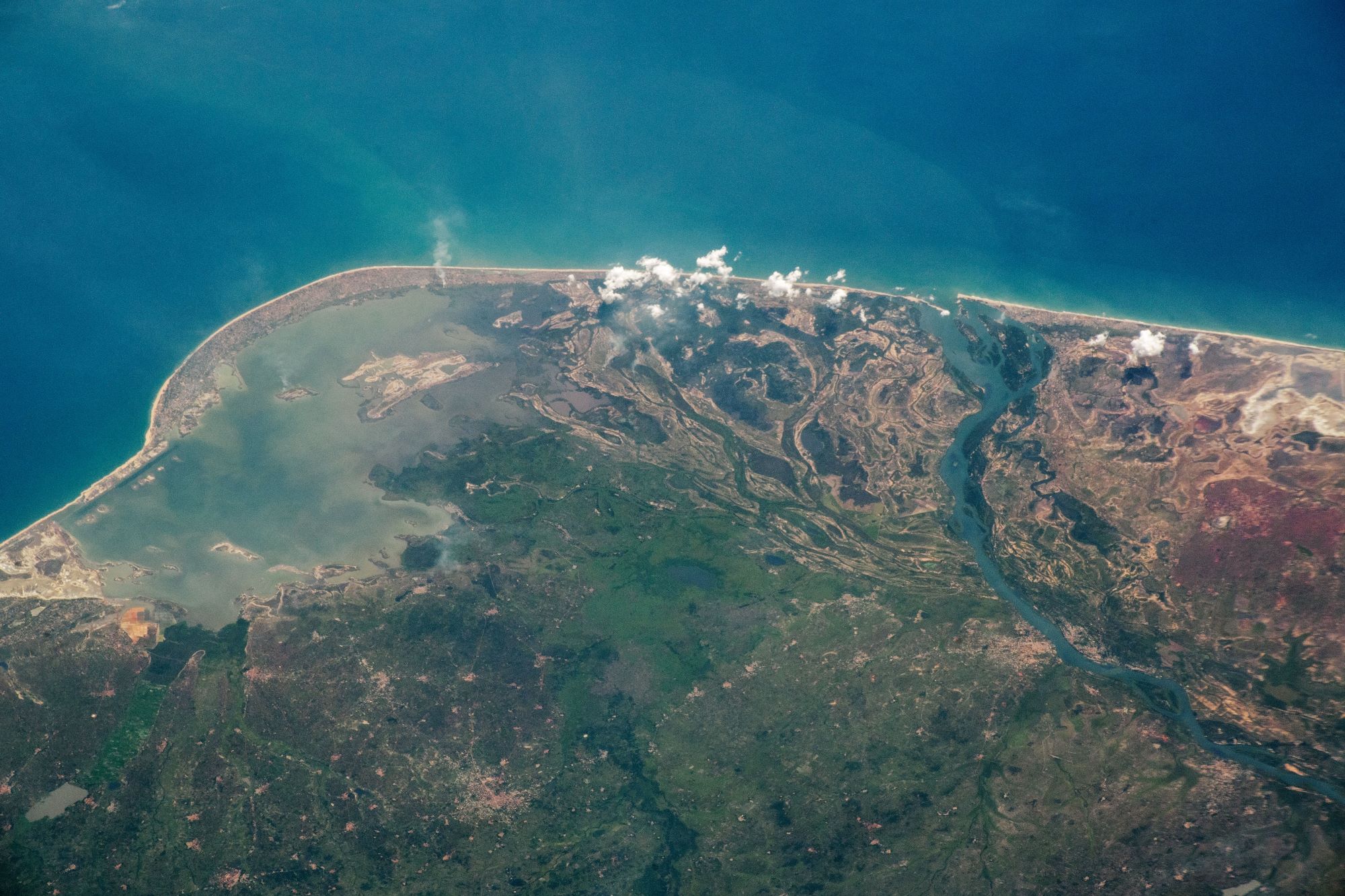
西アフリカのガーナ共和国の南は大西洋に面しています。脱植民地化が活発であった最中の1957年、サハラ以南のアフリカにおいて初めて現地人が中心となってヨーロッパの宗主国から独立を達成した国家です。イギリス領ゴールド・コーストと呼ばれていましたが、独立に際して国名を「ガーナ」に変更しました。また、初代大統領ンクルマは、アフリカ統一運動を推進したことで有名です。ダイヤモンドや金を産出しており、カカオ豆の産地としても有名。2010年12月から沖合油田で原油・ガス生産が始まり、国際的に大きな注目を集めています。キータ・ラグーンはガーナ南岸に126kmに広がる同国最大の潟です。砂州によってガーナ湾と区切られていますが、塩水湖で、マングローブ林などで囲まれています。1992年にラムサール条約の対象湿地となり、1999年から、浸食をおさえる工事などが進んでいます。
地上の様子はこちらです。

参考文献: NASA Earth’s Tweet
地球俯瞰画像を見る: LiVEARTH
[Earthview Wonders] No.1543: Keta Lagoon, Ghana🇬🇭
Astronaut on board ISS captured the Keta Lagoon Protected Area, Ghana.
Ghana spans diverse biomes that range from coastal savannas to tropical rain forests. With over 31 million people, Ghana is the second-most populous country in West Africa, after Nigeria. Ghana’s 4 separate British colonial territories were unified as an independent dominion within the Commonwealth of Nations on March 6, 1957, becoming the first colony in sub-Saharan Africa to achieve sovereignty. Ghana subsequently became influential in decolonisation efforts and the Pan-African movement. Keta Lagoon is the largest of the over 90 lagoons that cover the 550km stretch of the coastline of Ghana. This lagoon is 126km in length. It is located in the eastern coast of Ghana and separated from the Gulf of Guinea by a narrow strip of sandbar. This open salty water is surrounded by flood plains and mangrove swamps. In 1992 the Keta Lagoon was placed on the list of Wetlands of International Importance by the Ramsar Convention on Wetlands, and in 1999 work began on measures to limit further erosion and to control flooding of the coastal region.
The local scenery on the ground is as follows.
Reference: NASA Earth’s Tweet
See earthview photo gallery: LiVEARTH[:]