[:ja]シェーン・キンブロー宇宙飛行士がISSから撮影したスーダンの首都ハルツーム郊外と青ナイルです。
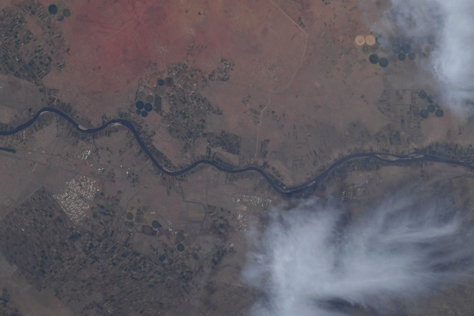
ハルツームは1820年にエジプトのムハンマド・アリー朝による支配の拠点として築かれ、現在の首都地域の人口は約500万人です。ナイル航路の拠点となり、奴隷貿易の中継地として栄えました。ウガンダから流れる白ナイルと、エチオピアから流れる青ナイルの合流地点の南岸に位置し、ナイル川はここからエジプトを通り、北の地中海へ向かいます。11月から5月までが乾期、7月・8月が雨期である。この2か月間で年間降水量160mmのほとんどを占めます。最高気温平均は4月から6月は40℃を超え、53℃に達することがあります。1990年代にスーダン国内の油田開発が活発になり、非メジャー石油企業の進出が目立つようになりました。ハルツーム北部に建設された精油所は、紅海に面したポートスーダンとパイプラインで結ばれており、同国の重要な経済施設となっています。
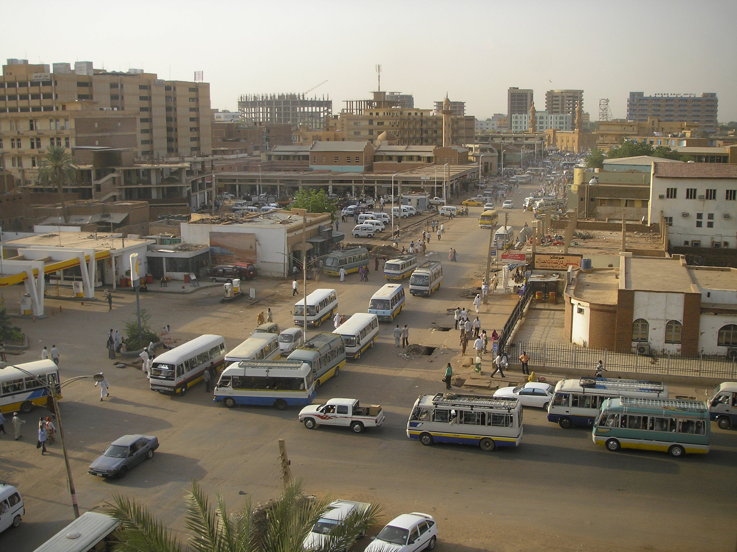
ハルツームの地上の様子はこちらです。
ハルツーム付近の青ナイルの地上の様子はこちらです。

参考文献: Shane Kimbrough’s Tweet
地球俯瞰画像を見る: LiVEARTH
[Earthview Wonders] No.1550: Khartoum and Blue Nile🇸🇩
Astronaut Shane Kimbrough captured from ISS the suburb of Khartoum, the capital of Sudan and the Blue Nile.
Khartoum or Khartum was founded in 1821 as part of Ottoman Egypt, north of the ancient city of Soba, and has a 5 million metropolitan area population today. It is located at the confluence of the White Nile, flowing north from Lake Victoria, and the Blue Nile, flowing west from Lake Tana in Ethiopia. The place where the two Niles meet is known as al-Mogran or al-Muqran. From there, the Nile continues north towards Egypt and the Mediterranean Sea. Khartoum is relatively flat, at elevation 385m. Khartoum features a hot desert climate (Köppen climate classification BWh) with a dry season occurring during winter, typical of the Saharo-Sahelian zone, which marks the progressive passage between the Sahara Desert’s vast arid areas and the Sahel’s vast semi-arid areas. The climate is extremely dry for most of the year, with about eight months when average rainfall is lower than 5mm.
The local scenery on the ground of Khartoum is as follows.
The local scenery on the ground of the Blue Nile near Khartoum is as follows.
Reference: Shane Kimbrough’s Tweet
See earthview photo gallery: LiVEARTH[:]