[:ja]宇宙飛行士が天宮号宇宙ステーションから撮影したタクラマカン砂漠とホータンです。
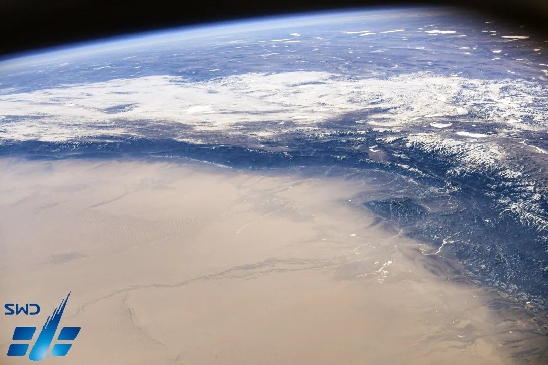
ホータン市はタリム盆地の南、チベットへと向かう崑崙山脈の北麓に位置しており、崑崙山脈から流れるユルンカシュ川とカラカシュ川に挟まれたオアシス都市です。合流してホータン川となるこれら2つの河川の水利によって都市は繁栄し、古来から農耕と果樹栽培が行われていました。「クルバック」と呼ばれる十字路が町の中心となっています。また、ホータンは高品質の軟玉の産地として知られています。
地上の様子はこちらです。

参考文献: CNSA’s Tweet
地球俯瞰画像を見る: LiVEARTH
[Earthview Wonders] No.1554: Taklamakan Desert and Hotan🇨🇳
Astronaut on board the Chinese Space Station captured the Taklamakan Desert and Hotan.
Hotan is a major oasis town at the southern end of Tarim Basin, in southwestern Xinjiang, an autonomous region in Western China. It lies just north of the Kunlun Mountains, which are crossed by the Sanju, Hindutash and Ilchi passes. An important station on the southern branch of the historic Silk Road, Hotan has always depended on two strong rivers-the Karakash River and the White Jade River to provide the water needed to survive on the southwestern edge of the vast Taklamakan Desert. The White Jade River still provides water and irrigation for the town and oasis.
The local scenery on the ground is as follows.
Reference: CNSA’s Tweet
See earthview photo gallery: LiVEARTH[:]