[:ja]NASAの地球観測衛星Terraが撮影したカスピ海上の層積雲です。
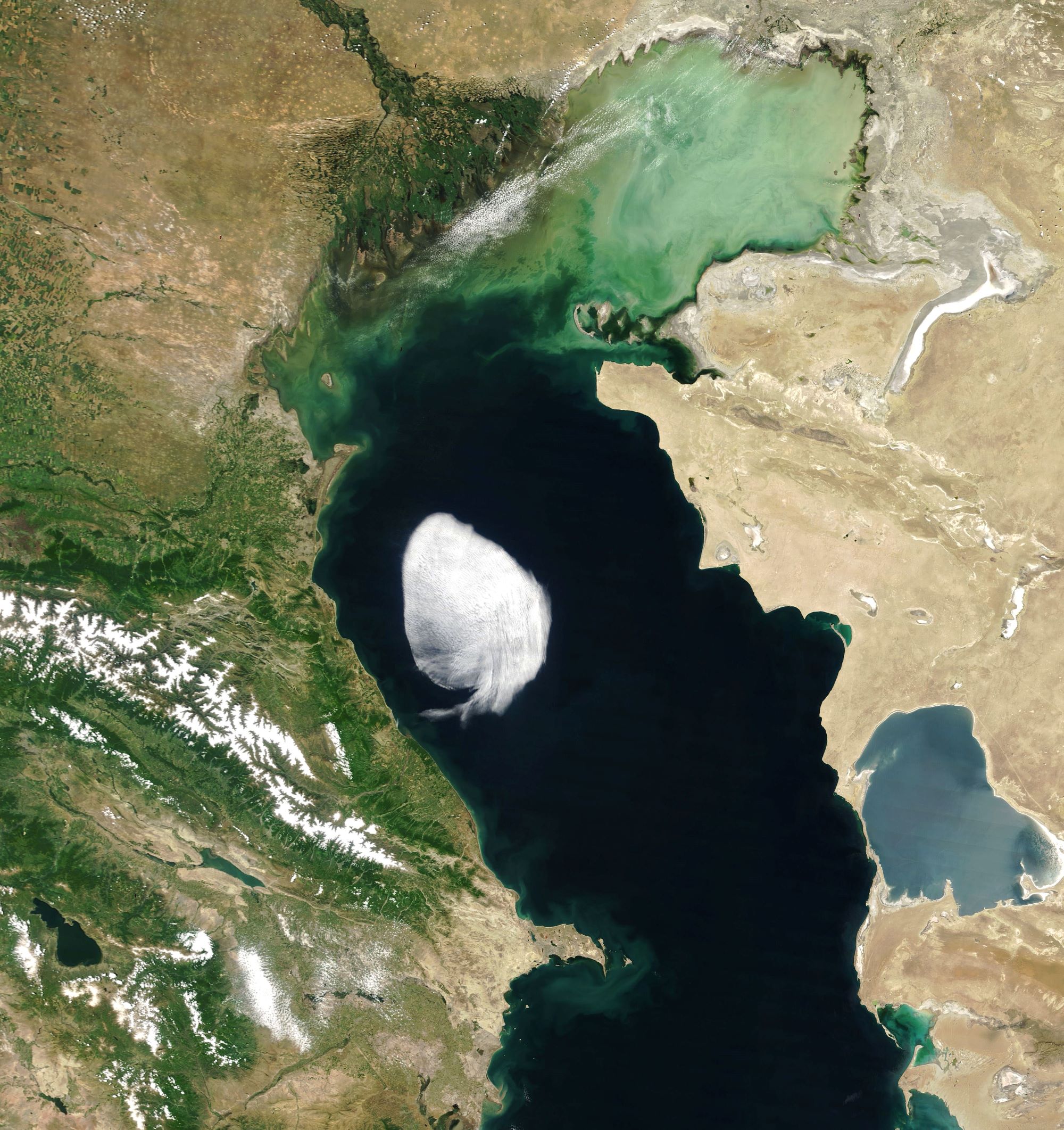
大気科学の専門家によると、このカスピ海上の雲は層積雲です。層積雲は雲の一種で、白色または灰色で、大きな塊が群れをなし、ロール状、斑状、層状などと形容される集まり方をした雲です。この画像の層積雲は水平方向に100km四方に広がっています。層積雲は通常、600~2000mの高度に形成されますが、この雲は1,500m程度と見られます。バルカン半島からの暖気が、カスピ海上の寒気とぶつかって、この層積雲が形成されたと考えられています。
参考文献: NASA Earth’s Tweet
地球俯瞰画像を見る: LiVEARTH
[Earthview Wonders] No.1574: Stratoculumus Over Caspian Sea
NASA’s Terra satellite captured stratocumulus over the Caspian Sea.
According to an atmospheric scientist, the cloud is a small stratocumulus. The cloud type is puffy like a cumulus cloud; cumulus is the Latin word for “heap” or “pile.” But unlike a cumulus cloud, the “heaps” in a stratocumulus cloud are clumped together, forming a widespread horizontal cloud layer. The stratocumulus pictured here formed a layer spanning about 100km across. Stratocumulus clouds form at low altitudes, generally between 600-2000m. This cloud was probably hovering at an altitude of about 1,500m. According to the scientist, the cloud could have formed when warm, dry air-possibly from the Balkans-encountered colder, moist air over the Caspian. It then drifted across the sea and dissipated when it reached land.
Reference: NASA Earth’s Tweet
See earthview photo gallery: LiVEARTH[:]