[:ja]ESAの地球観測衛星Copernicus Sentinel-2が撮影したペルーの首都リマです。
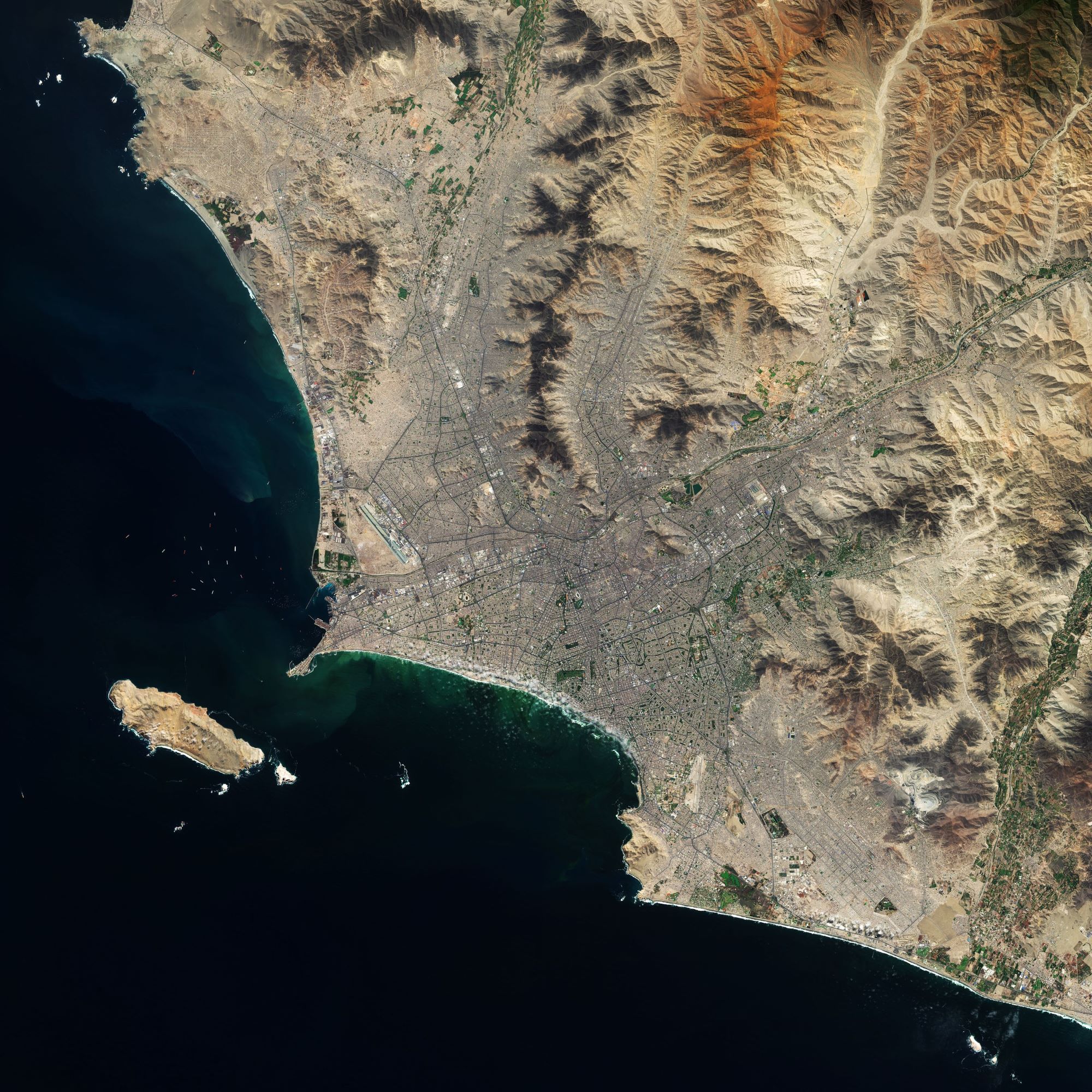
リマは人口1,000万人超を擁するペルーの政治、文化、金融、商業、工業の中心地です。画像からもわかりますが、チャラと呼ばれる海岸砂漠地帯に位置しています。市街地は植民地時代に建てられた建物が多く残るリマ・セントロ地区(1988年、ユネスコの世界遺産に登録)、それより海岸側の新市街(サン・イシドロ地区・ミラフローレス地区など三輪モトタクシー乗入れ禁止の閑静で裕福な地域)、それらの新旧市街地を取り巻く複数の人口密集地域(第二次世界大戦後に発展)、以上の三つに分類できます。リマは1535年にインカ帝国を征服したスペイン人のコンキスタドール、フランシスコ・ピサロによって築かれました。リマの名前の由来は市内を流れるリマク川(río Rimacが訛ったもの)に由来すると言われています。
地上の様子はこちらです。

参考文献: Lima, Peru (ESA Earth From Space)
地球俯瞰画像を見る: LiVEARTH
[Earthview Wonders] No.1587: Lima🇵🇪
ESA’s Copernicus Sentinel-2 satellite captured Lima, the capital of Peru.
Lima with 10.7 million in its metropolitan area is one of the largest cities in the Americas, and is considered to be the political, cultural, financial and commercial center of the country. As can be seen from the image, it is located in the valleys of the Chillón, Rímac and Lurín Rivers, in the desert zone of the central coastal part of the country, overlooking the Pacific Ocean. Lima was named by natives in the agricultural region known by native Peruvians as Limaq. It became the capital and most important city in the Viceroyalty of Peru. Following the Peruvian War of Independence, it became the capital of the Republic of Peru. Around one-third of the national population lives in the metropolitan area. (Credit: ESA)
The local scenery on the ground is as follows.
Reference: Lima, Peru (ESA Earth From Space)
See earthview photo gallery: LiVEARTH[:]