[:ja]ジェシカ・メイヤー宇宙飛行士がISSから撮影したモロッコのフェズです。
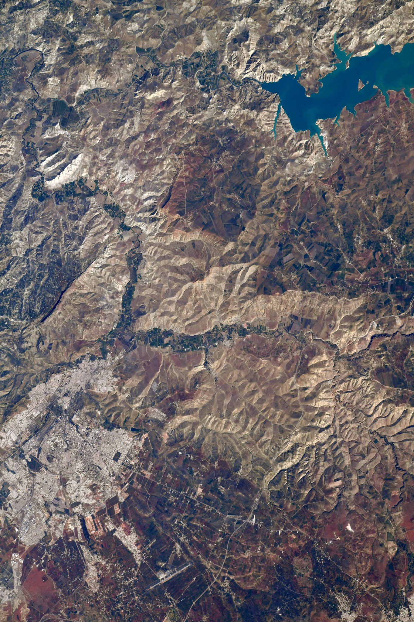
フェズはアフリカ北西端、モロッコ王国北部の内陸都市で、アラビア語では「アル=ファース」、フェスとも表記されます。アトラス山脈の北西、サイス平野の町で、フェズ川とセブー川の合流点の南に位置しています。モロッコ南部のサハラ砂漠、アトラス山脈と北の地中海沿いの都市、モロッコ西部のカサブランカ、ラバト、メクネスから東に向かう交易路の交差点に位置するフェズには隊商宿と巡礼者や商人のための小規模の商店が多く建てられました。イドリース朝、マリーン朝などのモロッコに存在した過去のイスラム王朝の多くはフェズを首都に定めていました。数世代前から町に住み続けているフェズの住民はファシ(ファーシー)と呼ばれ、彼らの間では独特の方言が話されています。フェズはラバト、マラケシュ、メクネス、カサブランカといった都市と共にモロッコの観光資源となっています。複雑な構造の旧市街地は迷路にも例えられ、1981年にユネスコの世界遺産(文化遺産)に「フェズ旧市街」が登録されました。
地上の様子はこちらです。


参考文献: Jessica Meir’s Tweet
地球俯瞰画像を見る: LiVEARTH
[Earthview Wonders] No.1595: Fez, Morocco🇲🇦
Astronaut Jessica Meir captured from ISS Fez, Morocco.
Fez is a city in northern inland Morocco and is the second largest city in the country. Located to the north west of the Atlas Mountains, Fez is linked to several important cities of different regions: Tangier, Casablanca and Rabat. The Trans-Saharan trade route may be accessed via Marrakesh, 387km to the southwest of Fez. It is surrounded by hills and the old city is centered around the Fez River (Oued Fes) flowing from west to east. Fez was founded under Idrisid rule during the 8th-9th centuries CE. It initially consisted of two autonomous and competing settlements. Successive waves of mainly Arab immigrants from Ifriqiya (Tunisia) and al-Andalus (Spain/Portugal) in the early 9th century gave the nascent city its Arab character. Today, the city consists of two old medina quarters, Fes el-Bali and Fes Jdid, and the much larger modern urban Ville Nouvelle area founded during the French colonial era.
The local scenery on the ground is as follows.
Reference: Jessica Meir’s Tweet
See earthview photo gallery: LiVEARTH[:]