[:ja]NASAの地球観測衛星Terraが撮影したフィンランド湾に広がる藻です。8月中旬の湾の海水温が例年と比べて2~3度高く、藻が広範囲に広がったと報告されています。フィンランドのヘルシンキ、エストニアのタリンも写っています。
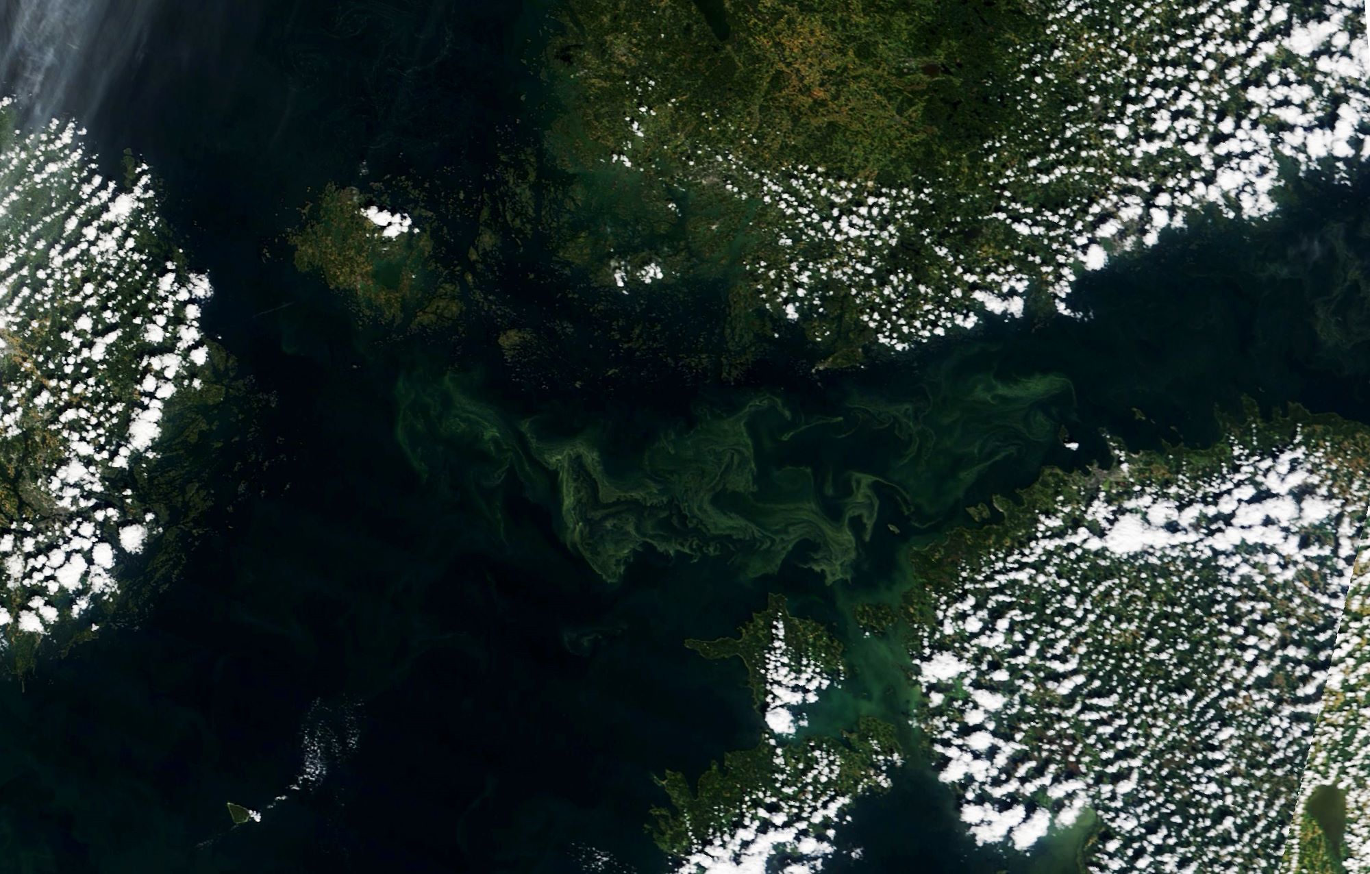
フィンランド湾はバルト海東部にある湾で、北のフィンランド、東のロシア、南のエストニアに囲まれた東西約400kmの細長い湾です。国際水路機関の「大洋と海の境界」の第3版は、エストニアのスピットハミから北西のオスムサール島、続いてフィンランドのハンコ半島の南西端によって囲まれた海域としています。平均水深は38mで、最も水深の深いところは100mになっています。多くの河川がフィンランド湾に注ぐため(うちネヴァ川は流量の3分の2を占めます)塩分濃度が低く、水面は0.2-から5.8パーミルで水底は0.3から8.5パーミルとなっています。平均水温は冬では0度に近く、夏では水面が15から17度、水底が2-3度になります。フィンランド湾、ネヴァ湾とネヴァ川の生態環境の状態は良くなく、水銀と銅のイオン、農薬の有機塩素化合物、フェノール類、石油製品、多環芳香族炭化水素によりきわめて汚染されていると報告されています。
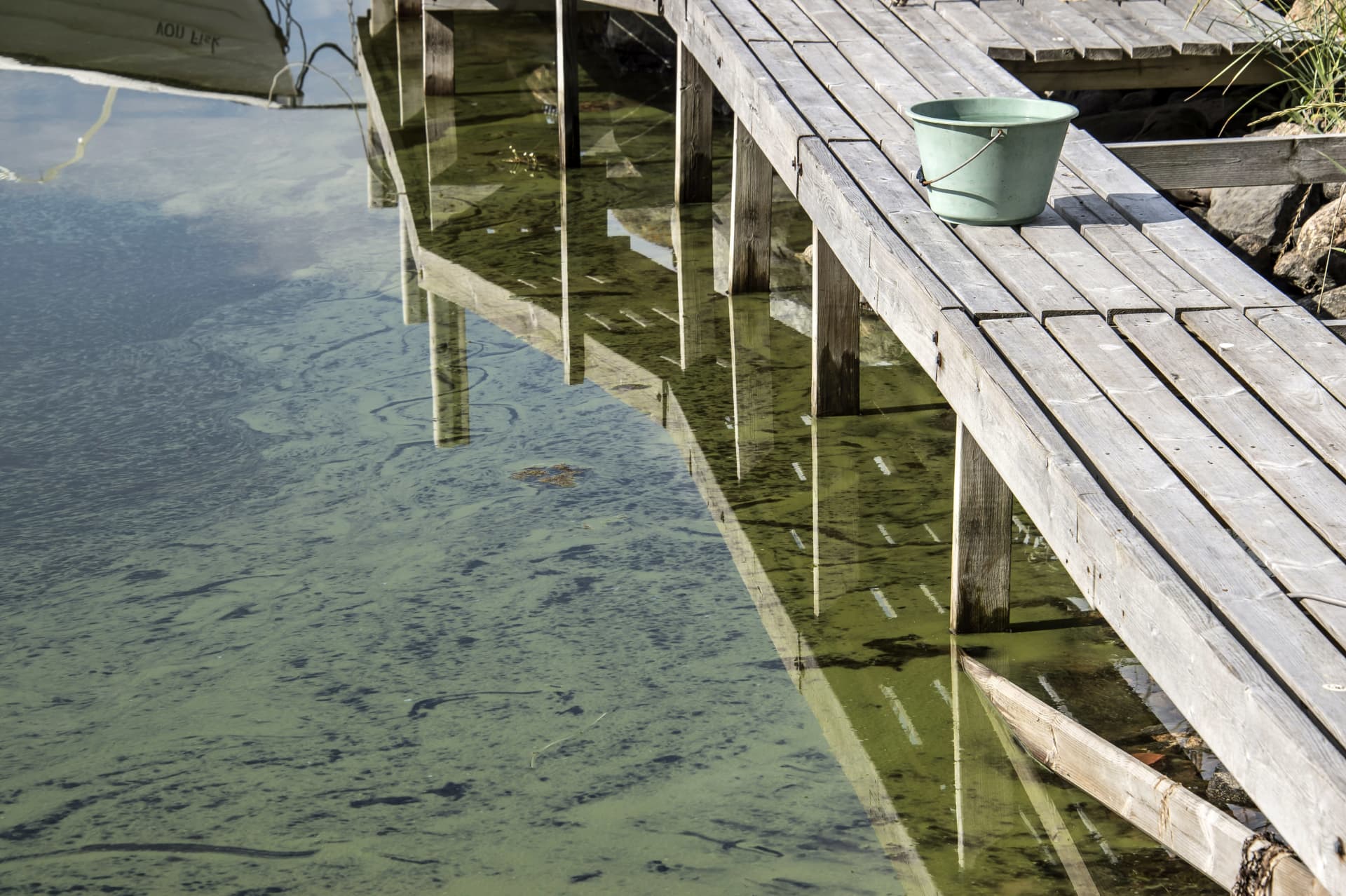
地上の様子はこちらです。
参考文献: NASA Earth’s Tweet
地球俯瞰画像を見る: LiVEARTH
[Earthview Wonders] No.1621: Green Gulf of Finland
NASA’s Terra satellite captured algea thriving in the Gulf of Finland. In mid-August, sea surface temps were 2-3°C warmer than normal in the Gulf of Finland and the Baltic Sea which lead to the thriving of blue-green algae. Helsinki of Finland and Tallinn of Estonia are also captured in the image.
The Gulf of Finland is the easternmost arm of the Baltic Sea. It extends between Finland to the north and Estonia to the south, to Saint Petersburg in Russia to the east, where the river Neva drains into it. Because of the large influx of fresh water from rivers, especially from the Neva River (two-thirds of the total runoff), the gulf water has very low salinity – between 0.2 and 0.3‰ at the surface and 0.3-0.5‰ near the bottom. The average water temperature is close to 0°C in winter; in summer, it is 15–17°C at the surface and 2–3°C at the bottom. The ecological condition of the Gulf of Finland, Neva Bay and Neva River is unsatisfactory. There is significant contamination by ions of mercury and copper, organochlorine pesticides, phenols, petroleum products and polycyclic aromatic hydrocarbons.
The local scenery on the ground is as follows.
Reference: NASA Earth’s Tweet
See earthview photo gallery: LiVEARTH[:]