[:ja]地球観測衛星Landsat 9が撮影した米国のパウェル湖です。
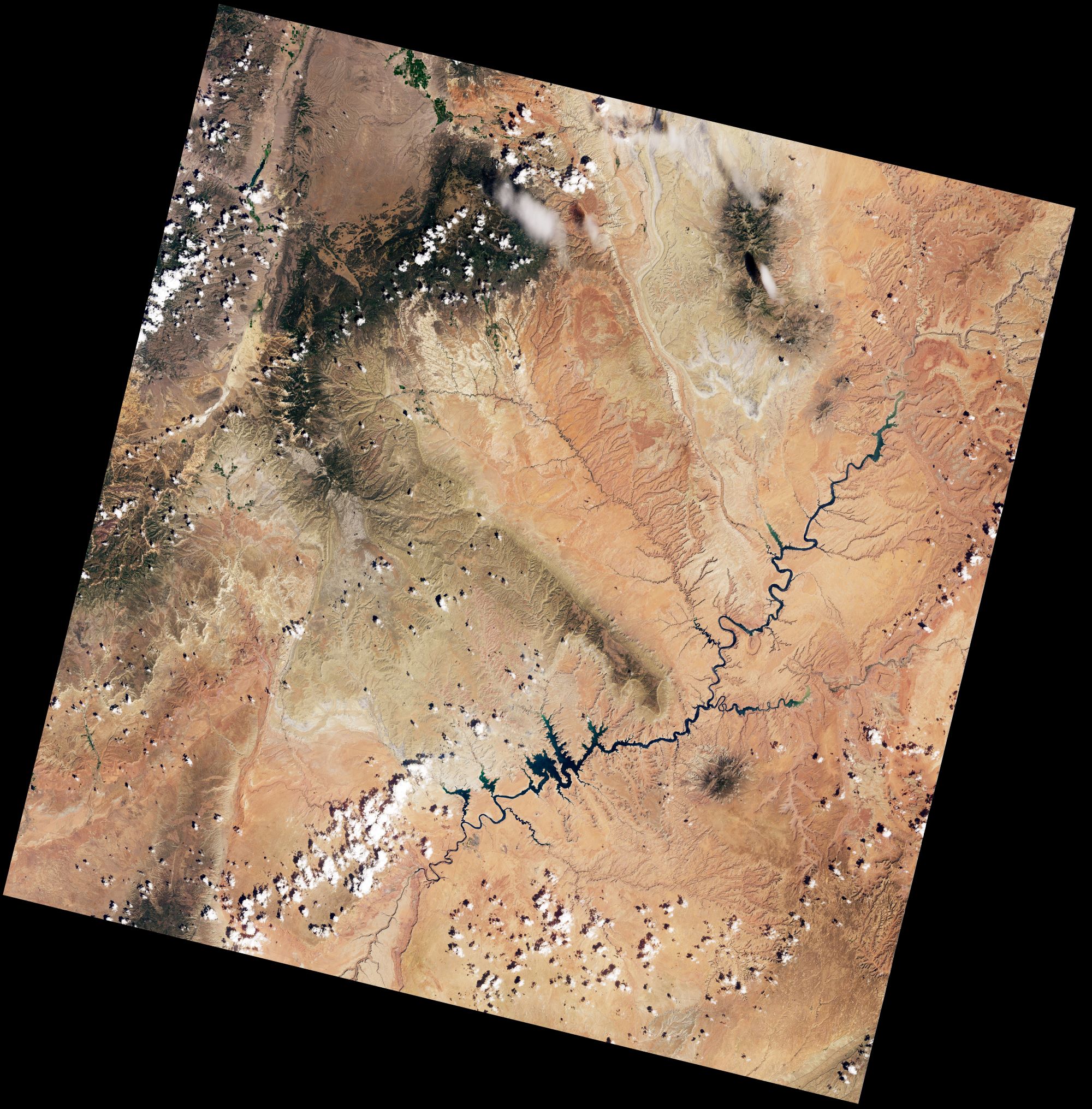
パウェル湖は、米衆国ユタ州とアリゾナ州に跨り、コロラド川の途中にある貯水池(人工湖)です。その大半はレインボーブリッジと共にユタ州内にあります。満水時の貯水量は30km3あり、アメリカ合衆国ではネバダ州とアリゾナ州にまたがっているミード湖に次いで第2位の人工貯水池です。議論の多かったグレンキャニオンダムでグレンキャニオンに水を湛えて湖になりました。乾燥が続き、2022年8月時点では26%まで貯水水準が低下し、1967年の完成後で最低水準となっています。2022年8月22日時点では、水面は1077mと、満水状態(1128m)より51mも低くなっています。
地上の様子はこちらです。

参考文献: NASA Earth’s Tweet
地球俯瞰画像を見る: LiVEARTH
[Earthview Wonders] No.1624: Lake Powell🇺🇸
Landsat 9 satellite captured Lake Powell, U.S.
Lake Powell is an artificial reservoir on the Colorado River in Utah and Arizona, U.S. It is the second largest artificial reservoir by maximum water capacity in the U.S. behind Lake Mead, storing 3.1042×10¹⁰m3 of water when full. However, Lake Mead has fallen below Lake Powell in size several times during the 21st century in terms of volume of water, depth and surface area. During summer 2022, It is currently filled to just 26% of capacity, its lowest point since 1967. On August 22, 2022, the water elevation of the lake surface was 1077m, more than 51m below “full pool” (elevation 1128m).
The local scenery on the ground is as follows.
Reference: NASA Earth’s Tweet
See earthview photo gallery: LiVEARTH[:]