[:ja]サマンサ・クリストフォレッティ宇宙飛行士がISSから撮影した北朝鮮と中国にまたがる白頭山です。
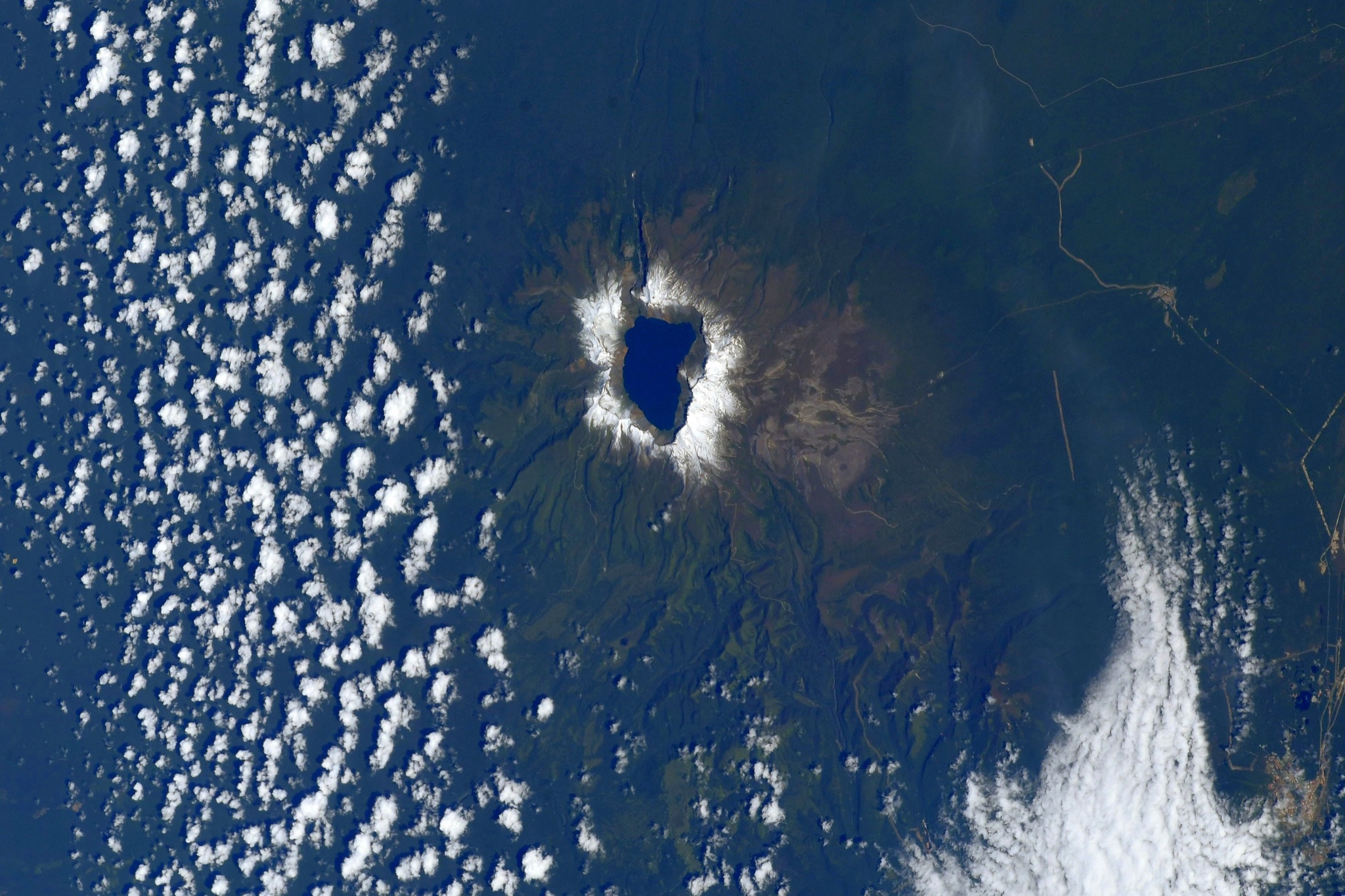
白頭山(はくとうさん・朝鮮名:ペクトゥサン)は、北朝鮮の両江道と中国の吉林省の国境地帯にある標高2,744mの火山です。山頂には天池とよばれる直径約5kmのカルデラ湖が存在する、玄武岩の溶岩台地上に形成された成層火山です。過去4000年の間に大規模な噴火を3度繰り返しました。西暦1000年ごろにおきた噴火は白頭山の1万年間の噴火史上で最大のもので、アルカリ流紋岩質マグマと粗面岩質マグマの噴火が約1年の間に立て続けにおこったと考えられています。山の中腹から頂上にかけて白い軽石に覆われているので、白頭山の名がついたといわれています。
地上の様子はこちらです。

参考文献: Samantha Cristoforetti’s Tweet
地球俯瞰画像を見る: LiVEARTH
[Earthview Wonders] No.1627: Paektu Mountain🇰🇵🇨🇳
Astronaut Samantha Cristoforetti captured from ISS Paektu Mountain on the Chinese-North Korean Border.
Paektu Mountain, also known as Baekdu Mountain and in China as Changbai Mountain, is an active stratovolcano on the Chinese–North Korean border. At 2,744m, it is the highest mountain of the Baekdudaegan and Changbai ranges. Koreans assign a mythical quality to the volcano and its caldera lake, considering it to be their country’s spiritual home. It is the highest mountain in North Korea and Northeast China. A large crater lake, called Heaven Lake, is in the caldera atop the mountain. The mountain plays an important mythological and cultural and nationalistic role in the societies and civil religions of both contemporary Korean states. For instance, it is mentioned in both of their national anthems and is depicted on the national emblem of North Korea. The mountain is regarded by the Manchu people as their ancestral homeland, and it was a symbol of imperial power in the Qing, the last imperial dynasty of China. (Credit: Samantha Cristoforetti, ESA, NASA)
The local scenery on the ground is as follows.
Reference: Samantha Cristoforetti’s Tweet
See earthview photo gallery: LiVEARTH[:]