[:ja]セルゲイ・コルサコフ宇宙飛行士がISSから撮影したタスマン海に太陽光が反射している様子です。
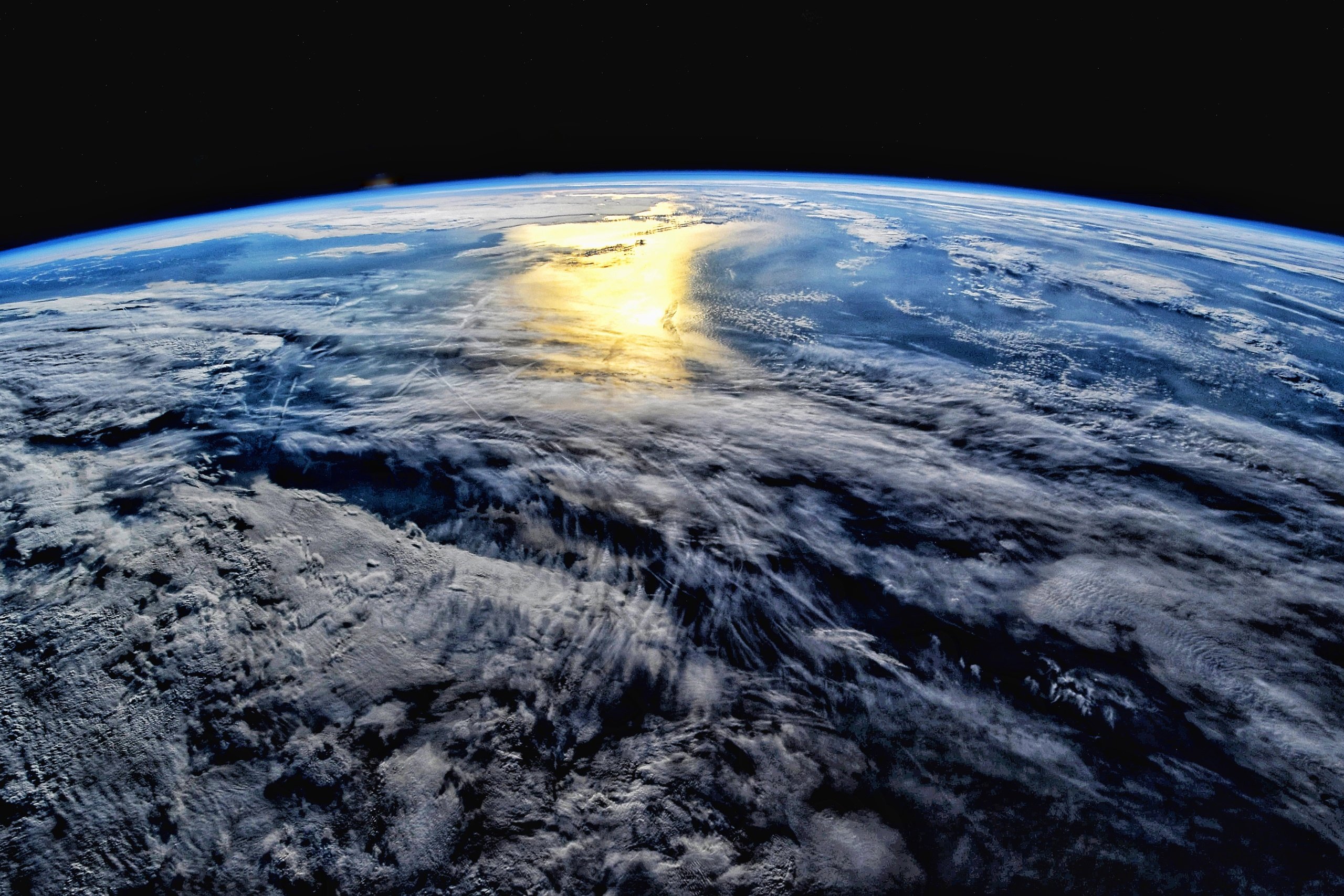
タスマン海は、オーストラリア南東部やタスマニア島とニュージーランドに挟まれた太平洋南部の海域で、水深は最高で5,257mです。オーストラリアやニュージーランドなどでは、タスマン海のことを俗にザ・ディッチ (The Ditch) と呼んでいます。1642年に来航したオランダの探検家アベル・タスマンにちなんで、1890年に命名されました。のちにイギリスの探検家キャプテン・クックも1770年代にタスマン海を探検しています。
参考文献: Sergey Korsakov’s Tweet
地球俯瞰画像を見る: LiVEARTH
[Earthview Wonders] No.1629: Tasman Sea
Astronaut Sergey Korsakov captured from ISS sunlight reflected on the Tasman Sea.
The Tasman Sea (Māori: Te Tai-o-Rēhua) is a marginal sea of the South Pacific Ocean, situated between Australia and New Zealand. It measures about 2,000km across and about 2,800km from north to south. The sea was named after the Dutch explorer Abel Janszoon Tasman, who in 1642 was the first known person to cross it. British explorer Lieutenant James Cook later extensively navigated the Tasman Sea in the 1770s during his three voyages of exploration. The Tasman Sea is informally referred to in both Australian and New Zealand English as the Ditch. (Credit: Sergey Korsakov, Roscosmos)
Reference: Sergey Korsakov’s Tweet
See earthview photo gallery: LiVEARTH[:]