[:ja]NASAの地球観測衛星Suomi NPPが撮影した夜のバングラデシュです。
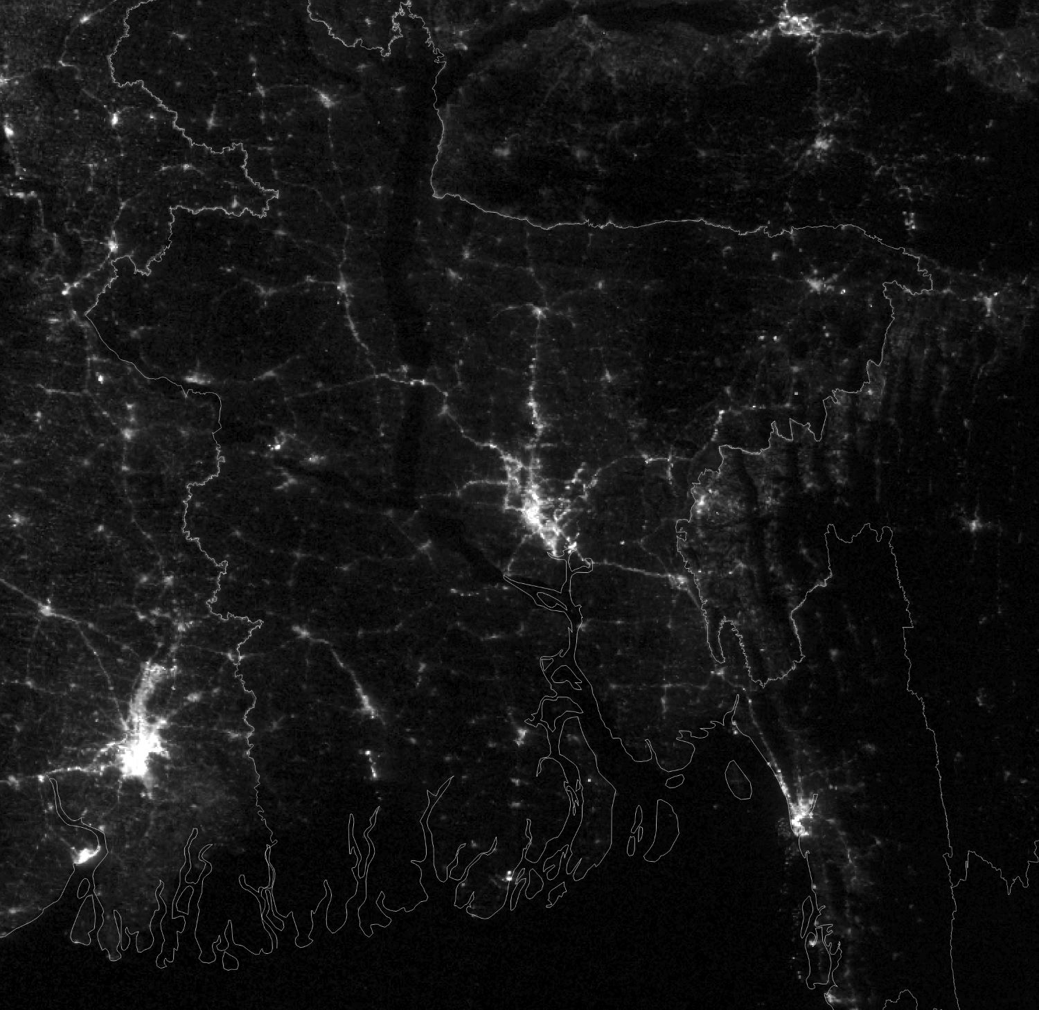
1988年から2022年の間に、首都ダッカの人口は570万人から4倍近くの2200万人にまで増加しました。夜のバングラデシュの画像を見ると、ダッカ以外の低地の明かりが増加しており、気候難民が増加していると報告されています。バングラデシュは地形の大部分が平坦なことから、殆どの耕作地域は雨季に河川の溢水により水に沈み、時折耕作地域だけでなく、土盛りして高台にしている住宅地や幹線道路も浸水被害を受けます。こういった大洪水が「ボンナ」と呼ばれ、破壊と災厄をもたらすものとみなされる一方で、毎年起こる程度の適度な洪水は「ボルシャ」と呼ばれ、土壌に肥沃さをもたらし、豊かな漁場とありあまるほどの水、豊作をもたらす恵みの存在と考えられてきました。しかし、近年の人口増加、気候変動の影響により、川の流域に住む人々が増え、家などを失う人口も増加しています。
参考文献: NASA Earth’s Tweet
地球俯瞰画像を見る: LiVEARTH
[Earthview Wonders] No.1634: Bangladesh🇧🇩
NASA’s Suomi NPP satellite captured Bangladesh at night.
From 1988 to 2022, the population of Dhaka ballooned from 5.7 million people to more than 22 million. That tremendous rate of growth has made Bangladesh’s capital among the most densely populated cities in the world. It also means many more people now live in areas prone to flooding. Cities throughout Bangladesh saw increased light in floodplains throughout the country from 2000 to 2018. Dhaka, Chattogram, Khulna, Sylhet, and Mymensingh were among the cities with pronounced increases. Bangladesh is predominantly rich fertile flat land. Most of it is less than 12m above sea level, and it is estimated that about 10% of its land would be flooded if the sea level were to rise by 1m.
Reference: NASA Earth’s Tweet
See earthview photo gallery: LiVEARTH[:]