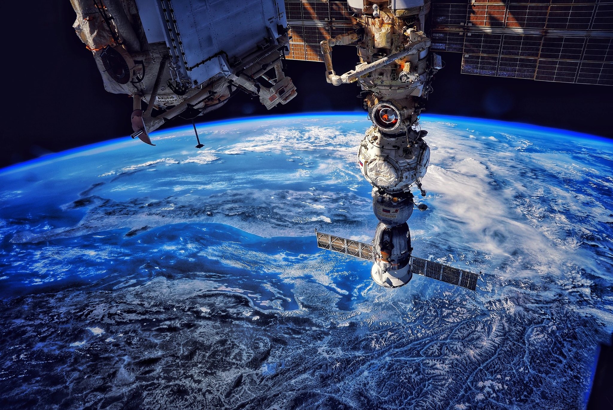
[:ja]セルゲイ・コルサコフ宇宙飛行士がISSから撮影したクロアチアです。アドリア海とイタリア半島も見えています。

クロアチアは、南ヨーロッパ、バルカン半島に位置する旧ユーゴスラビア構成国で、国民はローマ・カトリック教徒の南スラヴ系のクロアチア人が占めています。本土では西にスロベニア、北にハンガリー、東にボスニア・ヘルツェゴビナ、セルビアと国境を接している。南はアドリア海に面し対岸はイタリア、飛び地のドゥブロヴニクでは東にモンテネグロと接しています。ドゥブロヴニク地方は、ボスニア・ヘルツェゴビナのネウムによって分離され、飛び地となっています。他国を通過せずに移動できるようにするため、ドゥブロヴニク側から伸びるペリェシャツ半島とクロアチア本土との間に、長大橋ペリェシャツ橋が建設されました。また、同国は『該当地域が「分離と合併を幾度も繰り返した」歴史を持つ』国家のひとつに数え上げられます。1991年に、それまで連邦を構成していたユーゴスラビア社会主義連邦共和国から独立しました。
地上の様子はこちらです。

参考文献: Sergey Korsakov’s Tweet
地球俯瞰画像を見る: LiVEARTH
[Earthview Wonders] No.1636: Croatia🇭🇷
Astronaut Sergey Korsakov captured from ISS Croatia. Adriatic Sea and Italian Peninsula are also in this image.

Croatia is at the crossroads of Central and Southeast Europe, and shares a coastline along the Adriatic Sea. Part of the territory in the extreme south surrounding Dubrovnik is a practical exclave connected to the rest of the mainland by territorial waters, but separated on land by a short coastline strip belonging to Bosnia and Herzegovina around Neum. The Pelješac Bridge connects the exclave with mainland Croatia. After a series of a resistance movement and civil war during Yugoslavia era, on June 25 1991, Croatia declared independence, and the War of Independence was successfully fought over the subsequent four years. Croatia is classified by the World Bank as a high-income economy and ranks highly on the Human Development Index. Service, industrial sectors, and agriculture dominate the economy, respectively. (Credit: Sergey Korsakov, Roscosmos)
The local scenery on the ground is as follows.

Reference: Sergey Korsakov’s Tweet
See earthview photo gallery: LiVEARTH[:]