[:ja]トマ・ペスケ宇宙飛行士がISSから撮影したウルグアイ川です。アルゼンチン、エントレ・リオス州で、アルゼンチンとウルグアイの国境付近です。
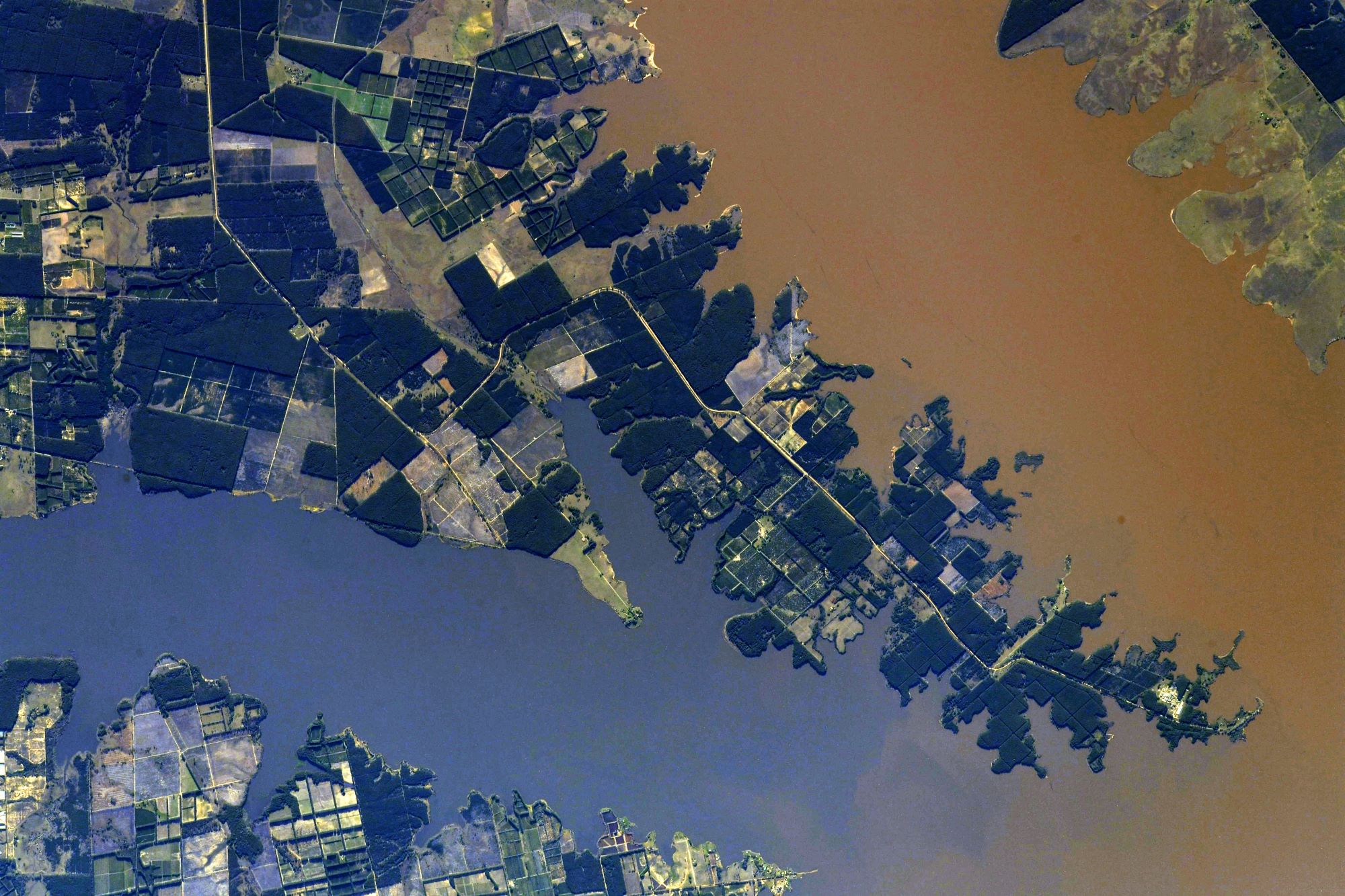
ウルグアイ川は、南アメリカを流れるラプラタ川第二の支流で、全長約1,593kmの河川でブラジルの海岸山脈の西斜面を水源とします。次第に水量を増して南西へと向きを変え、ブラジルとアルゼンチンの国境となって流れますが、ペペリグアス川との合流点の下流数kmで、川幅は460mから最小21mに急激に狭まり、急流となって13kmの区間を流れます。クアライ川との合流点より下流では、ウルグアイ川がウルグアイとアルゼンチンの国境となり、南へ向かって流れ、長さが約99kmのウルグアイ川最大の支流であるネグロ川を合わせ、川幅を一気に6~10kmに広げ、およそ100km流れてラプラタ川へと合流します。河口からメルセデスまでの約50kmは、かなりの大型の船でも航行できます。
地上の様子はこちらです。

参考文献: Thomas Pesquet’s Tweet
地球俯瞰画像を見る: LiVEARTH
[Earthview Wonders] No.1649: Uruguay River🇦🇷
Astronaut Thomas Pesquet captured from ISS Uruguay River. The image shows Isthilart, provincia de Entre Ríos, Argentina.
The Uruguay River is a major river in South America. It flows from north to south and forms parts of the boundaries of Brazil, Argentina, and Uruguay, separating some of the Argentine provinces of La Mesopotamia from the other two countries. The river measures 1,838km in length and starts in the Serra do Mar in Brazil, where the Canoas River and the Pelotas River are joined, at about 200m above mean sea level. In this stage the river goes through uneven, broken terrain, forming rapids and falls. Its course through Rio Grande do Sul is not navigable. Together with the Paraná River, the Uruguay forms the Río de la Plata estuary. The drainage basin of the Uruguay River has an area of 365,000km2. Its main economic use is the generation of hydroelectricity and it is dammed in its lower portion by the Salto Grande Dam and by the Itá Dam upstream in Brazil. (Credit: Thomas Pesquet, ESA, NASA)
The local scenery on the ground is as follows.
Reference: Thomas Pesquet’s Tweet
See earthview photo gallery: LiVEARTH[:]