[:ja]イワン・ワグナー宇宙飛行士がISSから撮影したタジキスタンのサレス湖です。
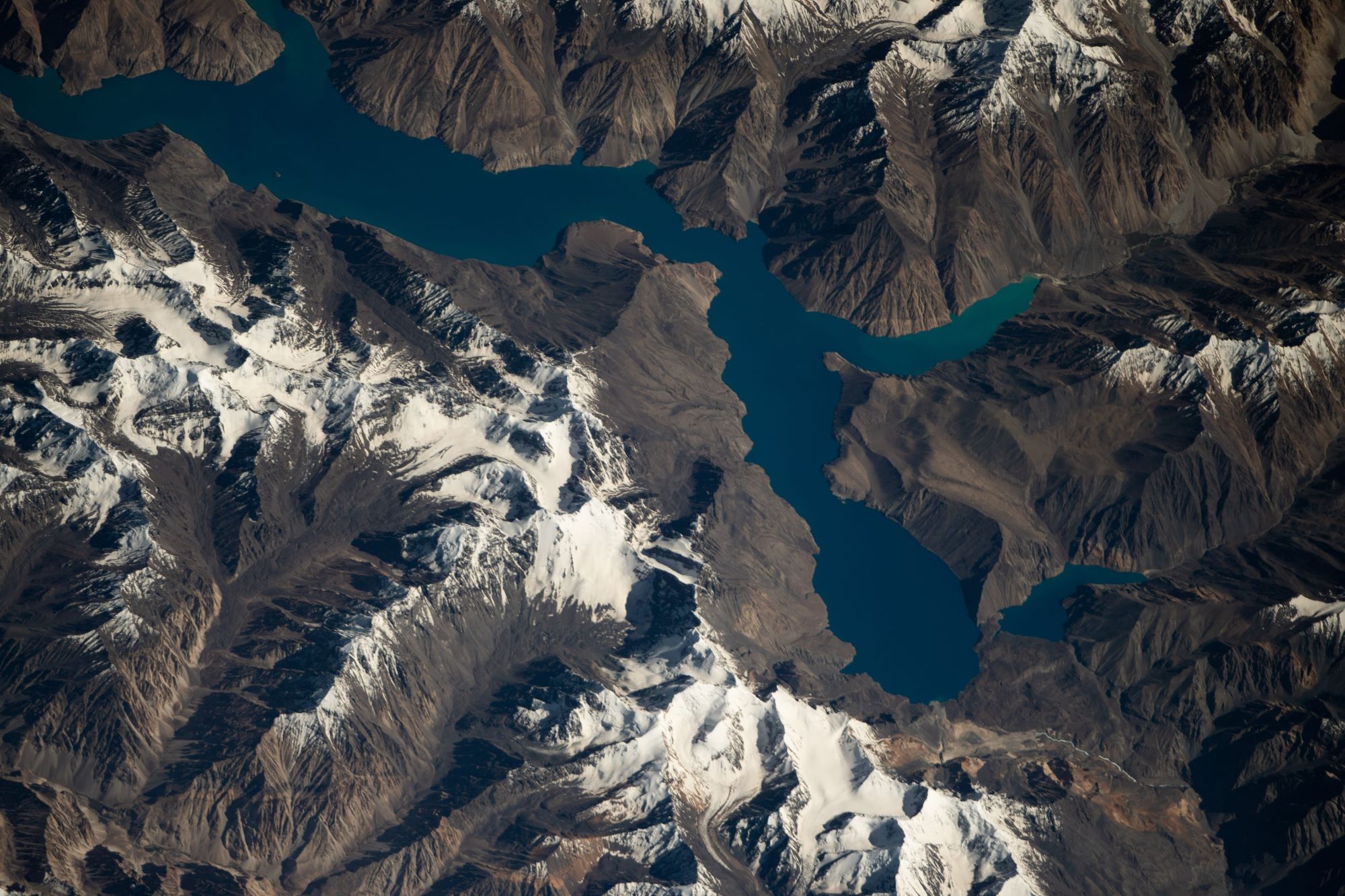
タジキスタンには約1450の湖がありますが、一部は海抜4,000メートル以上の高地に位置しています。サレス湖はタジキスタンでも神秘的な湖として知られ、パミール山脈の宝石は「眠り龍」と呼ばれています。サレス湖は、1911年の冬に南東部のパミール山脈で起きた巨大地震により形成されました。この地震により大規模土砂崩れが発生し、ムルガブ川がせき止められ、サレス湖となりました。
地上の様子はこちらです。


参考文献: Ivan Vagner’s Tweet
地球俯瞰画像を見る: LiVEARTH
[Earthview Wonders] No.1651: Sarez Lake, Tajikistan🇹🇯
Astronaut Ivan Vagner captured from ISS Sarez Lake, Tajikistan.
Sarez Lake is a lake in Rushon District of Gorno-Badakhshan province, Tajikistan. Length about 75.8km, depth few hundred meters, water surface elevation about 3,263m above sea level. The mountains around rise more than 2,300m above the lake level. The lake formed in 1911, after a great earthquake, when the Murghab River was blocked by a big landslide. Scientists believe that the landslide dam formed by the earthquake, known as the Usoi Dam, is unstable given local seismicity, and that the terrain below the lake is in danger of catastrophic flood if the dam were to fail during a future earthquake. The Usoi Dam wall survived a localised 7.2 magnitude earthquake, the 2015 Tajikistan earthquake, on the 7th December 2015 with no visible signs of deterioration.
The local scenery on the ground is as follows.
Reference: Ivan Vagner’s Tweet
See earthview photo gallery: LiVEARTHd[:]