[:ja]NASAの地球観測衛星Landsat 9が撮影した米ニューヨーク州、アディロンダック山地とシャンプレーン湖付近の美しい紅葉です。
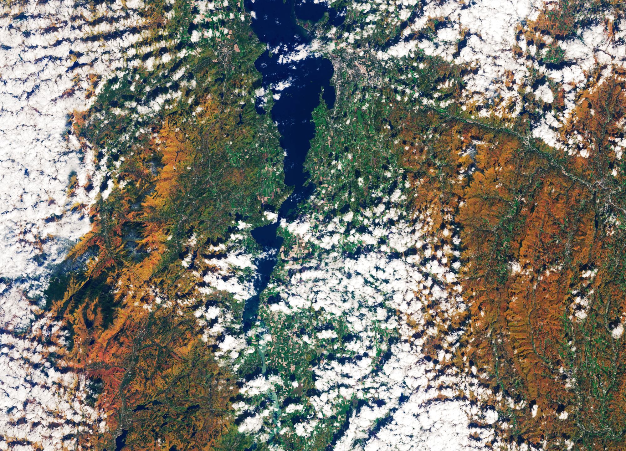
アディロンダック山地は米ニューヨーク州北部にあるゆるやかな山地で、最高峰はマーシー山(標高1,629m)です。先住民族モホーク族の言葉でアメリカヤマアラシを意味しています。北アメリカ大陸の東海岸を南部はジョージア州から北はメイン州まで北上しているアパラチア山脈の支脈とも考えられますが、むしろ北隣のカナダのローレンシャン山地の一部とみなす人が多いようです。この山地の北側と西側はセントローレンス川とそれに続くオンタリオ湖、東側はハドソン川上流とシャンプレーン湖、南側はモホーク川になっています。1932年と1980年の冬季オリンピックは、この山地のレーク・プラシッドで開催されました。
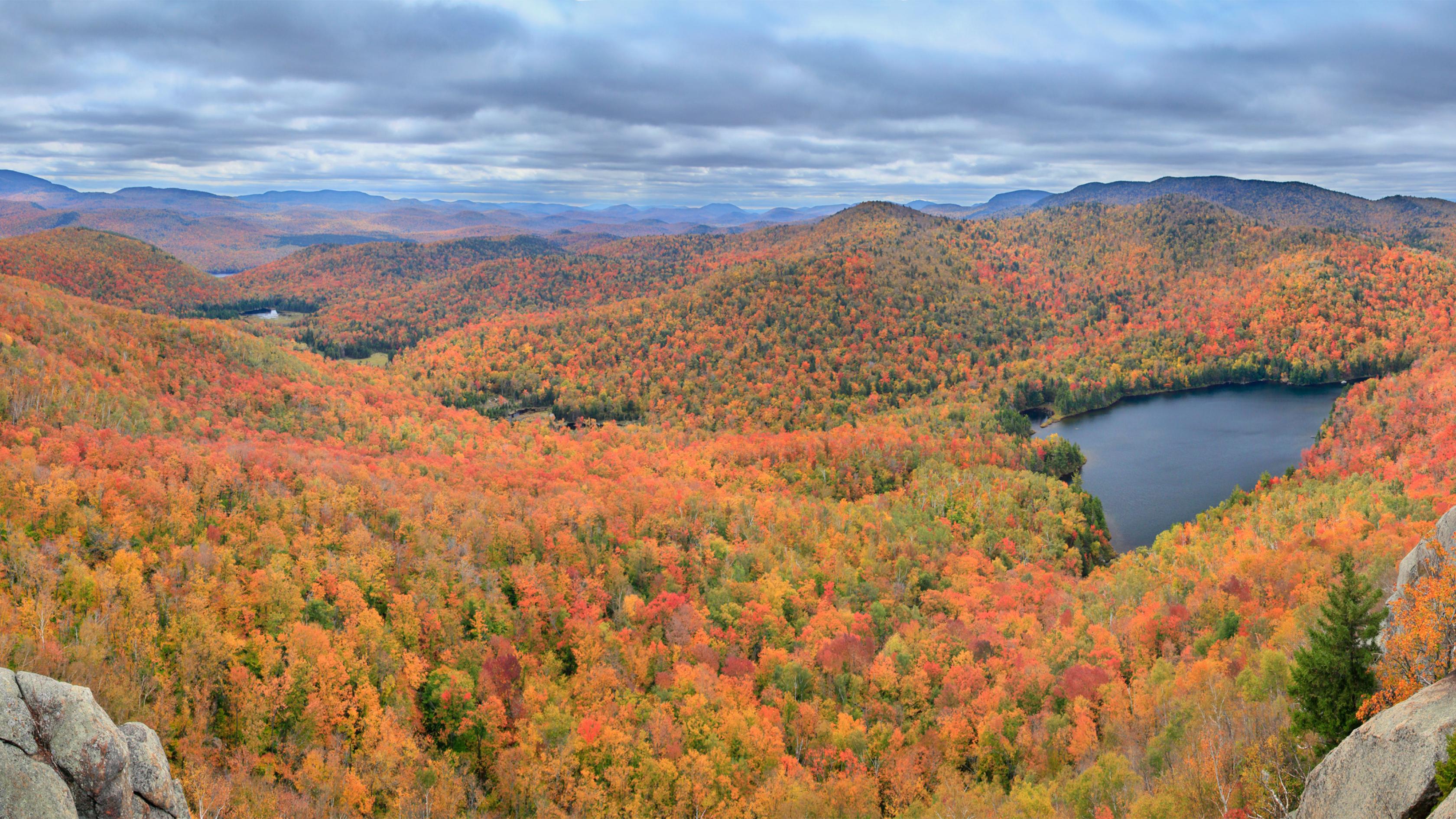
地上の様子はこちらです。
参考文献: NASA Earth’s Tweet
地球俯瞰画像を見る: LiVEARTH
[Earthview Wonders] No.1658: Autumn in Adirondack Mountains🇺🇸
NASA’s Landsat 9 satellite captured the beautiful autumn reddening of the Adirondack Mountains and Lake Champlain, New York, U.S.
The Adirondack Mountains form a massif in northeastern Upstate New York with boundaries that correspond roughly to those of Adirondack Park. The mountains form a roughly circular dome, about 260km in diameter and about 1,600m high. The current relief owes much to glaciation. There are more than 200 lakes around the mountains, including Lake George, Lake Placid, and Lake Tear of the Clouds, which is the source of the Hudson River. Lake Champlain is a natural freshwater lake which lies between the states of New York and Vermont, but also extends north into the Canadian province of Quebec.
The local scenery on the ground is as follows.
Reference: NASA Earth’s Tweet
See earthview photo gallery: LiVEARTH[:]