[:ja]宇宙飛行士が天宮号宇宙ステーションから撮影したチベット高原です。
チベット高原はユーラシア大陸の中央部に広がる世界最大級の高原です。チベット高原南部に東西に横たわるヒマラヤ山脈の南には、ネパール、ブータン、インドなどが位置しています。チベット高原は北上するインドプレートがユーラシアプレートに衝突した衝突境界の北側に形成された高原地帯です。この地域で最も高度のあるヒマラヤ山脈も衝突境界に形成された山脈です。この衝突境界の形成はインドプレート上にインド大陸よりなる大陸地殻がユーラシアプレートの下へ沈み込むことによって形成されました。チベット高原は、黄河の上流部のマチュ河、長江(揚子江)の上流部のディチュ河、メコン河、サルウィン川(怒江)、インダス川、ガンジス川の上流ヤルンツァンポ河など国際河川の単一水源では世界最大級です。
地上の様子はこちらです。

参考文献: CNSA’s Tweet
地球俯瞰画像を見る: LiVEARTH
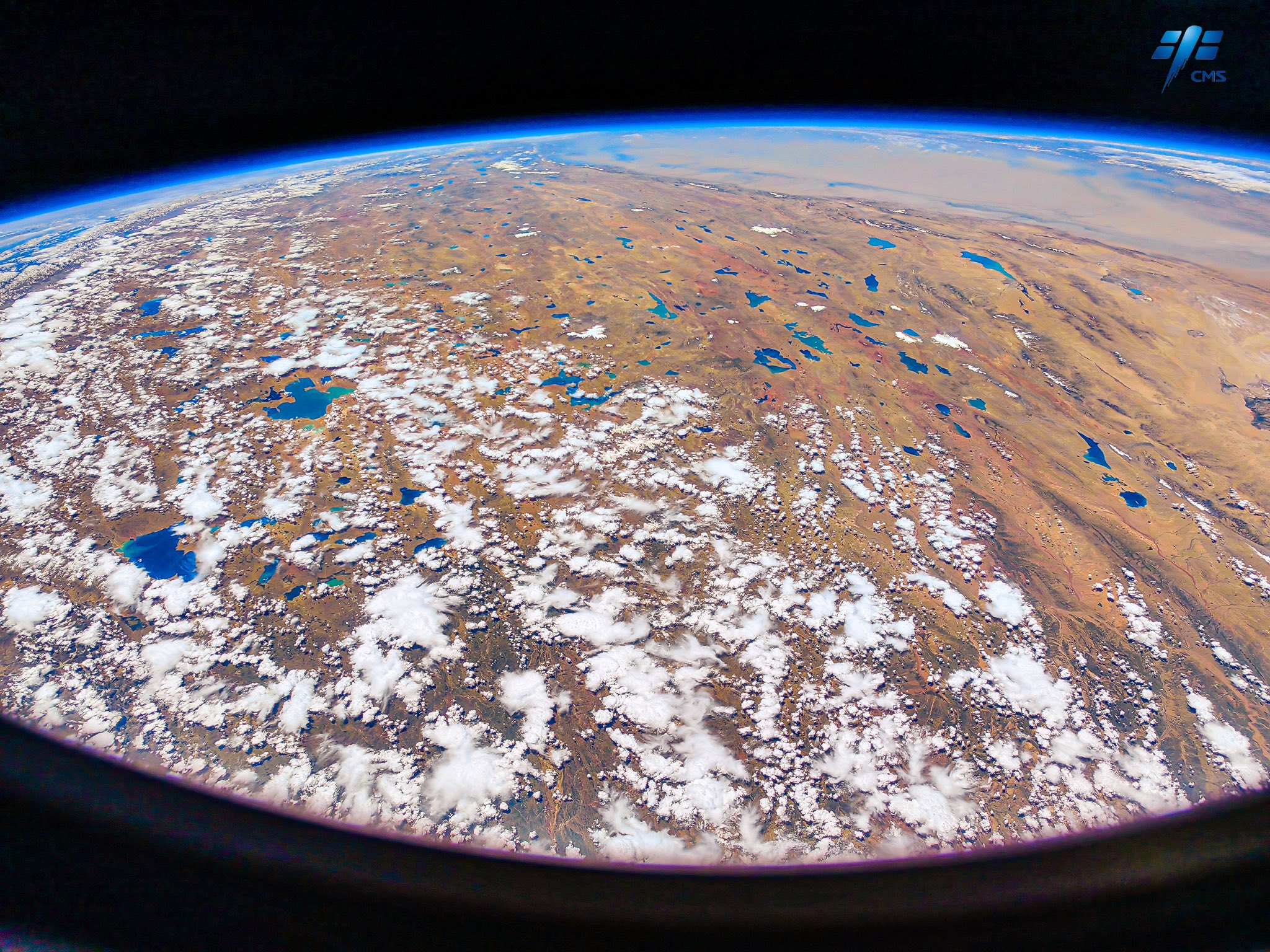
[Earthview Wonders] No.1665: Tibetan Plateau
Astronaut on board the Chinese Tiangong Space Station captured the Tibetan Plateau.
The Tibetan Plateau or the Qing–Zang Plateau is a vast elevated plateau in Central Asia, covering most of the Tibet Autonomous Region, most of Qinghai, China. It stretches approximately 1,000km north to south and 2,500km east to west. It is the world’s highest and largest plateau above sea level. With an average elevation exceeding 4,500m and being surrounded by imposing mountain ranges that harbor the world’s two highest summits, Mt. Everest and K2, the Tibetan Plateau is often referred to as “the Roof of the World”. The Tibetan Plateau contains the headwaters of the drainage basins of most of the streams in surrounding regions. Its tens of thousands of glaciers and other geographical and ecological features serve as a “water tower” storing water and maintaining flow. Its formation is a result of a continental collision or orogeny along the convergent boundary between the Indo-Australian Plate and the Eurasian Plate. (Credit: CNSA)
The local scenery on the ground is as follows.
Reference: CNSA’s Tweet
See earthview photo gallery: LiVEARTH[:]