[:ja]宇宙飛行士が天宮号宇宙ステーションから撮影した中国の黄河デルタです。
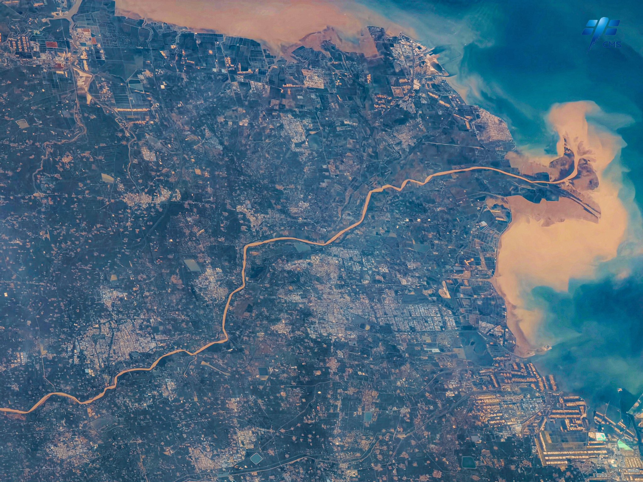
黄河は中国の北部を流れ、渤海へと注ぐ全長約5,464kmの川です。中国では長江(揚子江)に次いで2番目に長く、世界では6番目の長さです。黄河は、大運河に接続したのち、黄河は山東省の省都済南市の北側を通り、渤海湾に注ぎます。上流から流れてくる膨大な量の土砂の堆積により、山東省の河口付近には広大なデルタ地帯を形成しています。黄河から海へ流入する土砂の量は、年に16~17億トン以上にものぼります。渤海は黄海に属するが、黄海の名は黄河から流れ込む黄土などによって海面が黄色く濁って見えることからつけられた名です。
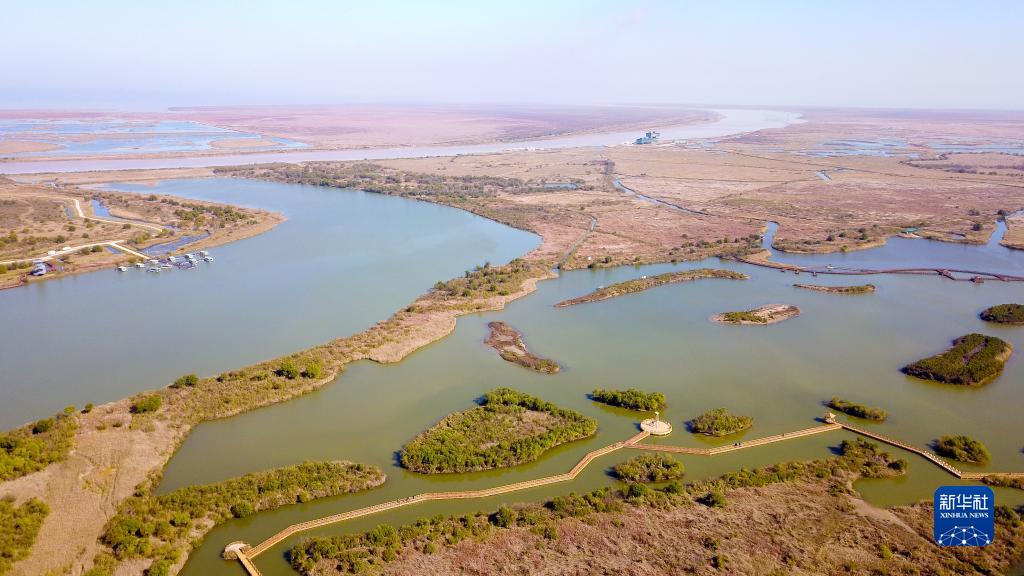
地上の様子はこちらです。
参考文献: CNSA’s Tweet
地球俯瞰画像を見る: LiVEARTH
[Earthview Wonders] No.1666: Yellow River Delta🇨🇳
Astronaut on board the Chinese Tiangong Space Station captured Yellow River Delta, China.
The Yellow River or Huang He is the second-longest river in China, after the Yangtze River, and the sixth-longest river system in the world at the estimated length of 5,464km. Originating in the Bayan Har Mountains in Qinghai province of Western China, it flows through nine provinces, and it empties into the Bohai Sea near the city of Dongying in Shandong province. The Yellow River is notable for the large amount of silt it carries-1.6 billion tons annually at the point where it descends from the Loess Plateau. If it is running to the sea with sufficient volume, 1.4 billion tons are carried to the sea per year.
The local scenery on the ground is as follows.
Reference: CNSA’s Tweet
See earthview photo gallery: LiVEARTH[:]