[:ja]アントン・シュカプレロフ宇宙飛行士がISSから撮影したモルディブ北部です。
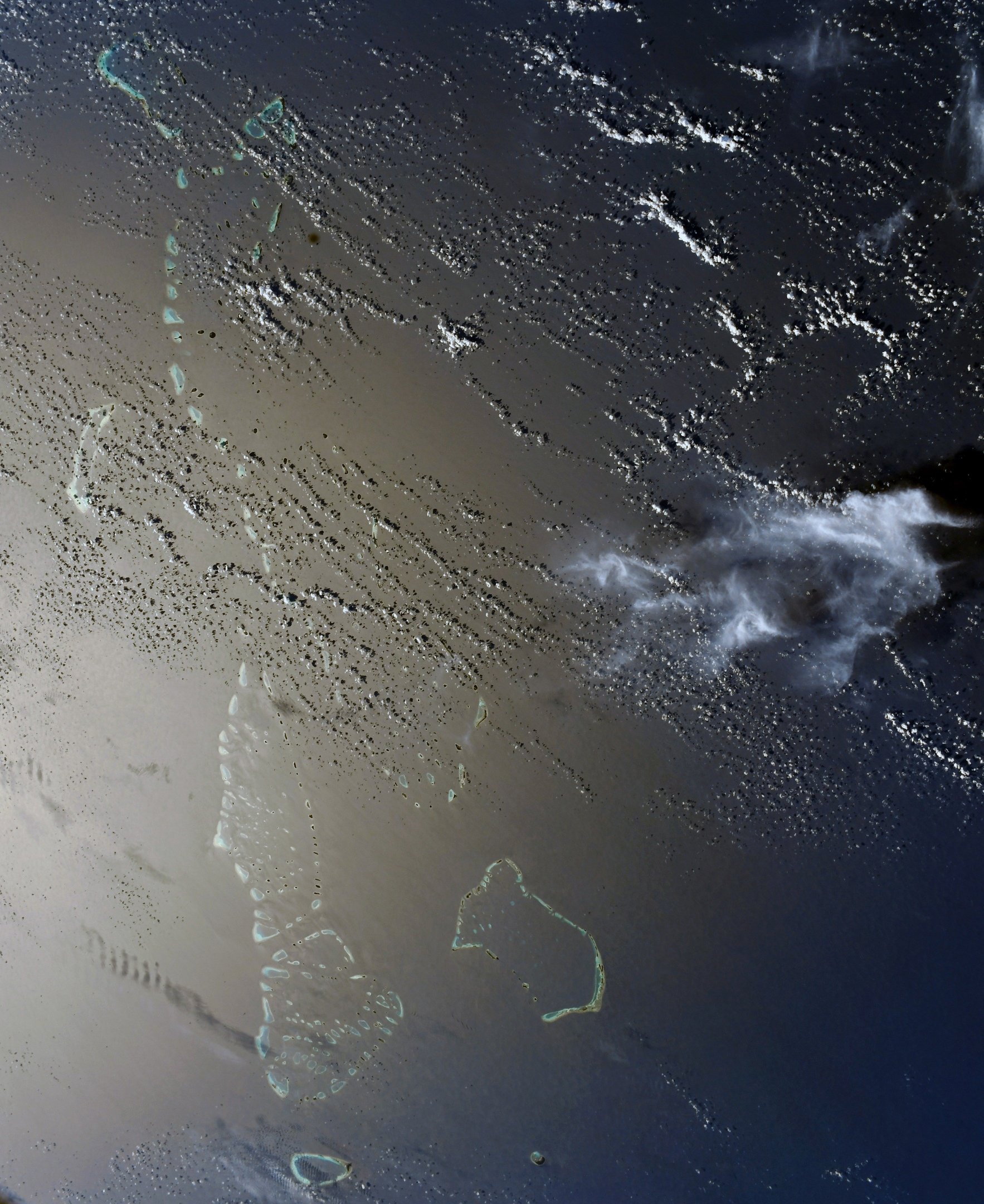
モルディブはスリランカ南西のインド洋に浮かぶ26の環礁や約1,200の島々から成り、高温多湿の熱帯気候の環境に約200の島に人が住みます。海抜の最高が2.4mという平坦な地形であり、近年の海面上昇と珊瑚礁の死滅により、国土が消滅する危険にさらされています。また、首都のマレ(マーレ)は、マレ島、ヴィリンギリ島、人工島フルマーレ(フルマレ)、空港島(フルレ島)等で構成される街です。カーフ環礁の真ん中にある北マレ環礁の南端に位置しています。モルディブの政治・経済の中心地で、貿易港でもあります。
地上の様子はこちらです。

参考文献: Anton Shkaplerov’s Tweet
地球俯瞰画像を見る: LiVEARTH
[Earthview Wonders] No.1672: Maldives🇲🇻
Astronaut Anton Shkaplerov captured from ISS northern Maldives.
The Maldives consists of 1,192 coral islands grouped in a double chain of 26 atolls, along the north-south direction, spread over roughly 90,000km2, making this one of the world’s most dispersed countries. Maldives is the lowest country in the world, with maximum and average natural ground levels of only 2.4m above sea level. Also, with a population of 227,486 and an area of 8.3km2, Male the capital is also one of the most densely populated cities in the world. A commercial harbour is located on the central island and serves as the heart of all commercial activities in the country.
The local scenery on the ground is as follows.
Reference: Anton Shkaplerov’s Tweet
See earthview photo gallery: LiVEARTH[:]