[:ja]イワン・ワグナー宇宙飛行士がISSから撮影したカリブ海のイスパニョーラ島です。ハイチとドミニカ共和国が1つの島にあります。
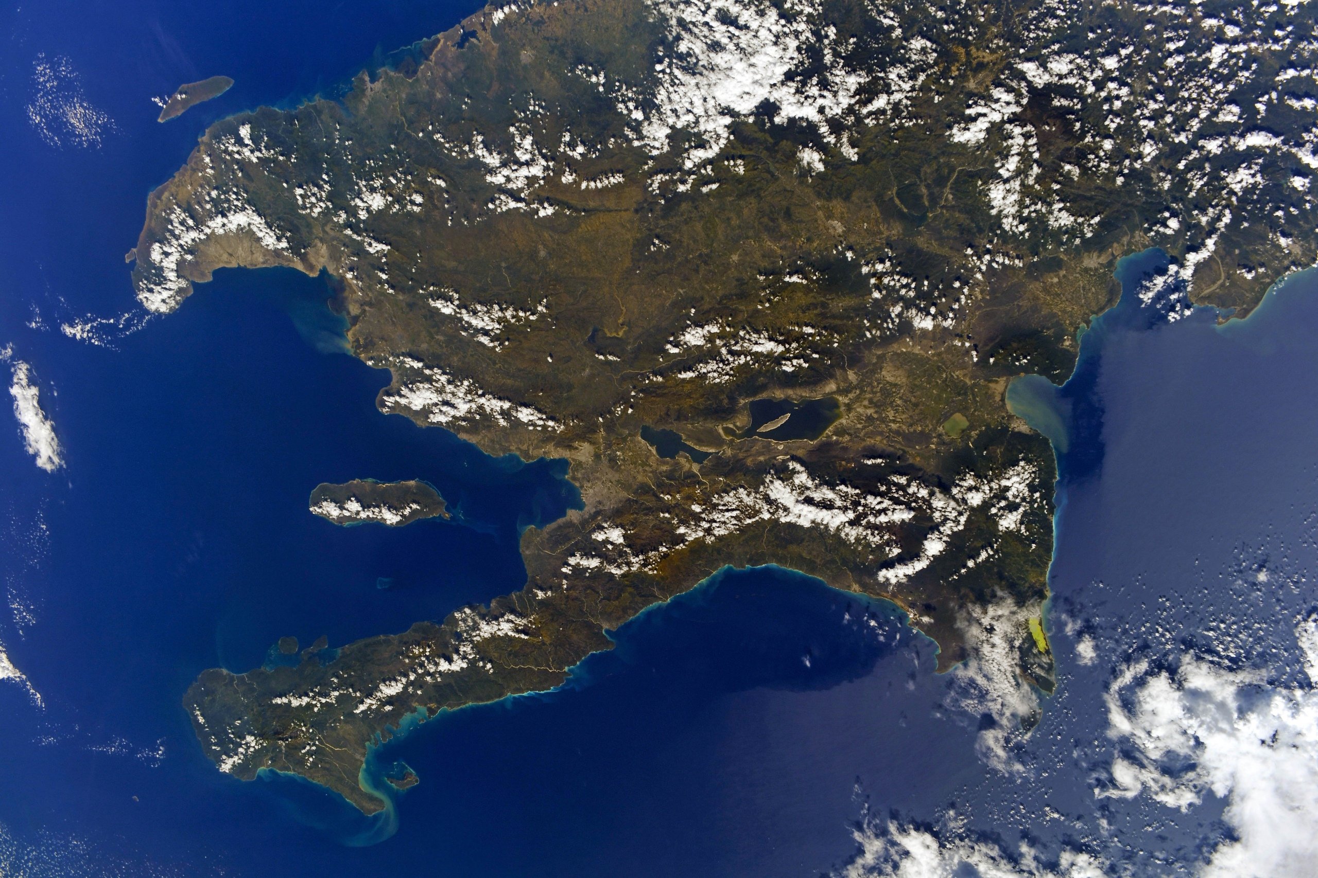
イスパニョーラ島は、カリブ海にある大アンティル諸島に属する島で、西側3分の1をハイチ、東側3分の2をドミニカ共和国が統治しています。大アンティル諸島は、小アンティル諸島の火山島やサンゴ礁とは異なり、大陸性の陸塊です。カリブ海の中ではキューバ島に次いで2番目に大きいです。かつては西側のハイチのほうが人口も国力も東側の現ドミニカ共和国を上回っており、東側は何度もハイチにより侵攻・占領されていました。現在は比較的安定したドミニカ共和国に比べ、ハイチは政情が不安定で世界最貧国の一つであり、農業の規模も小さく国土も森林がほとんど失われ荒廃しています。
地上の様子はこちらです。

参考文献: Ivan Vagner’s Tweet
地球俯瞰画像を見る: LiVEARTH
[Earthview Wonders] No.1693: Haiti and Dominican Republic🇭🇹🇩🇴
Astronaut Ivan Vagner captured from ISS Hispaniola Island in the Caribbean Sea. Two countries, Haiti and Dominican Republic, share one island.
Hispaniola is an island in the Caribbean that is part of the Greater Antilles. Hispaniola is the most populous island in the West Indies, and the region’s second largest in area, after the island of Cuba. The island is divided into two separate nations: the Spanish-speaking Dominican Republic to the east and the French/Haitian Creole-speaking Haiti to the west. The island was first formally divided in 1697 as part of the Peace of Ryswick, under which Spain ceded to France the western portion it had seized by force earlier in the century. In 1621, England made an unsuccessful attempt to take over both sides of the island. In the early 20th century, the U.S. occupied both countries, and made numerous changes to the border. The Dominican Republic comprises approximately the eastern two-thirds of the island and the Republic of Haiti the western third.
The local scenery on the ground is as follows.
Reference: Ivan Vagner’s Tweet
See earthview photo gallery: LiVEARTH[:]