[:ja]NASAの地球観測衛星Terraが撮影したアルゼンチン北西部の山火事です。
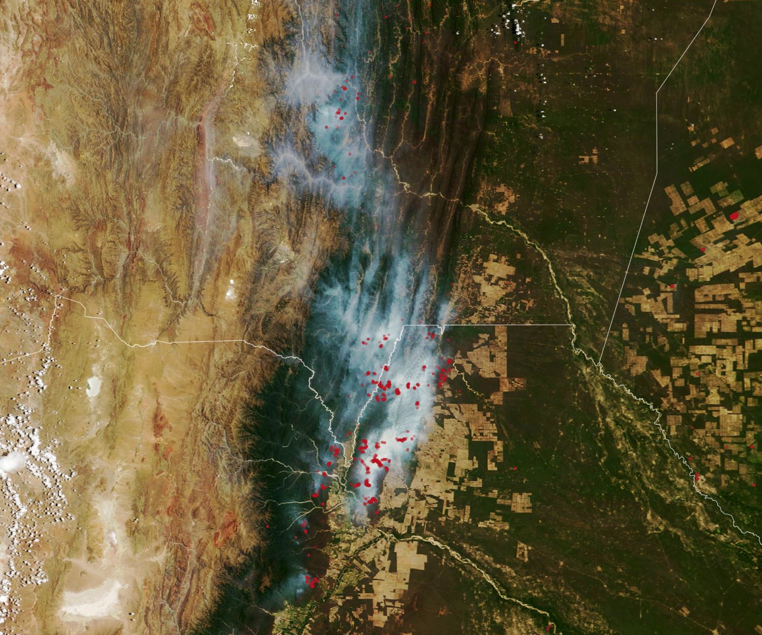
アルゼンチンの山火事は例年8月頃から始まりますが、11月に入り、同国北西部で大規模な山火事が確認されています。殆どの山火事は人為的なもので、農場や道路を維持するために沿道で火を付けますが、それが広がることが多いようです。また、3年連続で太平洋赤道付近の海面水温が平年より低くなるラニーニャ現象が続き、同国では乾燥が続いていることも山火事の原因とされています。
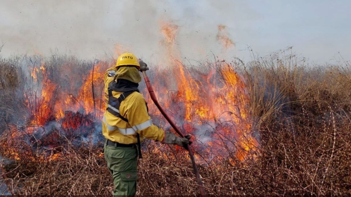
地上の様子はこちらです。
参考文献: NASA Earth’s Tweet
地球俯瞰画像を見る: LiVEARTH
[Earthview Wonders] No.1696: Wildfires in Argentina🇦🇷
NASA’s Terra and Suomi-NPP satellites captured the wildfires in northwestern Argentina.
In Nov. 2022, several months into Argentina’s fire season, burning was evident in the northwestern Argentiana. Most of the fires shown here are burning in Argentina’s Salta province, with some showing up to the south in Jujuy province and to the north in Bolivia. The fires were burning across several forested ecosystems: subtropical forests at low and middle altitudes, and premontane and montane forests on mountain slopes. Almost all wildland fires in the region are caused by human activity. People routinely start fires to maintain pastures and roads, dispose of yard waste and household trash, and to cook during hunting and fishing trips.
The local scenery on the ground is as follows.
Reference: NASA Earth’s Tweet
See earthview photo gallery: LiVEARTH[:]