[:ja]NASAの地球観測衛星Landsat 8が撮影したオーストラリアのデインツリー熱帯雨林です。
デインツリー熱帯雨林は、オーストラリアのクイーンズランド州の北東海岸、モスマンとケアンズの北にある地域です。約1,200km2の広さがあり、オーストラリア大陸で最大の熱帯雨林の連続地域の一部です。這い回るつる植物や、エメラルドグリーンの林冠は1億8,000万年以上かけて成長してきたもので、1,000万年という長い時間をかけて育まれた世界最古の熱帯雨林です。また、この地域の伝統的な管理者はクク・ヤランジの人々です。
地上の様子はこちらです。

参考文献: NASA Earth’s Tweet
地球俯瞰画像を見る: LiVEARTH
[Earthview Wonders] No.1698: Daintree Rainforest🇦🇺
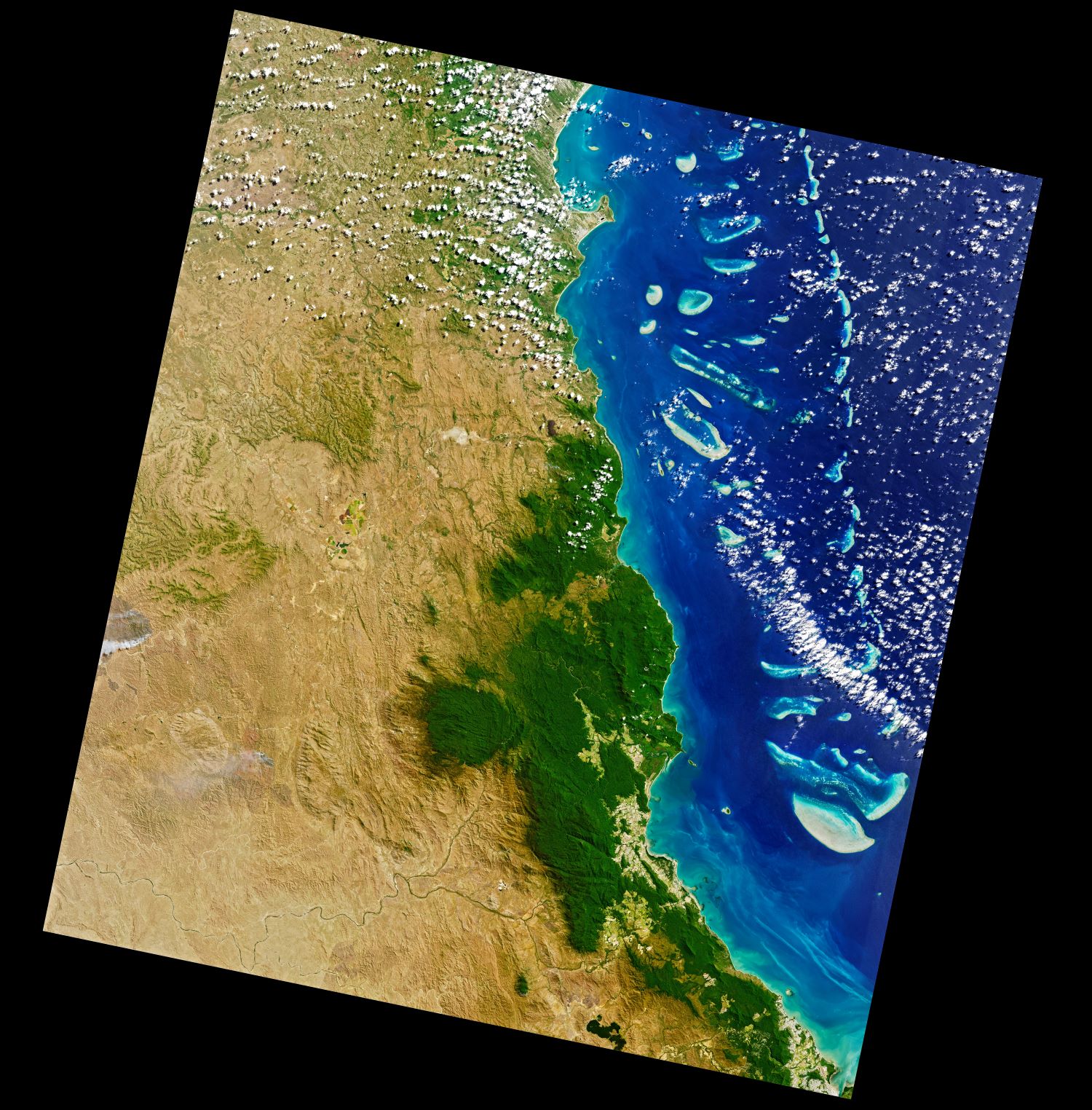
NASA’s Landsat 8 satellite captured the Daintree Rainforest, Australia.
The Daintree Rainforest is a region on the northeast coast of Queensland, Australia, north of Mossman and Cairns. At around 1,200km2, it is a part of the largest continuous area of tropical rainforest on the Australian continent. The Daintree Rainforest is a part of the Wet Tropics of Queensland Rainforest, that spans across the Cairns Region. The Wet Tropics Rainforest (that the Daintree is a part of) is the oldest continually surviving tropical rainforest in the world. Along the coastline north of the Daintree River, tropical forest grows right down to the edge of the sea.
The local scenery on the ground is as follows.
Reference: NASA Earth’s Tweet
See earthview photo gallery: LiVEARTH[:]