[:ja]宇宙飛行士がISSから撮影したアルゼンチンのアピペ島と、その下流にあるパラグアイのヤシレタダムです。
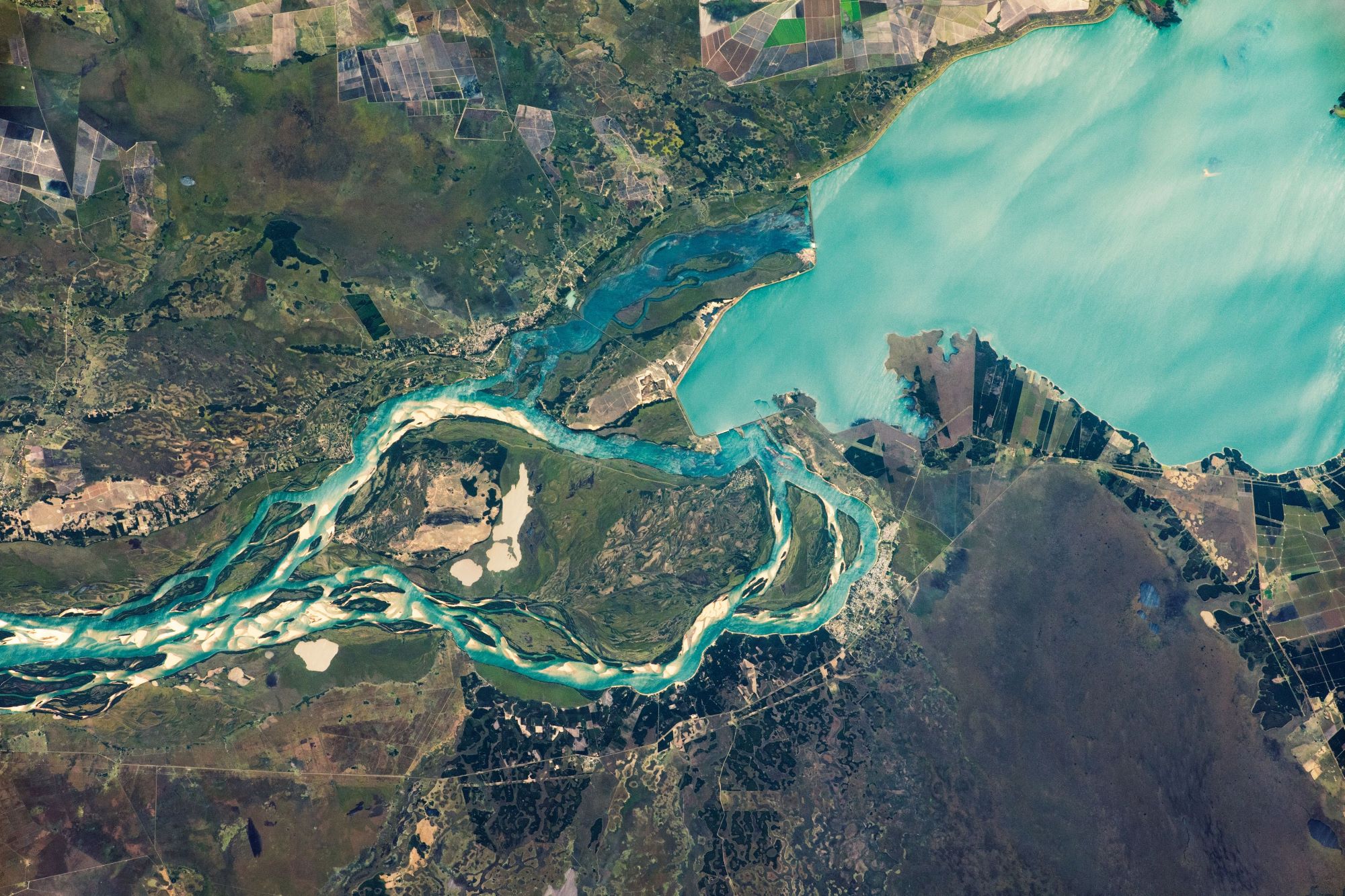
アピペ島はパラナ川にある長さ約25kmの島で、アルゼンチンとパラグアイの国境に位置しています。ヤシレタダムは、アルゼンチンとパラグアイの共同水力発電事業として計画され、ダム本体及び関連施設の工事が完成し、2011年に貯水位が計画水位に到達したことでダム建設計画が完成し、二国間協定の取水権(水利権)に基づく取水が可能となりました。
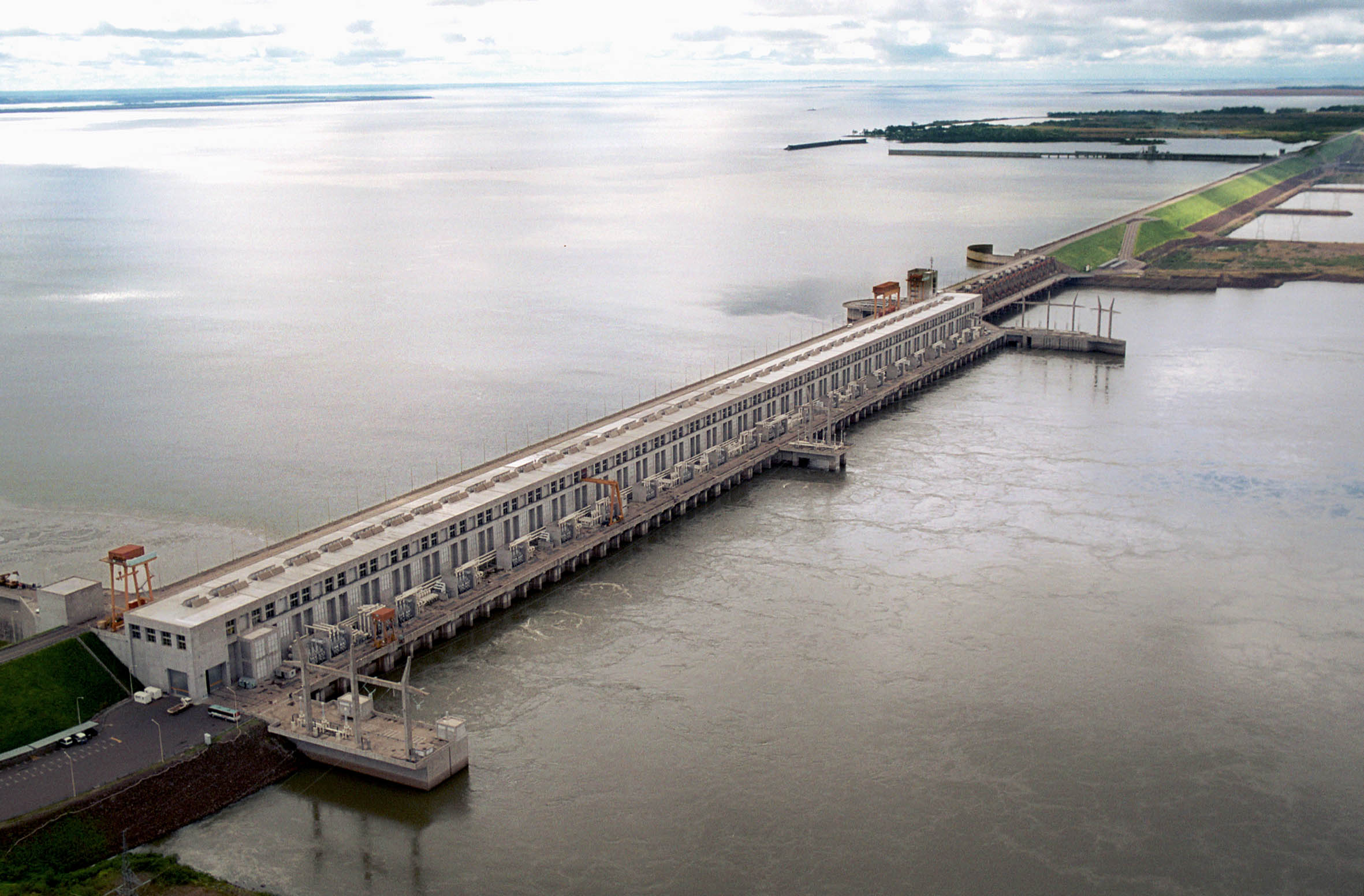
地上の様子はこちらです。
参考文献: NASA Earth’s Tweet
地球俯瞰画像を見る: LiVEARTH
[Earthview Wonders] No.1699: Isla Apipé and Yacyretá Dam🇦🇷🇵🇾
Astronaut on board ISS captured Isla Apipé, Argentina, and Yacyretá Dam, Paraguay.
Isla Apipé is an Argentine island about 25km long in the Paraná River below the Argentine city of Posadas, Misiones, very marginally within the border of Paraguay, divided by river and a thin strip of variable marsh depending on the season. Just at the downstream of the river located the Yacyretá Dam or Jasyretâ-Apipé Hydroelectric Power Station (from Guaraní jasy retã, “land of the moon”), a dam and hydroelectric power plant built over the waterfalls of Jasyretâ-Apipé in the Paraná River, between the Paraguayan City of Ayolas and the Argentine Province of Corrientes. The Yacyreta Dam is managed by the Yacyreta Bi-National Entity, established by treaty between the two countries.
The local scenery on the ground is as follows.
Reference: NASA Earth’s Tweet
See earthview photo gallery: LiVEARTH[:]