[:ja]トーマス・マーシュバーン宇宙飛行士がISSから撮影したクロアチアのクルク島です。
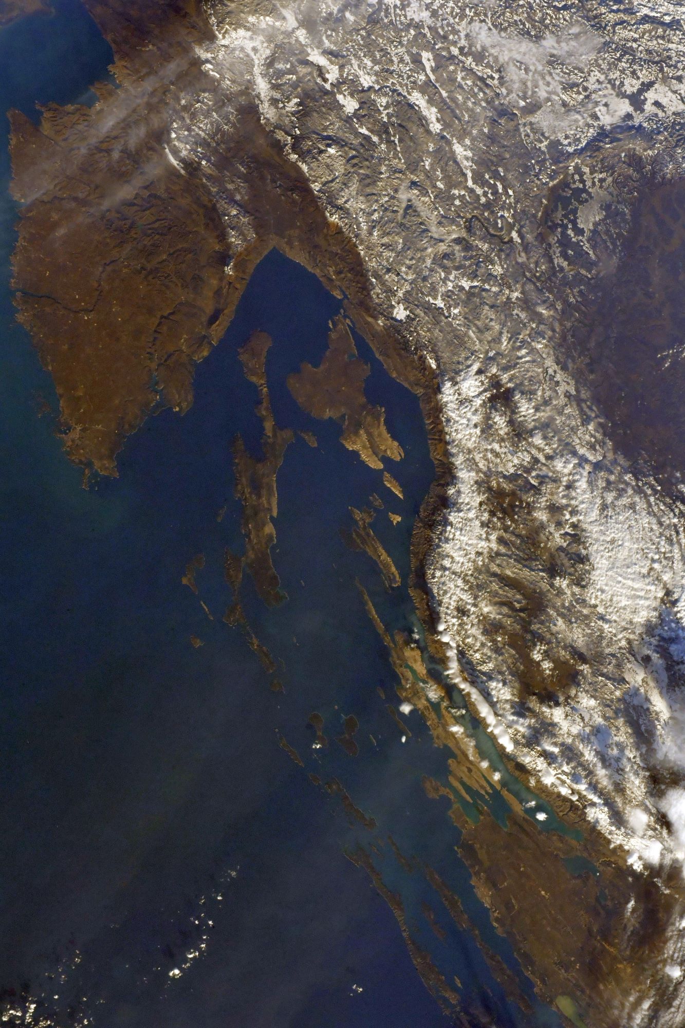
クルク島は、クロアチアのアドリア海北に浮かぶ島で、行政上はプリモリェ=ゴルスキ・コタル郡に属しています。人口は2万人弱で、最大の町は、人口約6千人を抱えるクルクです。クロアチア本土とは1980年に掛けられた長さ1,430mの橋を通じて結ばれており、南ドイツや東欧から観光客が訪れています。島には紀元前10世紀から人が定住しており、古代ローマ人は島をクリクタ(Curicta)と呼んでいました。クルクは中世からヴェネツィア共和国の支配下にあり、1797年のカンポ・フォルミオ条約以後はイストリアとともにオーストリア帝国領となりました。第一次世界大戦後、島はイタリアに併合され、第二次世界大戦後にユーゴスラビア社会主義連邦共和国の一部となりました。
地上の様子はこちらです。

参考文献: Thomas Marshburn’s Tweet
地球俯瞰画像を見る: LiVEARTH
[Earthview Wonders] No.1701: Krk Island, Croatia
Astronaut Thomas Marshburn captured from ISS Krk Island, Croatia.
Krk is a Croatian island in the northern Adriatic Sea, located near Rijeka in the Bay of Kvarner and part of Primorje-Gorski Kotar county. Krk is tied with Cres as the largest Adriatic island, depending on the methodology used to measure the coastline. Krk is the most populous island in the Adriatic Sea, with multiple towns and villages that contain a total of about 20,000 inhabitants. Krk is, like many Croatian islands, rocky and hilly. The rock is mostly karst. Krk has historically been a center of Croatian culture. Various literature in the Glagolitic alphabet was created and in part preserved on Krk (notably the Baška tablet, one of the oldest preserved texts in Croatian). (Credit: Thomas H. Marshburn, NASA)
The local scenery on the ground is as follows.
Reference: Thomas Marshburn’s Tweet
See earthview photo gallery: LiVEARTH[:]