[:ja]サマンサ・クリストフォレッティ宇宙飛行士がISSから撮影したタンガニーカ湖です。
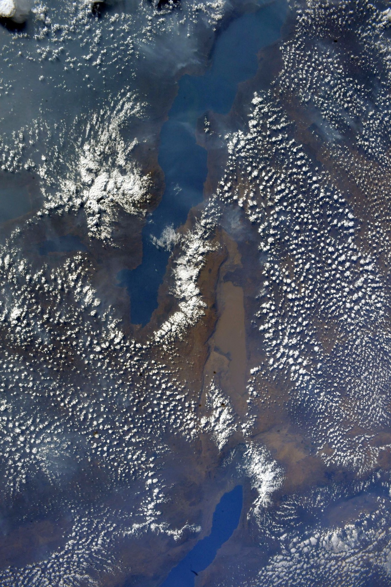
タンガニーカ湖は、アフリカ大陸東部のアフリカ大陸の大地溝帯の直上に点在する構造湖の1つで、タンザニア、コンゴ民主共和国、ザンビア、ブルンジに面しています。湖面の海抜は773mで、湖岸線の長さは約1900kmに達します。面積はアフリカ大陸でヴィクトリア湖に次いで2位、世界で6位の大きさで、深さは平均水深570m、最大水深147mと、アフリカ大陸で1位、世界ではバイカル湖に次いで2位です。タンガニーカ湖は地球上でも固有種の多い湖として有名で、ここに生息する魚の約8割、貝類の約9割が固有種です。湖に生息する400以上の動物種のうち、固有種は実に約300種に上ります。
地上の様子はこちらです。

参考文献: Samantha Cristoforetti’s Tweet
地球俯瞰画像を見る: LiVEARTH
[Earthview Wonders] No.1702: Lake Tanganyika🇹🇿🇨🇩🇿🇲🇧🇮
Astronaut Samantha Cristoforetti captured from ISS Lake Tanganyika that is shared among four countries – Tanzania, the Democratic Republic of the Congo (DRC), Burundi, and Zambia.
Lake Tanganyika is an African Great Lake and is the second-oldest freshwater lake in the world, the second-largest by volume, and the second-deepest, in all cases after Lake Baikal in Siberia. Tanzania (46%) and DRC (40%) possess the majority of the lake. It drains into the Congo River system and ultimately into the Atlantic Ocean. The lake holds at least 250 species of cichlid fish and undescribed species remain. Almost all (98%) of the Tanganyika cichlids are endemic to the lake and it is thus an important biological resource for the study of speciation in evolution. (Credit: Samantha Cristoforetti, ESA, NASA)
The local scenery on the ground is as follows.
Reference: Samantha Cristoforetti’s Tweet
See earthview photo gallery: LiVEARTH[:]