[:ja]サマンサ・クリストフォレッティ宇宙飛行士がISSから撮影したマレーシアのサバ州です。
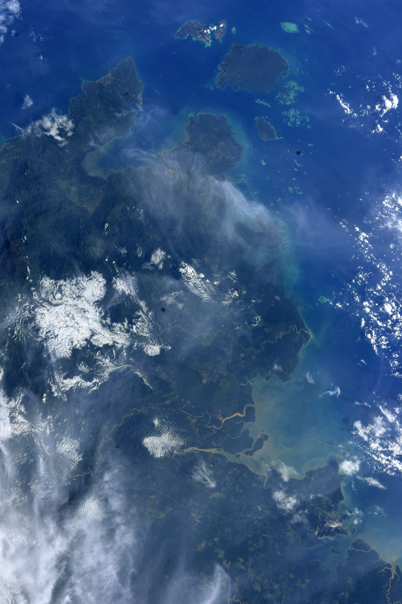
サバ州は、ボルネオ島にあるマレーシア領の東側3分の1を占めていて、州都はコタキナバル。マレーシア国内において高度な自治権を有しており、州外との行き来には入境管理が行われ、マレーシア国民であっても身分証明書(MyKadと呼ばれる国民身分証)が必要となります。1963年、サラワク州やシンガポールとともにマラヤ連邦と統合してマレーシアを結成しました。州の大半がジャングルに覆われており、世界遺産にも登録されたキナバル国立公園や東南アジア最高峰のキナバル山(標高4,095m)もこのサバ州にあります。なお、キナバル山は州の旗にも描かれています。
地上の様子はこちらです。

参考文献: ‘s Tweet
地球俯瞰画像を見る: LiVEARTH
[Earthview Wonders] No.1709: Sabah, Malaysia🇲🇾
Astronaut Samantha Cristoforetti captured from ISS Sabah, Malaysia.
Sabah is in northern Borneo and borders the Malaysian state of Sarawak to the southwest and the North Kalimantan province of Indonesia to the south. It has an equatorial climate with tropical rainforests, abundant with animal and plant species. The state has long mountain ranges on the west side which forms part of the Crocker Range National Park. Kinabatangan River, the second longest river in Malaysia runs through Sabah. The highest point of Sabah, Mount Kinabalu is also the highest point of Malaysia. Sabah exhibits notable diversity in ethnicity, culture and language. Sabah is known for its traditional musical instrument, the sompoton. Sabah has abundant natural resources, and its economy is strongly export-oriented. Its primary exports include oil, gas, timber and palm oil. The other major industries are agriculture and ecotourism. (Credit: Samantha Cristoforetti, ESA, NASA)
The local scenery on the ground is as follows.
Reference: ‘s Tweet
See earthview photo gallery: LiVEARTH[:]