[:ja]若田光一宇宙飛行士がISSから撮影したメキシコのシウダー・フアレスと米テキサス州のエルパソです。
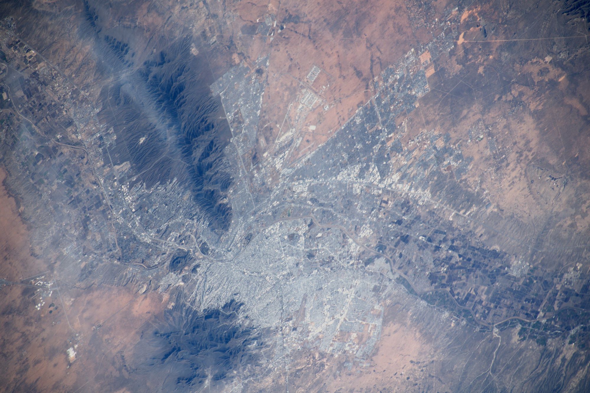
人口約150万人を擁するシウダー・フアレスは、メキシコ北部のチワワ州の最大の都市で、アメリカ国境に接しています。旧名のエル・パソ・デル・ノルテ(El Paso del Norte)でも知られています。1863年、メキシコシティがフランス軍に制圧されたため、当時のメキシコの大統領、ベニート・フアレス率いる共和党が一時的にエルパソ・デル・ノルテに移住し、フランス軍との侵略戦争(メキシコ出兵)に抵抗しました。その行為に敬意を表す形で1888年にエルパソ・デル・ノルテはシウダー・フアレスに改称されました。町は、北米最大の砂漠であるチワワ砂漠の中にあり、市の北側にメキシコとアメリカの国境でもあるリオ・グランデ川が流れています。川を渡ればアメリカに入国することになり、テキサス州最西部の町エルパソにたどり着き、シウダー・フアレスにはエルパソと結ぶ4つの橋があり、2008年におよそ2,200万人の移民がこれらの橋を利用して2つの都市を行き来したといわれている。シウダー・フアレスにはチワワ砂漠から近いため、気候は異常に乾燥している上、最高気温と最低気温に大きな差があります。
地上の様子はこちらです。

参考文献: Koichi Wakata’s Tweet
地球俯瞰画像を見る: LiVEARTH
[Earthview Wonders] No.1710: Ciudad Juarez and El Paso🇲🇽🇺🇸
Astronaut Koichi Wakata captured from ISS Ciudad Juarez, Mexico, and El Paso, Texas, U.S.
Ciudad Juárez with 1.5 million population is the most populous city in the Mexican state of Chihuahua. Together with the surrounding areas, the cities form El Paso–Juárez, the second largest binational metropolitan area on the Mexico–U.S. border (after San Diego–Tijuana), with a combined population of over 2.7 million people. 4 international points of entry connect Ciudad Juárez and El Paso. The city has a growing industrial center, which in large part is made up by more than 300 “maquiladoras” (assembly plants) located in and around the city. It lies on the Rio Grande River. Due to its location in the Chihuahuan Desert and high altitude, Ciudad Juárez has a cold desert climate (Köppen: BWk). Seasons are distinct, with hot summers, mild springs and autumns, and cold winters.
The local scenery on the ground is as follows.
Reference: Koichi Wakata’s Tweet
See earthview photo gallery: LiVEARTH[:]