[:ja]マーク・ヴァンデ・ハイ宇宙飛行士がISSから撮影したネパールと中国の国境にまたがるエベレスト山です。
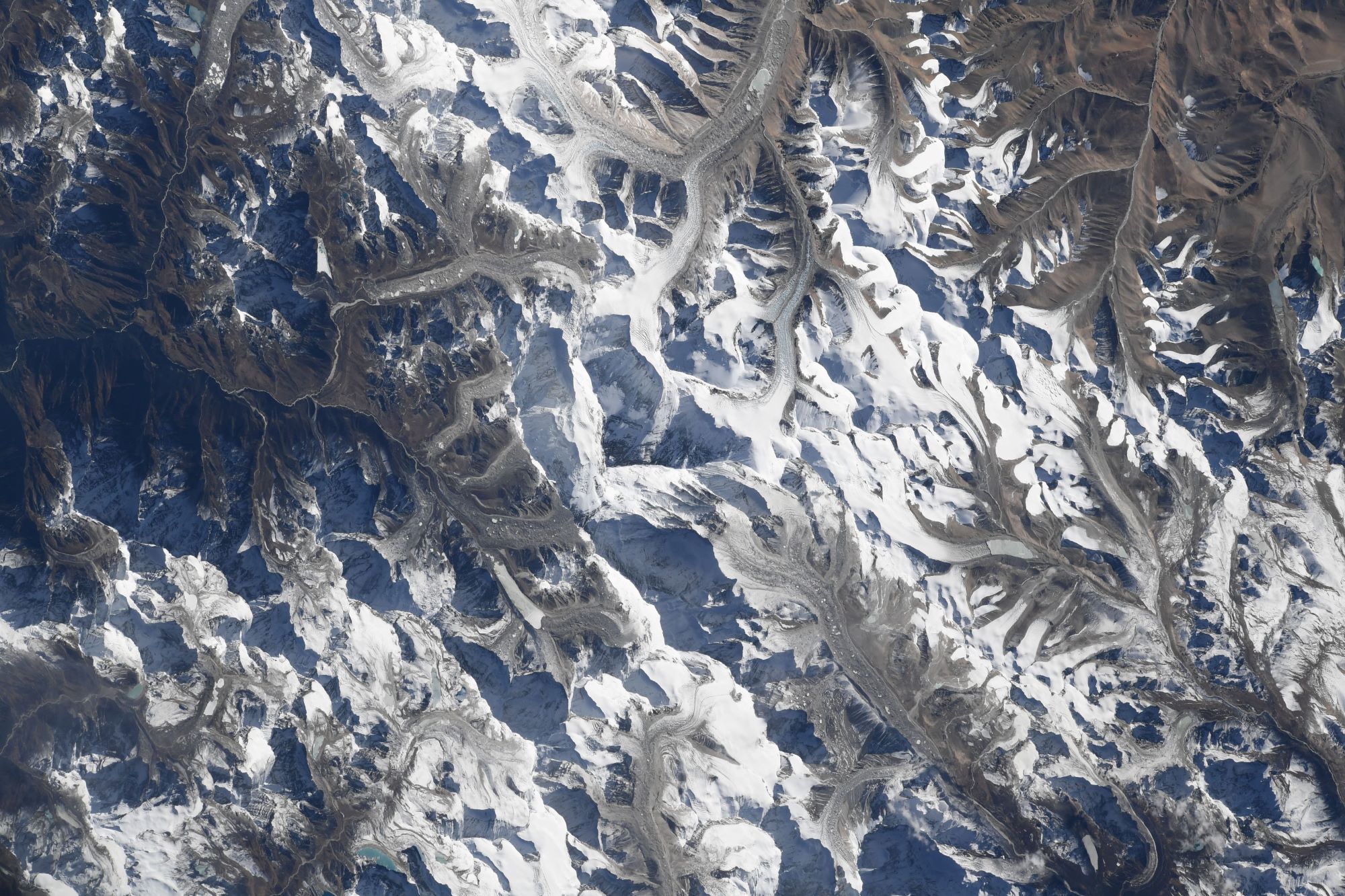
エベレストは、ヒマラヤ山脈にある世界最高峰で、山頂はネパールと中国との国境上にあります。1920年代から長きにわたる挑戦の末、1953年にイギリス探検隊のメンバーでニュージーランド出身の登山家であるエドモンド・ヒラリーとネパール出身のシェルパであるテンジン・ノルゲイによって初登頂がなされました。
地上の様子はこちらです。

参考文献: Mark Vande Hei’s Tweet
地球俯瞰画像を見る: LiVEARTH
[Earthview Wonders] No.1714: Mt. Everest🇳🇵🇨🇳
Astronaut Mark Vande Hei captured from ISS Mt. Everest lying between Nepal and China.
Mt. Everest is Earth’s highest mountain above sea level, located in the Mahalangur Himal sub-range of the Himalayas. Tenzing Norgay and Edmund Hillary made the first official ascent of Everest in 1953, using the southeast ridge route. (Credit: Mark Vande Hei, NASA)
The local scenery on the ground is as follows.
Reference: Mark Vande Hei’s Tweet
See earthview photo gallery: LiVEARTH[:]