[:ja]トーマス・マーシュバーン宇宙飛行士がISSから撮影したケルゲレン諸島です。
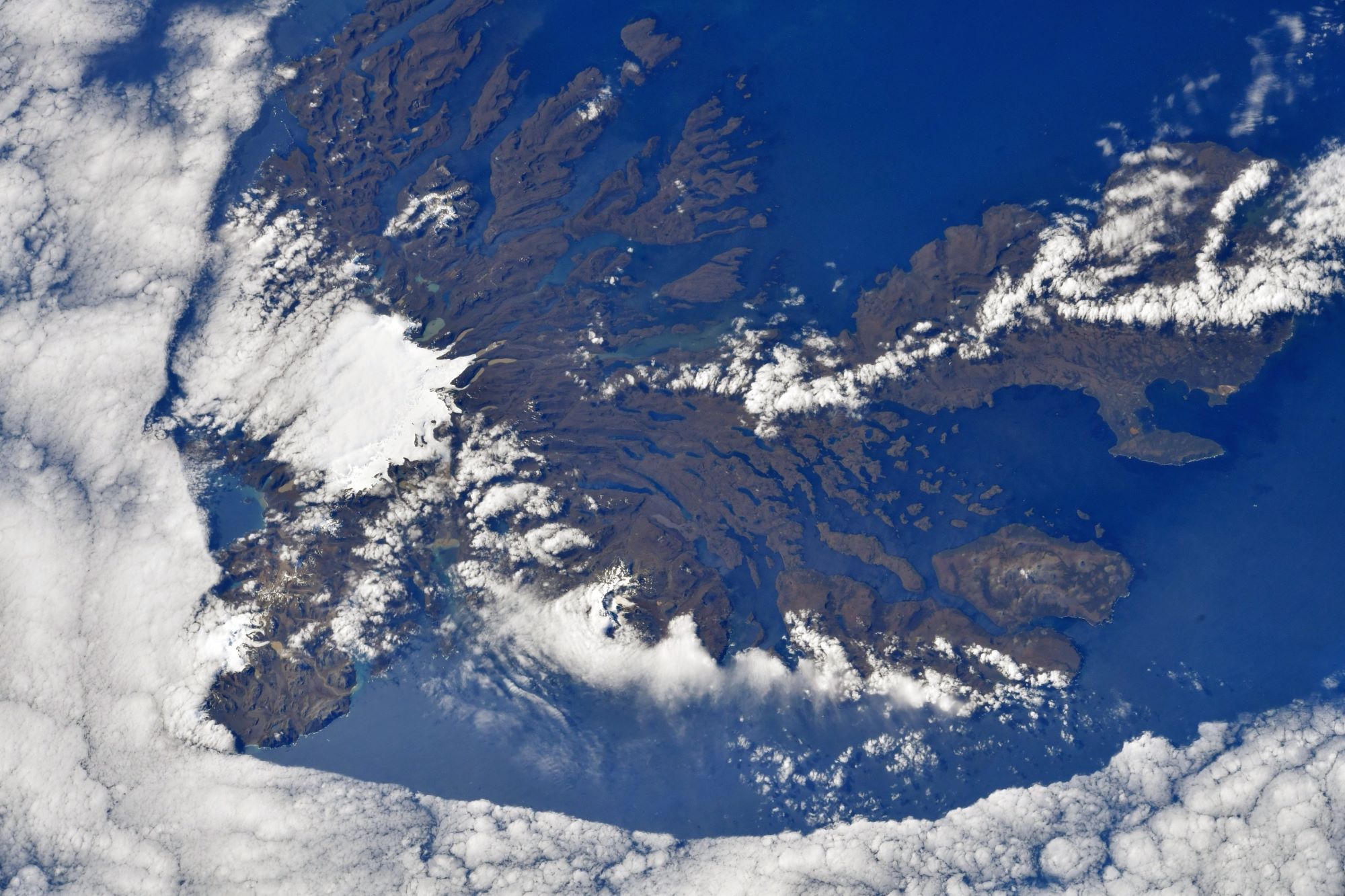
ケルゲレン諸島は、南インド洋にあるフランス領南方・南極地域の島々で、南極大陸から約2,000km、レユニオンから約3,400km、オーストラリアから約4,080km離れています。ケルゲレン島を中心に約300の島で構成されています。気候は寒冷海洋性ですが、寒帯性ではありません。風が強く、海は常に荒れています。1772年、フランスのイヴ・ジョゼフ・ド・ケルゲレン・ド・トレマレックにより発見されました。何度か定住が試みられてはいますが、研究者以外に永住居住者はいません。ケルゲレン諸島は領海も含めて自然保護区となっています。占有経済水域は、法定漁業海域となっています。
地上の様子はこちらです。

参考文献: Thomas Marshburn’s Tweet
地球俯瞰画像を見る: LiVEARTH
[Earthview Wonders] No.1715: Kerguelen Islands🇫🇷
Astronaut Thomas Marshburn captured from ISS Kerguelen Islands.
The Kerguelen Islands, also known as the Desolation Islands, are a group of islands in the sub-Antarctic constituting one of the two exposed parts of the Kerguelen Plateau, a large igneous province mostly submerged in the southern Indian Ocean. They are among the most isolated places on Earth, located more than 3,300km from Madagascar. The main island, Grande Terre, is surrounded by a further 300 smaller islands and islets, forming an archipelago. The climate is harsh and chilly with frequent high winds throughout the year. The surrounding seas are generally rough and they remain ice-free year-round. There are no indigenous inhabitants, but France maintains a permanent presence of 45 to 100 soldiers, scientists, engineers, and researchers. There are no airports on the islands, so all travel to and from the outside world is conducted by ship. (Credit: Thomas Marshburn, NASA)
The local scenery on the ground is as follows.
Reference: Thomas Marshburn’s Tweet
See earthview photo gallery: LiVEARTH[:]