[:ja]マティアス・マウラー宇宙飛行士がISSから撮影したフエゴ島です。ウシュアイアは画像左方の雲の下です。
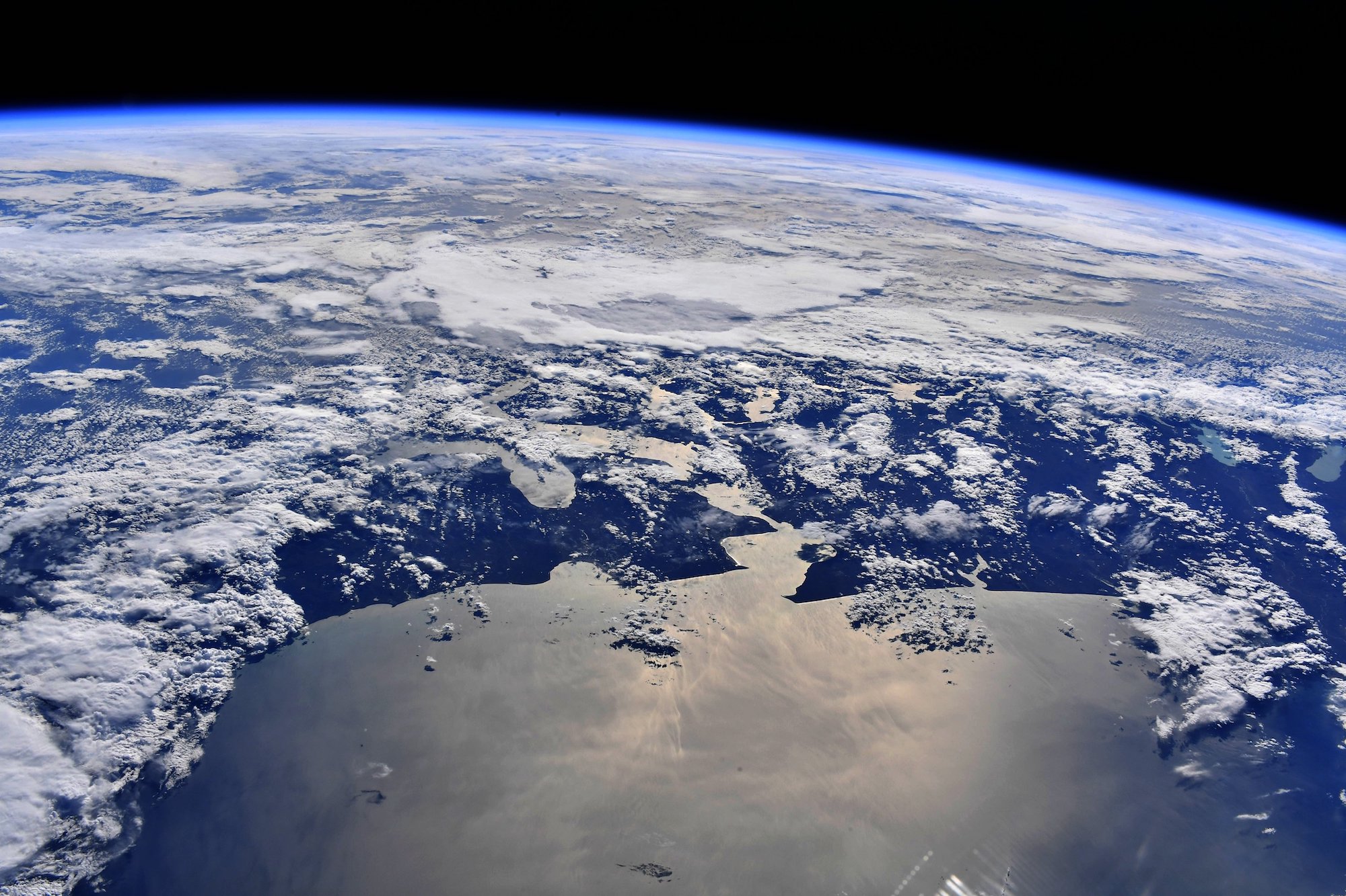
スペイン語でティエラは陸地、フエゴは火の意味で、1520年、フエゴ島が世界一周の航海の途上でマゼランによって発見された時に島に多数の焚き火を見たことから名づけられました。フエゴ島は、南アメリカの南端部のフエゴ諸島の主島で、西半分をチリ、東半分をアルゼンチンが領有しています。島は北をマゼラン海峡で南アメリカ大陸と隔てられ、南をビーグル水道で、ナバリノ島、オステ島と隔てられています。アルゼンチン領のウシュアイア(人口6万人)は人間が常時居住する世界最南端の都市です。
地上の様子はこちらです。

参考文献: Matthias Maurer’s Tweet
地球俯瞰画像を見る: LiVEARTH
[Earthview Wonders] No.1717: Tierra del Fuego🇨🇱🇦🇷
Astronaut Matthias Maurer captured from ISS Tierra del Fuego. Ushuaia is to the left of the image,just under the cloud.
Tierra del Fuego is an archipelago off the southernmost tip of the South American mainland, across the Strait of Magellan. Eastern half of the island belongs to Chile and western half to Argentina. Europeans first explored the islands during Ferdinand Magellan’s expedition of 1520; Tierra del Fuego and similar namings stem from sightings of the many bonfires that the natives built. Today, petroleum extraction dominates economic activity in the north of Tierra del Fuego, while tourism, manufacturing, and Antarctic logistics are important in the south. Ushuaia, Argentina, lies on the south by the Beagle Channel and is commonly regarded as the southernmost city in the world. (Credit: Matthias Maurer, ESA, NASA)
The local scenery on the ground is as follows.
Reference: Matthias Maurer’s Tweet
See earthview photo gallery: LiVEARTH
[:]