[:ja]宇宙飛行士がISSから撮影した黄海と朝鮮半島です。季節は秋で、タチウオやアンチョビ(カタクチイワシ)の漁が行われています。また、38度線を境に北朝鮮側には都市の光があまり見えない一方、右側の韓国のソウルの明かりがまぶしく光っています。画像左側の中国では、大連や威海、煙台が見えています。
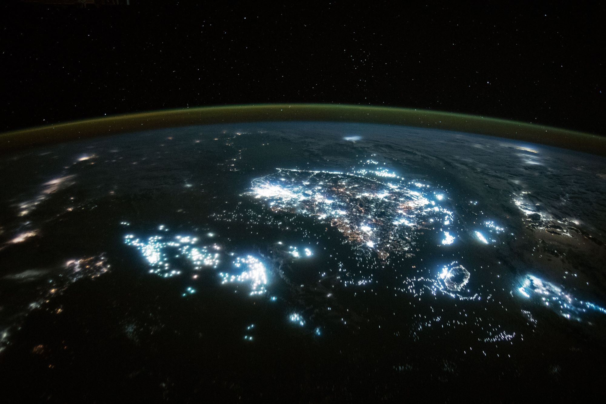
黄海は、中国大陸と朝鮮半島の間にある海で、黄河から運ばれる黄土により黄濁している部分があることからこのように呼ばれています。黄海は広義の東シナ海の一部で、北西側では、山東半島と遼東半島の間の渤海海峡を通じて渤海とつながっています。水深は平均44mと浅く、大陸棚となっています。フランスの地図製作者ダンヴィルが1737年に作成した『中国新地図帳』に黄海 (Hoang Hai ou Mer Jaune) と表記したことで国際的にも認知されるようになりました。中韓問題では、韓国が李承晩ラインを設定して公海上で操業する中国漁船を拿捕して「国際法上の慣例を無視した措置」をした時から、中国と韓国の間では排他的経済水域に関する争いがあります。蘇岩礁、可居礁をめぐる領有権争いに加え、中国漁船が韓国側水域に侵入することが両国間の問題となっています。
地上の様子はこちらです。

参考文献: NASA Earth’s Tweet
地球俯瞰画像を見る: LiVEARTH
[Earthview Wonders] No.1719: Yellow Sea and Korean Peninsula
Astronaut on board ISS captured the Yellow Sea and Korean Peninsula. The time was autumn when hairtail and anchovy fishing was active. North Korea just left side of the Military Demarcation Line (MDL) has little lights. Also, to the left of the image lie Dalian, Weihai and Yantai of China.
The Yellow Sea is a marginal sea of the Western Pacific Ocean located between mainland China and the Korean Peninsula, and can be considered the northwestern part of the East China Sea. Its name is descriptive of the golden-yellow colour of the silt-laden water discharged from major rivers. The innermost bay of northwestern Yellow Sea is called the Bohai Sea, into which flow some of the most important rivers of northern China.
The local scenery on the ground is as follows.
Reference: NASA Earth’s Tweet
See earthview photo gallery: LiVEARTH[:]