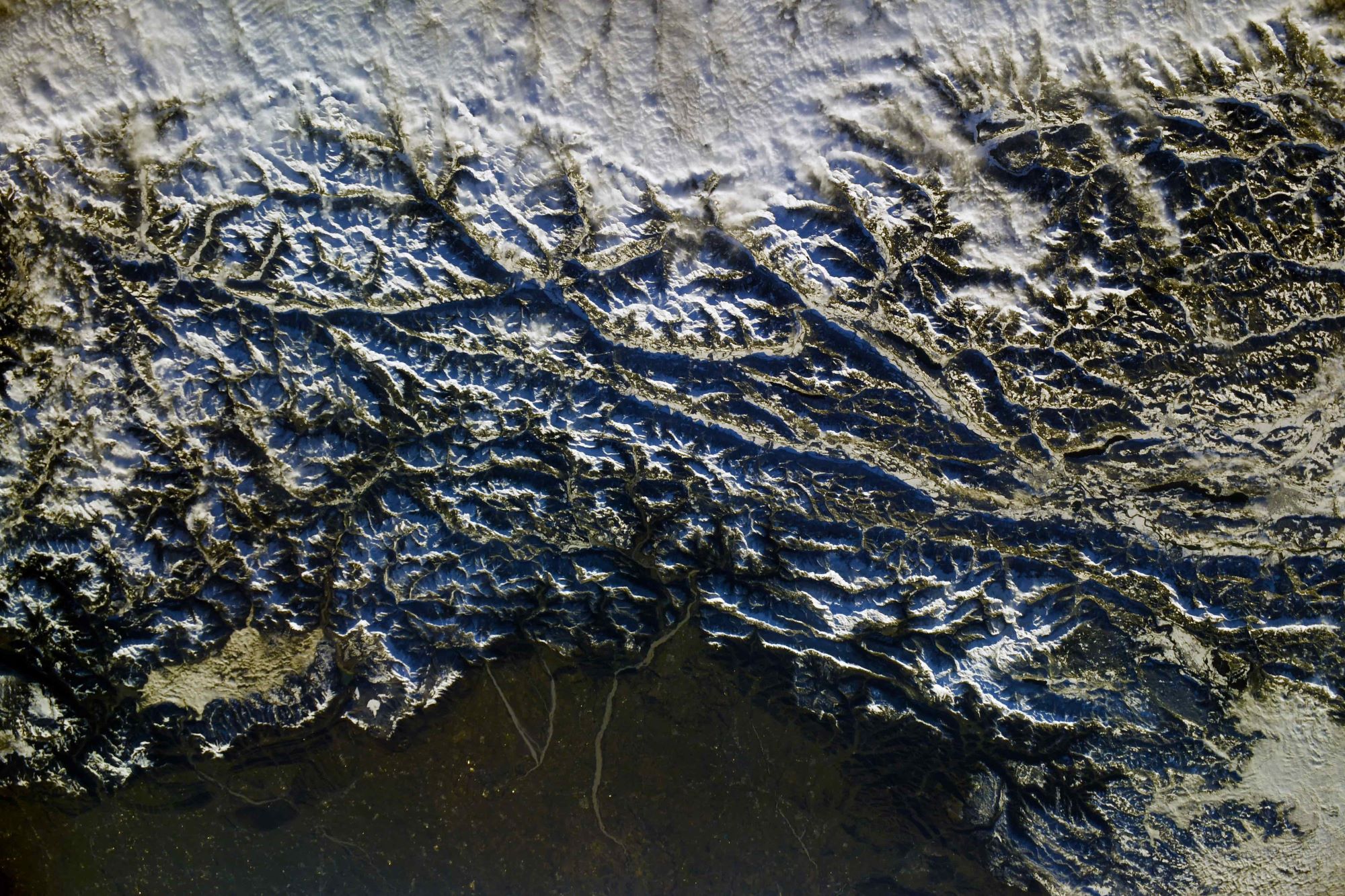
[:ja]アントン・シュカプレロフ宇宙飛行士がISSから撮影した東アルプス山脈です。イタリアのベネチアの北東、オーストリアとの国境付近で、モンテ・ゾンコラン(カルニケ・アルプス)も写っています。
東アルプス山脈はヨーロッパ・アルプスのうち、イタリアのコモ湖から北へリヒテンシュタインを経てスイス・オーストリア・ドイツ国境のボーデン湖に至る線より東にある山々を指し、この線の西にある西アルプス山脈に対する呼称です。
カルニケ・アルプス山系のモンテ・ゾンコランの地上の様子はこちらです。

参考文献: Anton Shkaplerov’s Tweet
地球俯瞰画像を見る: LiVEARTH
[Earthview Wonders] No.1722: Eastern Alps🇮🇹
Astronaut Anton Shkaplerov captured from ISS the Eastern Alps. The image shows the area north of Venice, near the border between Austria and Italy. The Monte Zoncolan in the Carnic Alps is in the image as well.
The Eastern Alps is the name given to the eastern half of the Alps, usually defined as the area east of a line from Lake Constance and the Alpine Rhine valley up to the Splügen Pass at the Alpine divide and down the Liro River to Lake Como in the south. The peaks and mountain passes are lower than the Western Alps, while the range itself is broader and less arched. (Credit: Anton Shkaplerov, Roscosmos)
The local scenery on the ground of the Monte Zoncolan in the Carnic Alps is as follows.
Reference: Anton Shkaplerov’s Tweet
See earthview photo gallery: LiVEARTH[:]