[:ja]野口聡一宇宙飛行士がISSから撮影したハイチの首都ポルトープランスです。約23年前の2010年1月12日に起こったマグニチュード 7.0のハイチ大地震では、地震の規模の大きさやハイチの政情不安定に起因する社会基盤の脆弱さが相俟って、死者が31万6千人程に及ぶなど、単一の地震災害としてはスマトラ島沖地震に匹敵する現代空前の大規模なものとなりました。
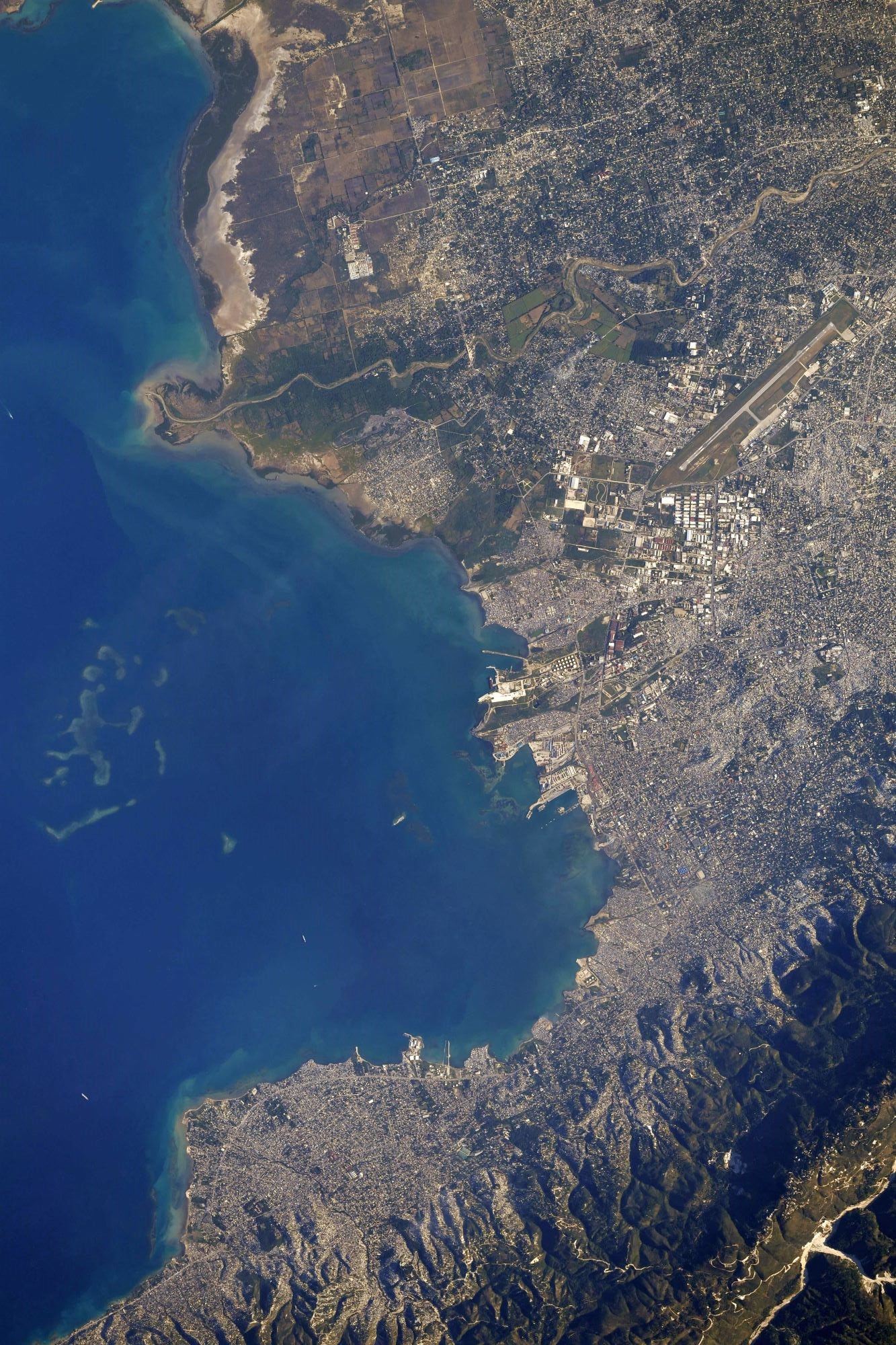
植民地の歴史を背景に、ハイチの公用語はハイチ語とフランス語ですが、ポルトープランスはフランス語で「王子の港」を意味しています。中心市街地はゴナイーヴ湾に面した低地にあり、住宅地は周囲の丘陵地帯に広がっています。首都圏の人口は約370万人と推定されており、これはハイチの人口の半分弱です。首都への極度の人口集中により住宅地の一部はスラム化しています。熱帯気候で1年を通じ高温 (平均27~30 ℃) で、4~6月と8~10月は比較的雨が多くなっています。ポルトープランスはコーヒー豆や砂糖の主要な積出港を有しており、石鹸、繊維、セメントも輸出しています。
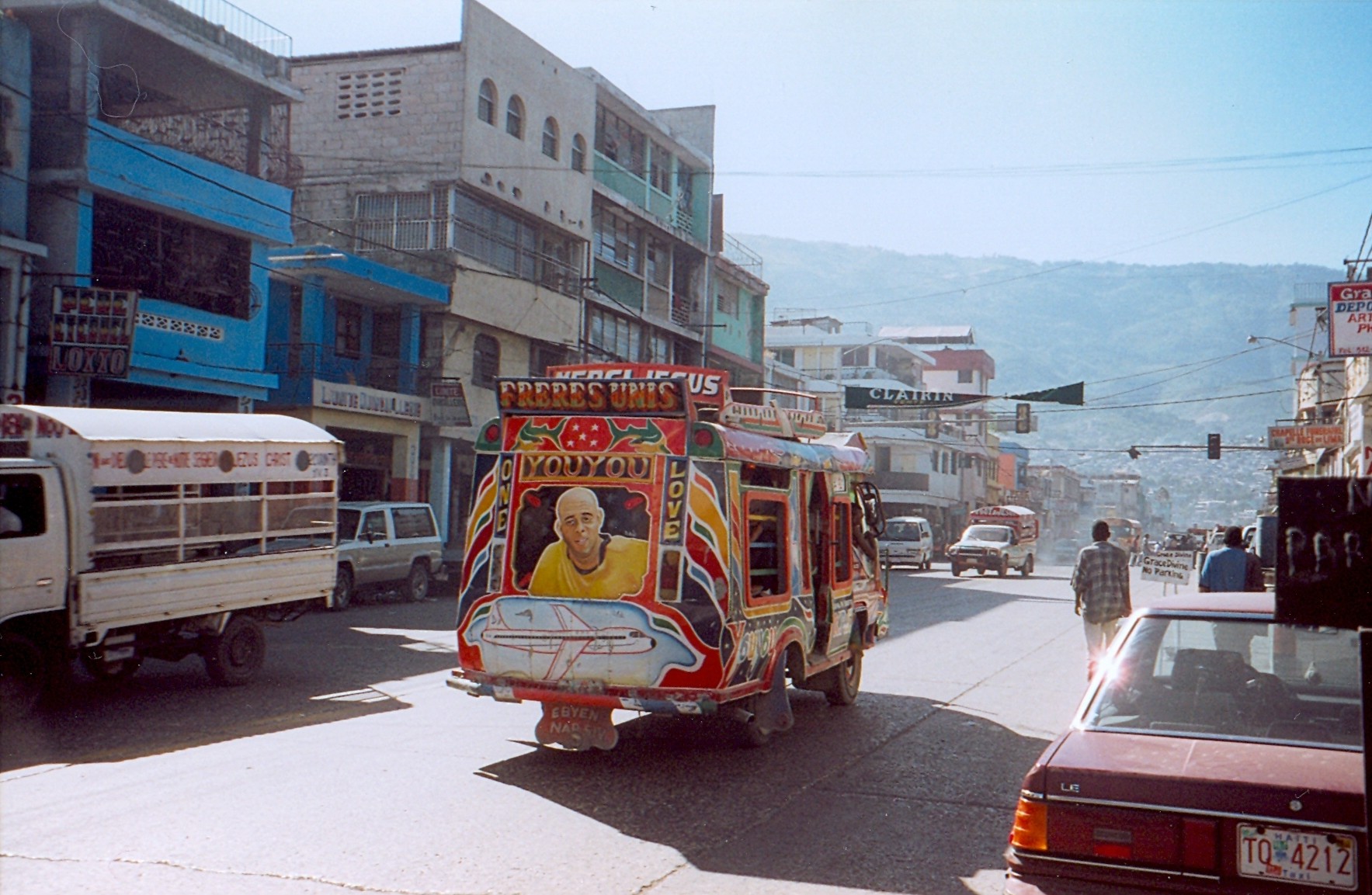
地上の様子はこちらです。
参考文献: Soichi Noguchi’s Tweet
地球俯瞰画像を見る: LiVEARTH
[Earthview Wonders] No.1726: Port-au-Prince🇭🇹
Astronaut Soichi Noguchi captured from ISS Port-au-Prince, the capital of Haiti. 23 years ago on Jan. 12, 2010, a catastrophic magnitude 7.0 earthquake struck Haiti which caused death toll of 316,000.
The city of Port-au-Prince is on the Gulf of Gonâve: the bay on which the city lies, which acts as a natural harbor, has sustained economic activity since the civilizations of the Taíno. It was first incorporated under French colonial rule in 1749. Recent estimates place the metropolitan area’s population at around 3.7 million, nearly half of the country’s national population. The capital exports its most widely consumed produce of coffee and sugar, and has, in the past, exported other goods, such as shoes and baseballs. Port-au-Prince has food-processing plants as well as soap, textile and cement factories. Despite political unrest, the city also relies on the tourism industry and construction companies to move its economy. (Credit: Shane Kimbrough, NASA)
The local scenery on the ground is as follows.
Reference: Soichi Noguchi’s Tweet
See earthview photo gallery: LiVEARTH[:]