[:ja]宇宙飛行士がISSから撮影したモザンビークのキリンバス諸島です。
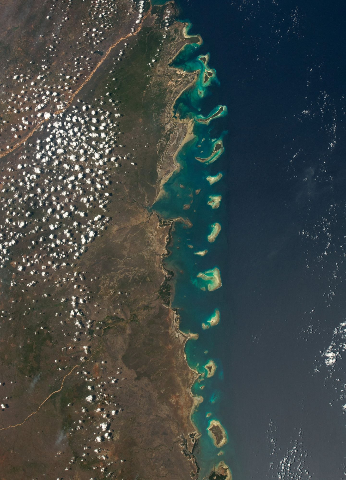
キリンバス諸島はモザンビーク海峡に浮かぶモザンビーク領の島で、モザンビーク北東部カボ・デルガード州に属し、イボ島、マテモ島、キリンバ島、Metundo島、Quisiva島、Vamizi島、Rolas島など、およそ32の島からなります。もともとは漁民の集落がありましたが、16世紀にアラブ人の交易拠点周辺で人口が増加しポルトガル人の交易路として発展しました。ポルトガルが都市の占領を始めるとアラブ人は他所へ移動しました。諸島は1975年のモザンビーク独立までポルトガル統治下にありました。独立前は有人島は4つのみでしたが、現在では多くの島に住民がいます。
地上の様子はこちらです。

参考文献: NASA Earth’s Tweet
地球俯瞰画像を見る: LiVEARTH
[Earthview Wonders] No.1744: Quirimbas Islands🇲🇿
Astronaut on board ISS Quirimbas, Mozambique.
The Quirimbas Islands lie in the Indian Ocean off northeastern Mozambique, close to Pemba, the capital of the province of Cabo Delgado. The archipelago consists of about 32 islands, including Ibo, Matemo, Medjumbe, Quirimba, Metundo, Quisiva, Vamizi Island and Rolas Island all going up to the Tanzanian border. Originally home to fishing settlements, the islands’ population grew around Arab trading posts and thrived under the Portuguese trading routes during the 16th century. When the Portuguese started occupying cities in the islands such as Ibo, the Arab merchants fled to other parts of the island to operate in. The island was in control by the Portuguese until Mozambique gained independence in 1975. Before independence, only four of the 32 islands were inhabited, but today, many of the islands are inhabited.
The local scenery on the ground is as follows.
Reference: NASA Earth’s Tweet
See earthview photo gallery: LiVEARTH[:]