[:ja]NASAの地球観測衛星Terraが撮影した四川盆地です。成都や重慶などの大都市があり、その地形から、大気汚染が深刻です。
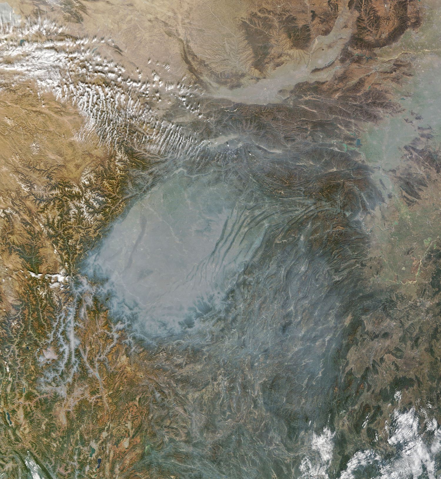
四川盆地は長江の上流域にあり、四方を高い山脈や高原に囲まれた大きな盆地で、タリム盆地・ジュンガル盆地・ツァイダム盆地と並ぶ中国4大盆地の一つです。四川の名の由来には、盆地内を流れる長江の四つの支流に由来するという説、また宋代にこの地方に置かれた行政区画・川峡路が後に四つに分割され、川峡四路と総称されたことが四川の名の始まりという説もあります。四川盆地はチベット高原の東に位置するおおよそ長方形の平野で北東から南西方向に伸び、褶曲作用でできた高い山脈が連続して周りを囲みます。西には横断山脈、岷山山脈など、5,000mを超え最高で7,590mに達する高山がチベット高原方面まで続き、これらの山脈により四川盆地は完全に閉ざされています。四川盆地内は丘陵が起伏し、風が弱いので冬には地表面近くでは気温の逆転が起こり、霧が発生しやすくなっています。さらに湿度が高く、雲も多いため霧が消えにくい条件にあります。
地上の様子はこちらです。

参考文献: NASA Goddard’s Tweet
地球俯瞰画像を見る: LiVEARTH
[Earthview Wonders] No.1745: Sichuan Basin🇨🇳
NASA’s Terra satellite captured Sichuan Basin, China. Due to its geological terrain, air pollution and haze often pools in the basin.
The Sichuan Basin is a lowland region in southwestern China. It is surrounded by mountains on all sides and is drained by the upper Yangtze River and its tributaries. The basin is anchored by Chengdu, the capital of Sichuan province, in the west, and the direct-administered municipality of Chongqing in the east. Due to its relative flatness and fertile soils, it is able to support a population of more than 100 million. Due to the surrounding mountains, the Sichuan Basin often experiences fog and smog as a result of temperature inversion caused by the basin’s convective layer being capped by a layer of air moving east across the Tibet Plateau.
The local scenery on the ground is as follows.
Reference: NASA Goddard’s Tweet
See earthview photo gallery: LiVEARTH[:]