[:ja]野口聡一宇宙飛行士がISSから撮影したコロンビアとパナマにまたがるダリエン地峡です。
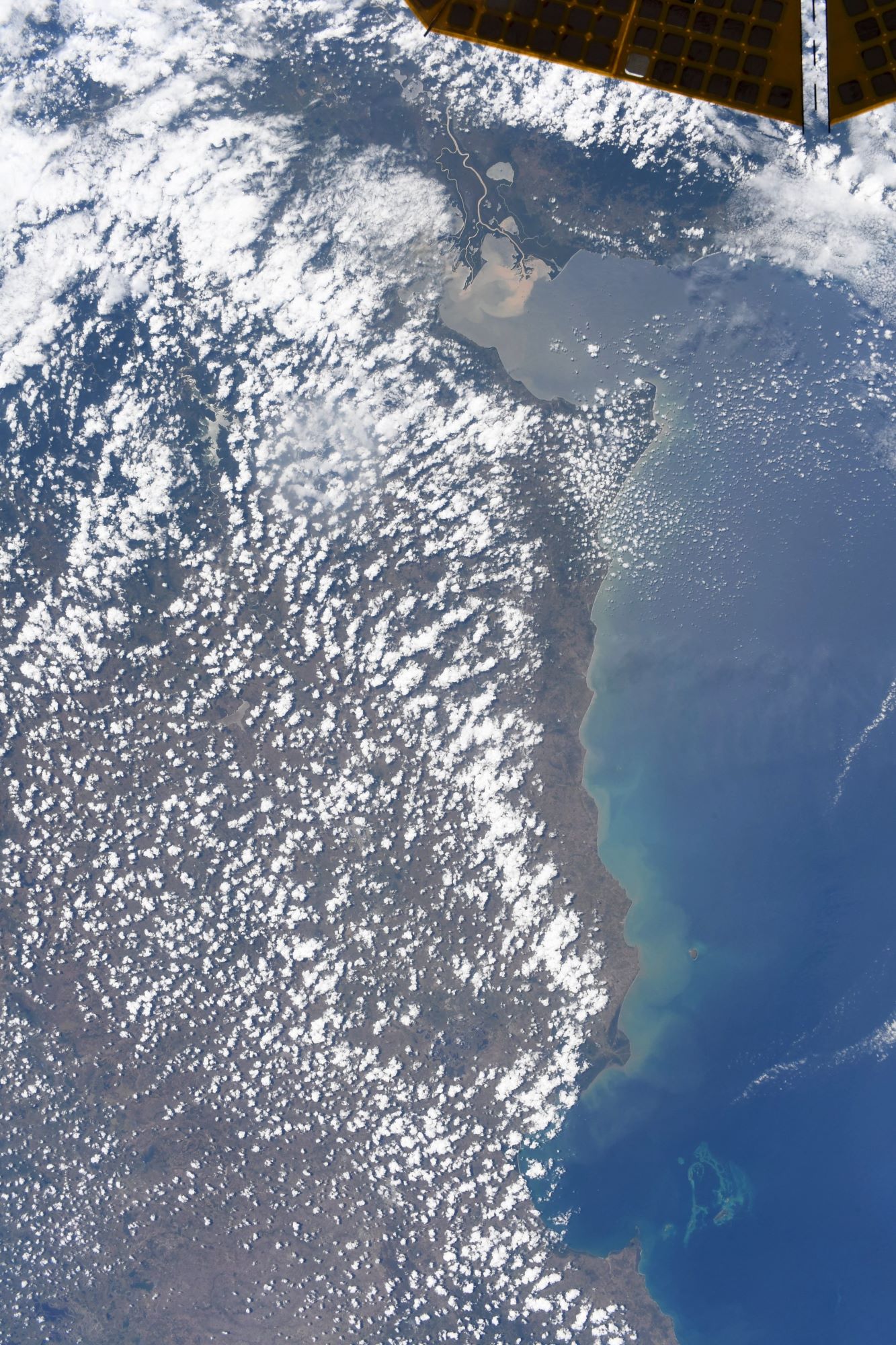
ダリエン地峡(ダリエン・ギャップ)は、北アメリカ大陸と南アメリカ大陸とをつなぐ地峡部分において、最も南アメリカ大陸に近い区間です。中央アメリカのパナマのダリエン県と、南アメリカのコロンビアのチョコ県北部にまたがっており、21世紀初頭においても開発の手があまり及んでいない沼地や熱帯雨林が残る地帯です。南北アメリカ大陸を縦断するパン・アメリカン・ハイウェイにおける未開通区間となっています。地峡部のコロンビア側はアトラト川のデルタ地帯が大勢を占めており、低平な沼沢地が80kmにわたって広がり、その大半は沼地です。また、バウド山脈がコロンビアの太平洋岸に沿ってパナマまで延びています。パナマ側は対照的に、60mの谷床から最高1,845m(ダリエン山脈)に達する山がちな熱帯雨林地帯です。
地上の様子はこちらです。

参考文献: Soichi Noguchi’s Tweet
地球俯瞰画像を見る: LiVEARTH
[Earthview Wonders] No.1751: Darien Gap🇨🇴🇵🇦
Astronaut Soichi Noguchi captured from ISS the Darien Gap over Colombia and Panama.
The Darién Gap is a geographic region between the North and South American continents within Central America, consisting of a large watershed, forest, and mountains in Panama’s Darién Province and the northern portion of Colombia’s Chocó Department. The “gap” in question is that of the Pan-American Highway, of which 106 km (66 mi) between Yaviza, Panama, and Turbo, Colombia, has not been built. The geography of the Darién Gap on the Colombian side is dominated primarily by the river delta of the Atrato River, which creates a flat marshland at least 80km wide. The Serranía del Baudó range extends along Colombia’s Pacific coast and into Panama. The Panamanian side, in stark contrast, is a mountainous rainforest, with terrain reaching from 60m in the valley floors to 1,845m at the tallest peak (Cerro Tacarcuna, in the Serranía del Darién). (Credit: Soichi Noguchi, JAXA, NASA)
The local scenery on the ground is as follows.
Reference: Soichi Noguchi’s Tweet
See earthview photo gallery: LiVEARTH[:]