[:ja]NASAの地球観測衛星Landsat 8が撮影したボリビアのポトシです。
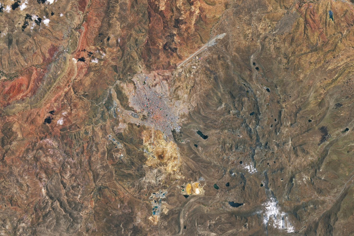
ポトシは、アンデス山脈中の盆地にあり、標高約4,000mと人が住む都市としては世界で最も標高が高い都市の一つです。高山地域のうえ乾燥気候であるために植生には乏しいです。民族的には、インディオの特徴を強く持つ人が多く、チョリータが多くなっています。ケチュア語を話す人が多いですが、スペイン語を全く解さない人は近年だいぶ少なくなってきました。町は1546年に鉱山町として設立され、人口も一時は20万人にまで増加。スペイン統治時代に金・銀を多く産出する鉱山が開発され、45,000tの銀などを産出しましたが、19世紀にはすっかり枯渇してしまいました。1987年、セロ・リコ銀山を含め、他の構造物とともに世界遺産に登録されました。また、奴隷制度の象徴として、負の世界遺産にも数えられています。
地上の様子はこちらです。


参考文献: ‘s Tweet
地球俯瞰画像を見る: LiVEARTH
[Earthview Wonders] No.1771: Potosi🇧🇴
NASA’s Landsat 8 satellite captured Potosi, Bolivia.
Potosí is one of the highest cities in the world at a nominal 4,090m. For centuries, it was the location of the Spanish colonial silver mint. A considerable amount of the city’s colonial architecture has been preserved in the historic center of the city, which – along with the globally important Cerro Rico de Potosí – are part of a designated UNESCO World Heritage Site. Potosí lies at the foot of the Cerro de Potosí, a mountain popularly conceived of as being “made of” silver ore that dominates the city. The Cerro Rico is the reason for Potosí’s historical importance since it was the major supply of silver for the Spanish Empire until Guanajuato in Mexico surpassed it in the 18th century.
The local scenery on the ground is as follows.
Reference: ‘s Tweet
See earthview photo gallery: LiVEARTH[:]