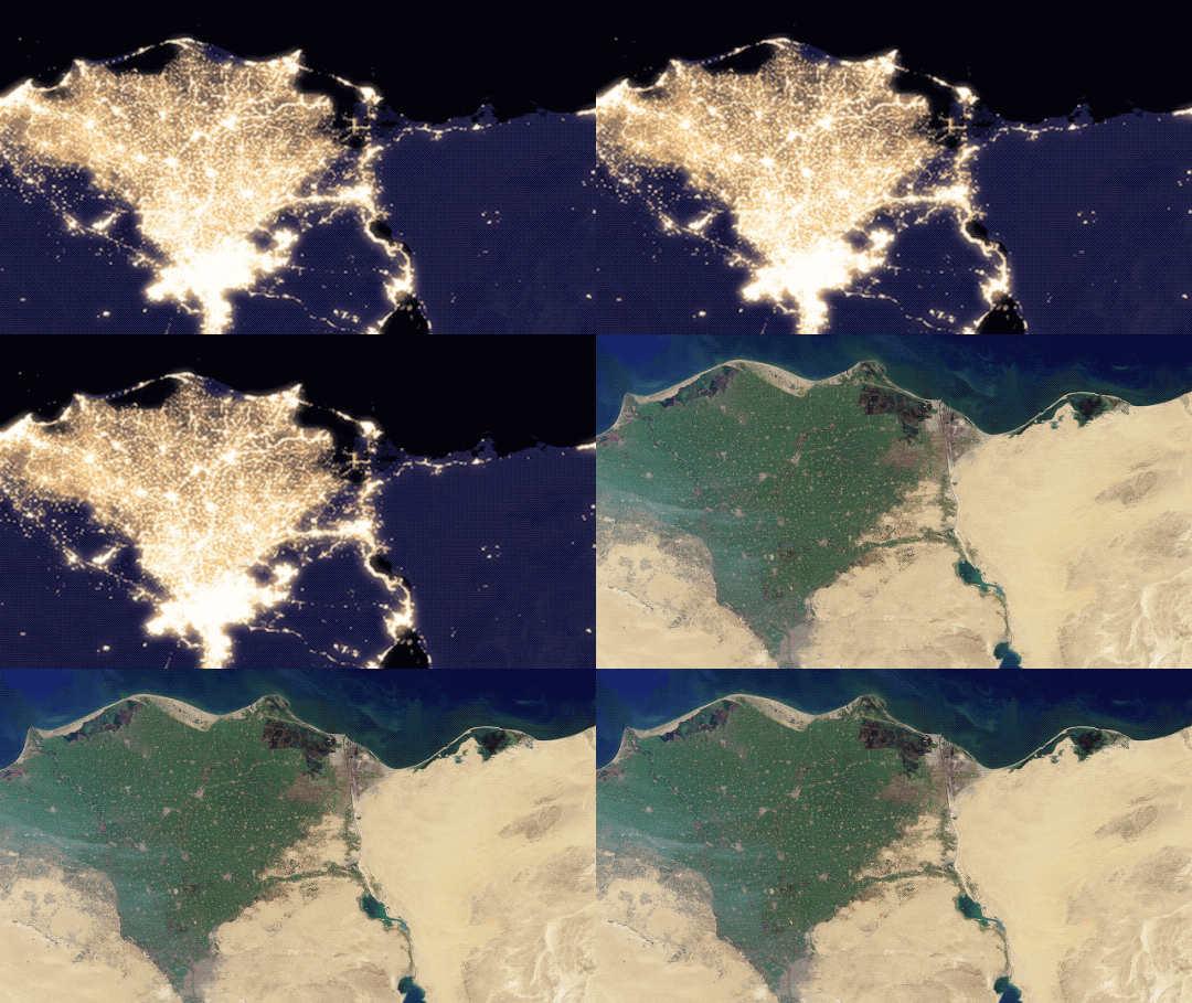
[:ja]NASAが5年ぶりに更新した夜の地球「ブラックマーブル」の画像から、夜のナイル川デルタ(三角州)です。衛星画像ではアレクサンドリアをはじめ、大都市の灯を中心に明るくなっています。

ナイル川デルタは東西240kmにわたり広がる世界最大級の三角州で、肥沃な土壌を生んでいます。アレクサンドリアからポートサイドにかけ、首都カイロから少し下ったところから始まります。河口まで160kmですが、その間の高低差は16mしかありません。
地上の様子はこちらです。

ちなみに夜のナイル川はNo.83: 夜のナイル川でも紹介しています。
参考文献: Black Marble: NASA View Illuminates Earth at Night
ウェブ地球儀で地球俯瞰画像を見る: LiVEARTH
[Earthview Wonders] No.231: Night Earth 3: Nile Delta At Night🇪🇬
From the “Black Marble” NASA released first time in 5 years, Nile Delta at night is stunning. From the image, lights of the cities on the coastline including Alexandria are prominent.

The Nile Delta is where the Nile River spreads out and drains into the Mediterranean Sea. It is one of the world’s largest river deltas, from Alexandria in the west to Port Said in the east, it covers 240km of Mediterranean coastline, and is a rich agricultural region.
The local scenery on the ground is as follows.

Nile River at night is introduced in No.83: Nile River At Night as well.
Reference: Black Marble: NASA View Illuminates Earth at Night
See earthview photo gallery with web-globe: LiVEARTH[:en][Earthview Wonders] No.231: Night Earth 3: Nile Delta At Night🇪🇬
From the “Black Marble” NASA released first time in 5 years, Nile Delta at night is stunning. From the image, lights of the cities on the coastline including Alexandria are prominent.

The Nile Delta is where the Nile River spreads out and drains into the Mediterranean Sea. It is one of the world’s largest river deltas, from Alexandria in the west to Port Said in the east, it covers 240km of Mediterranean coastline, and is a rich agricultural region.
The local scenery on the ground is as follows.

Nile River at night is introduced in No.83: Nile River At Night as well.
Reference: Black Marble: NASA View Illuminates Earth at Night
See earthview photo gallery with web-globe: LiVEARTH[:]