[:ja]トマ・ペスケ宇宙飛行士がISSから撮影したスーダンを流れるナイル川です。ナイル川の東側は岩山、西側は砂漠で、川が2つ異なる地形を隔てているのが面白いです。
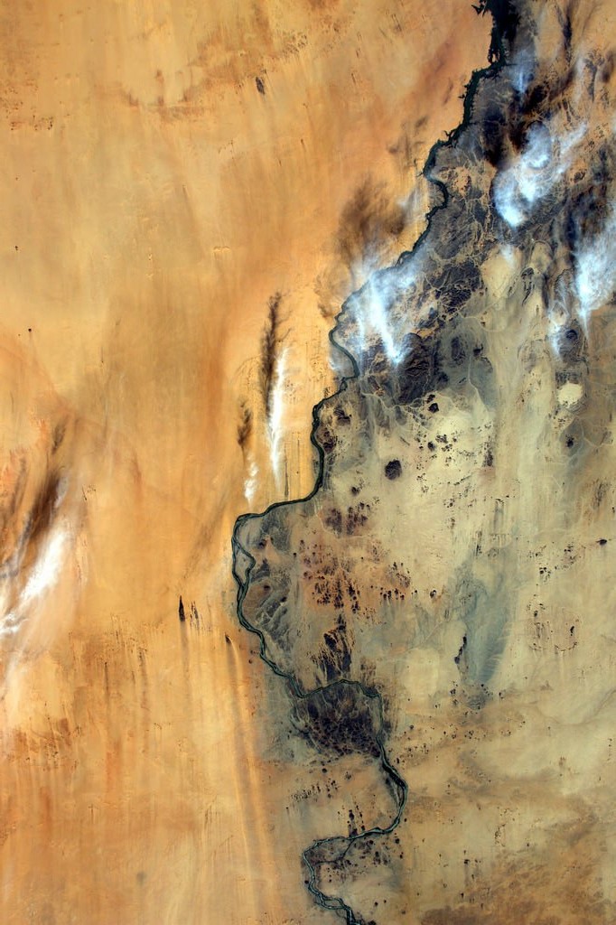
ナイル川は全長6695kmで世界最長の川です。ルワンダ北部の高山地方に源を発するホワイトナイルと、エチオピア高原のタナ湖に源を発するブルーナイルの2つの支流が、スーダンのハルツームで合流しナイル本流となります。タナ湖はNo.198: エチオピアのタナ湖でも紹介しています。
スーダンのナイル川の様子はこちらです。

参考文献: Thomas Pesquet’s Tweet
ウェブ地球儀で地球俯瞰画像を見る: LiVEARTH
[Earthview Wonders] No.241: Nile River in Sudan🇸🇩
Astronaut Thomas Pesquet captured from ISS the Nile River in Sudan. It is interesting to note the river separates rocky terrain on the east and sandy land on the west side.
The Nile River is 6695km long and is the longest in the world. The Nile has 2 major tributaries, the White Nile originating in Rwanda and Brundi, and the Blue Nile begins at lake Tana in Ethiopia. These two rivers merge at Khartoum, Sudan. Lake Tana was introduced in No.198: Ethiopia’s Lake Tana.
The Nile in Sudan looks like this.
Reference: Thomas Pesquet’s Tweet
See earthview photo gallery with web-globe: LiVEARTH[:en][Earthview Wonders] No.241: Nile River in Sudan🇸🇩
Astronaut Thomas Pesquet captured from ISS the Nile River in Sudan. It is interesting to note the river separates rocky terrain on the east and sandy land on the west side.
The Nile River is 6695km long and is the longest in the world. The Nile has 2 major tributaries, the White Nile originating in Rwanda and Brundi, and the Blue Nile begins at lake Tana in Ethiopia. These two rivers merge at Khartoum, Sudan. Lake Tana was introduced in No.198: Ethiopia’s Lake Tana.
The Nile in Sudan looks like this.
Reference: Thomas Pesquet’s Tweet
See earthview photo gallery with web-globe: LiVEARTH[:]