[:ja]NASAの地球観測衛星Aquaが撮影したベネズエラ北西の塩湖、マラカイボ湖です。南アメリカ大陸最大の湖ですが、実際は水路によってベネズエラ湾に、さらにはカリブ海、大西洋にもつながっていて海と定義する事もできます。
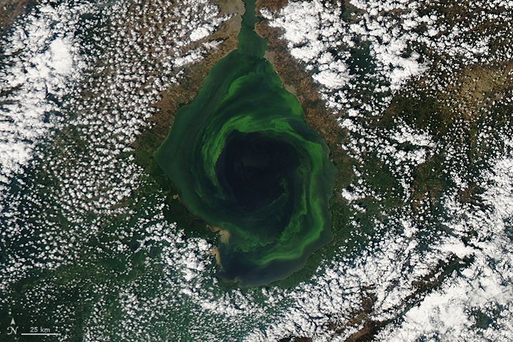
マラカイボ湖は湖底に養分のある冷たい塩水が、水面付近に温かい淡水が層を成しています。豪雨の後などは、これらの層が混ざり合って、アオウキクサ等の植物の成長が促進されます。
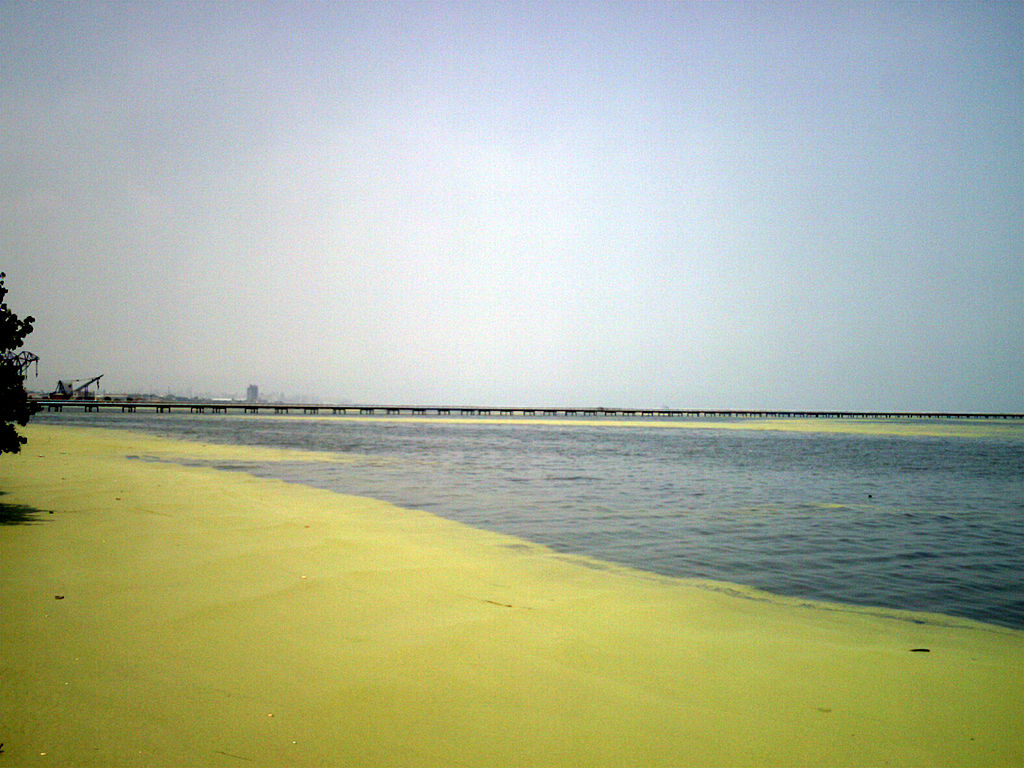
地上の様子はこちらです。
参考文献: An Emerald Vortex
ウェブ地球儀で地球俯瞰画像を見る: LiVEARTH
[Earthview Wonders] No.245: Lake Maracaibo of Venezuela🇻🇪
NASA’s Aqua satellite captured Lake Maracaibo northwestern Venezuela. The lake is the largest in South America, but is actually connected to the Gulf of Venezuela by Tablazo Strait, Caribbean Sea and the Atlantic Ocean.
Maracaibo’s waters are stratified into layers, with nutrient-rich, cooler, saltier water at the bottom, and a warmer, fresher layer near the surface. But after heavy rains, the layers can mix and make the lake an ideal habitat for plant growth.
The local scenery on the ground is as follows.
Reference: An Emerald Vortex
See earthview photo gallery with web-globe: LiVEARTH[:en][Earthview Wonders] No.245: Lake Maracaibo of Venezuela🇻🇪
NASA’s Aqua satellite captured Lake Maracaibo northwestern Venezuela. The lake is the largest in South America, but is actually connected to the Gulf of Venezuela by Tablazo Strait, Caribbean Sea and the Atlantic Ocean.
Maracaibo’s waters are stratified into layers, with nutrient-rich, cooler, saltier water at the bottom, and a warmer, fresher layer near the surface. But after heavy rains, the layers can mix and make the lake an ideal habitat for plant growth.
The local scenery on the ground is as follows.
Reference: An Emerald Vortex
See earthview photo gallery with web-globe: LiVEARTH[:]