[:ja]NASAの地球観測衛星Landsat8が撮影した中国最大の都市、上海です。上海は長江河口南岸に位置し、人口は2400万人を超える世界有数の国際都市です。
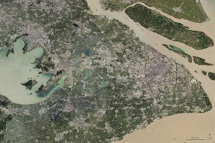
経済発展と共に都市化も進み、1960年には1億1千万人(人口の16%)が都市に住んでいましたが、今は7億6千万人(人口の56%)に膨れ上がっています。画像でもグレーの部分が都市化が進んでいる場所です。
1984年の上海の衛星画像はこちらです。

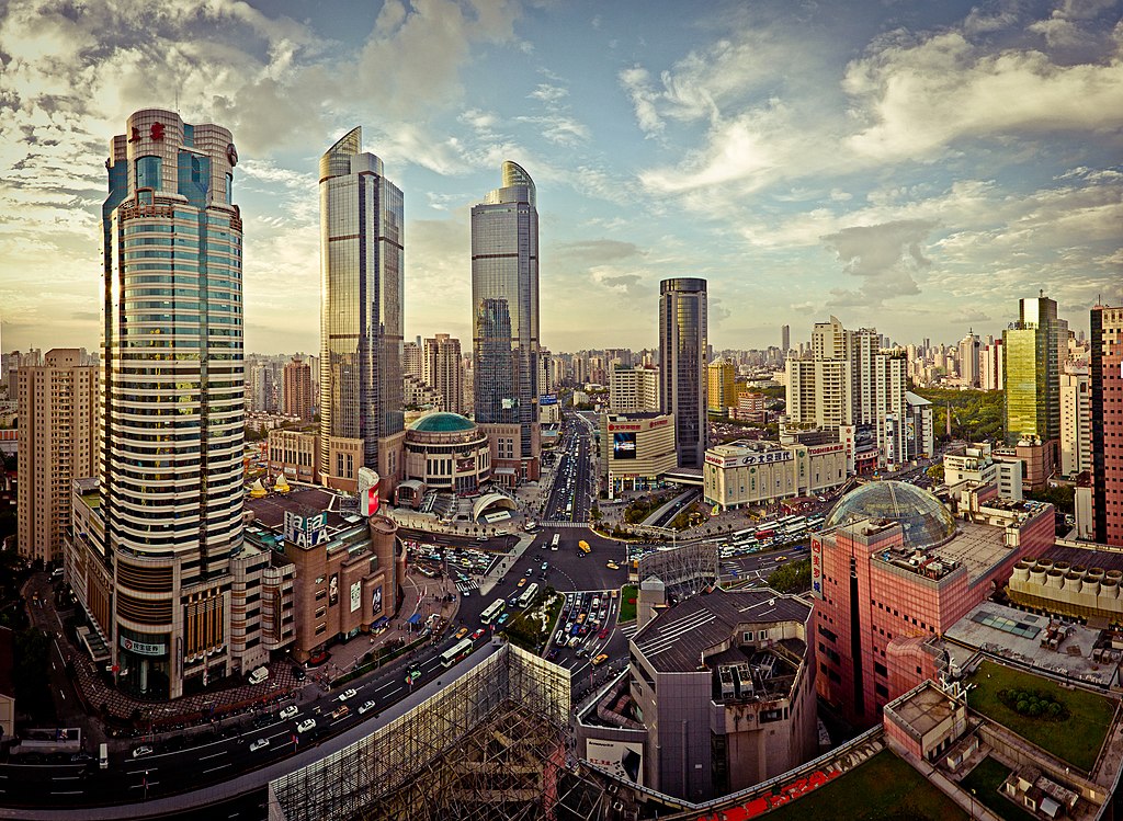
地上の様子はこちらです。
参考文献: Sprawling Shanghai
ウェブ地球儀で地球俯瞰画像を見る: LiVEARTH
[Earthview Wonders] No.256: Sprawling Shanghai🇨🇳
NASA’s Landsat 8 satellite captured Shanghai, the largest city of China. Shanghai is located at the mouth of the Chang Jiang (Yangtze River) with over 24 million population.
Urbanization took place along with economic growth. In 1960 only 110 million people (16% of the country) lived cities while 760 million (56%) today. The urbanization is readily recognizable with gray color.
Shanghai in 1984 is as follows.
Also the local scenery on the ground is as follows.
Reference: Sprawling Shanghai
See earthview photo gallery with web-globe: LiVEARTH[:en][Earthview Wonders] No.256: Sprawling Shanghai🇨🇳
NASA’s Landsat 8 satellite captured Shanghai, the largest city of China. Shanghai is located at the mouth of the Chang Jiang (Yangtze River) with over 24 million population.
Urbanization took place along with economic growth. In 1960 only 110 million people (16% of the country) lived cities while 760 million (56%) today. The urbanization is readily recognizable with gray color.
Shanghai in 1984 is as follows.
Also the local scenery on the ground is as follows.
Reference: Sprawling Shanghai
See earthview photo gallery with web-globe: LiVEARTH[:]