[:ja]パオロ・ネスポリ宇宙飛行士がISSから撮影したイラクを流れるユーフラテス川とサルサール湖です。
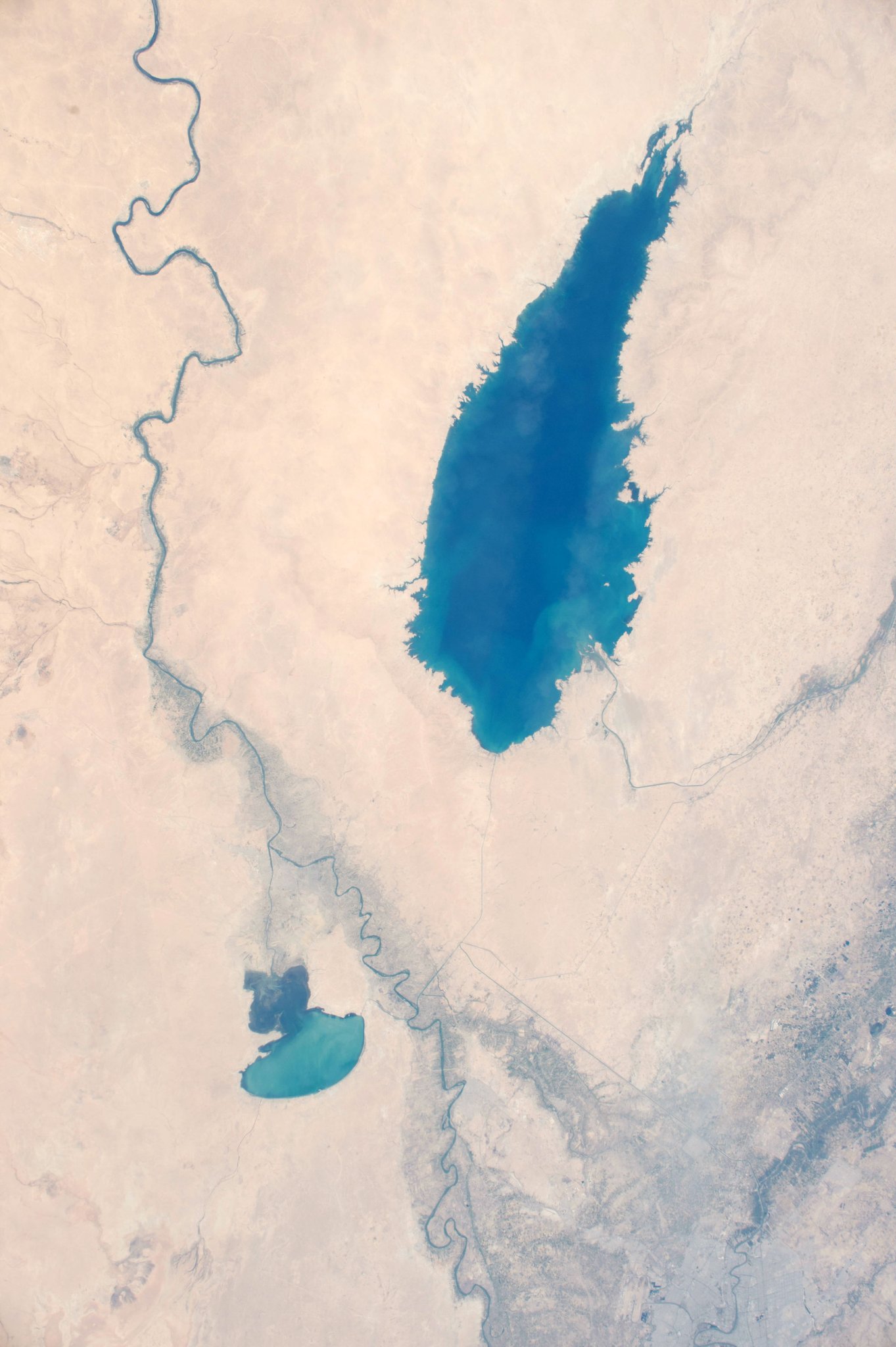
ユーフラテス川は、トルコ北東部の山地を源流としてシリアを通過し、イラクでチグリス川と合流してシャットゥルアラブ川となり、最終的にペルシア湾に注ぐ全長2780kmの国際河川です。数千年前、この川と隣のチグリス川の水は、いわゆる「肥沃な三日月地帯」を形成し、中東最初の文明を構築することに貢献しました。下流域は古代メソポタミア文明の発祥地として知られています。
地上の様子はこちらです。

参考文献: Paolo Nespoli’s Tweet
ウェブ地球儀で地球俯瞰画像を見る: LiVEARTH
[Earthview Wonders] No.334: Euphrates River🇮🇶
Astronaut Paolo Nespoli captured from ISS Euphrates River and Lake Tharthar of Iraq.
The Euphrates is the longest and one of the most historically important rivers of Western Asia. Together with the Tigris, it is one of the two defining rivers of Mesopotamia (the “Land between the Rivers”). Originating in eastern Turkey, the Euphrates flows through Syria and Iraq to join the Tigris in the Shatt al-Arab, which empties into the Persian Gulf.
The local scenery on the ground is as follows.
Reference: Paolo Nespoli’s Tweet
See earthview photo gallery with web-globe: LiVEARTH[:en][Earthview Wonders] No.334: Euphrates River🇮🇶
Astronaut Paolo Nespoli captured from ISS Euphrates River and Lake Tharthar of Iraq.
The Euphrates is the longest and one of the most historically important rivers of Western Asia. Together with the Tigris, it is one of the two defining rivers of Mesopotamia (the “Land between the Rivers”). Originating in eastern Turkey, the Euphrates flows through Syria and Iraq to join the Tigris in the Shatt al-Arab, which empties into the Persian Gulf.
The local scenery on the ground is as follows.
Reference: Paolo Nespoli’s Tweet
See earthview photo gallery with web-globe: LiVEARTH[:]