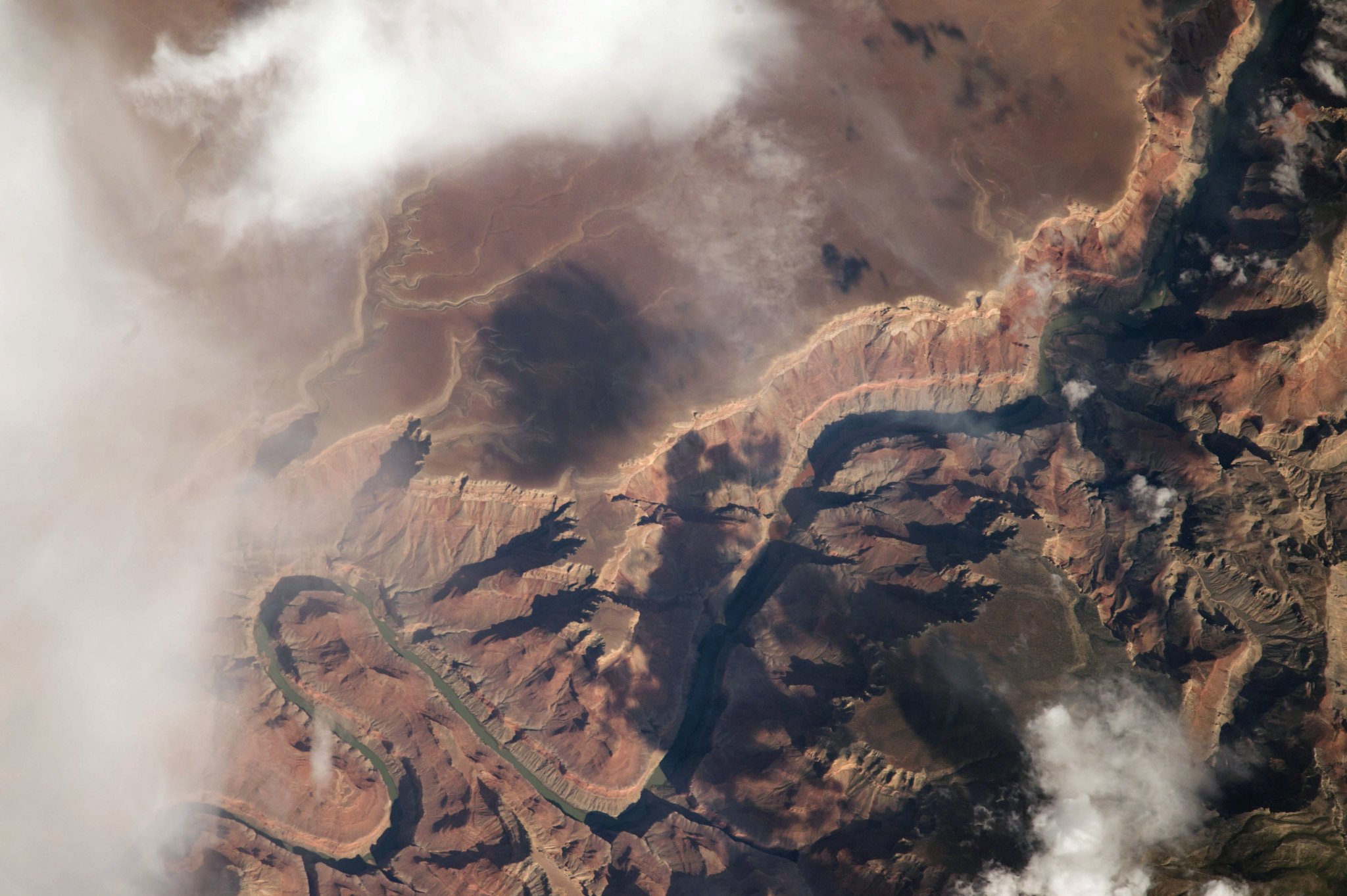
[:ja]パオロ・ネスポリ宇宙飛行士がISSから撮影した米アリゾナ州のマーブル・キャニオンとコロラド川です。マーブル・キャニオンはナバホ居留地の西端に位置します。
コロラド川はコロラド州のロッキーマウンテン国立公園内に源を発し南西に流れます。下流のメキシコ領内ではバハカリフォルニア州とソノラ州との境界を形成し、ほとんど干上がった状態でカリフォルニア湾に注ぎます。
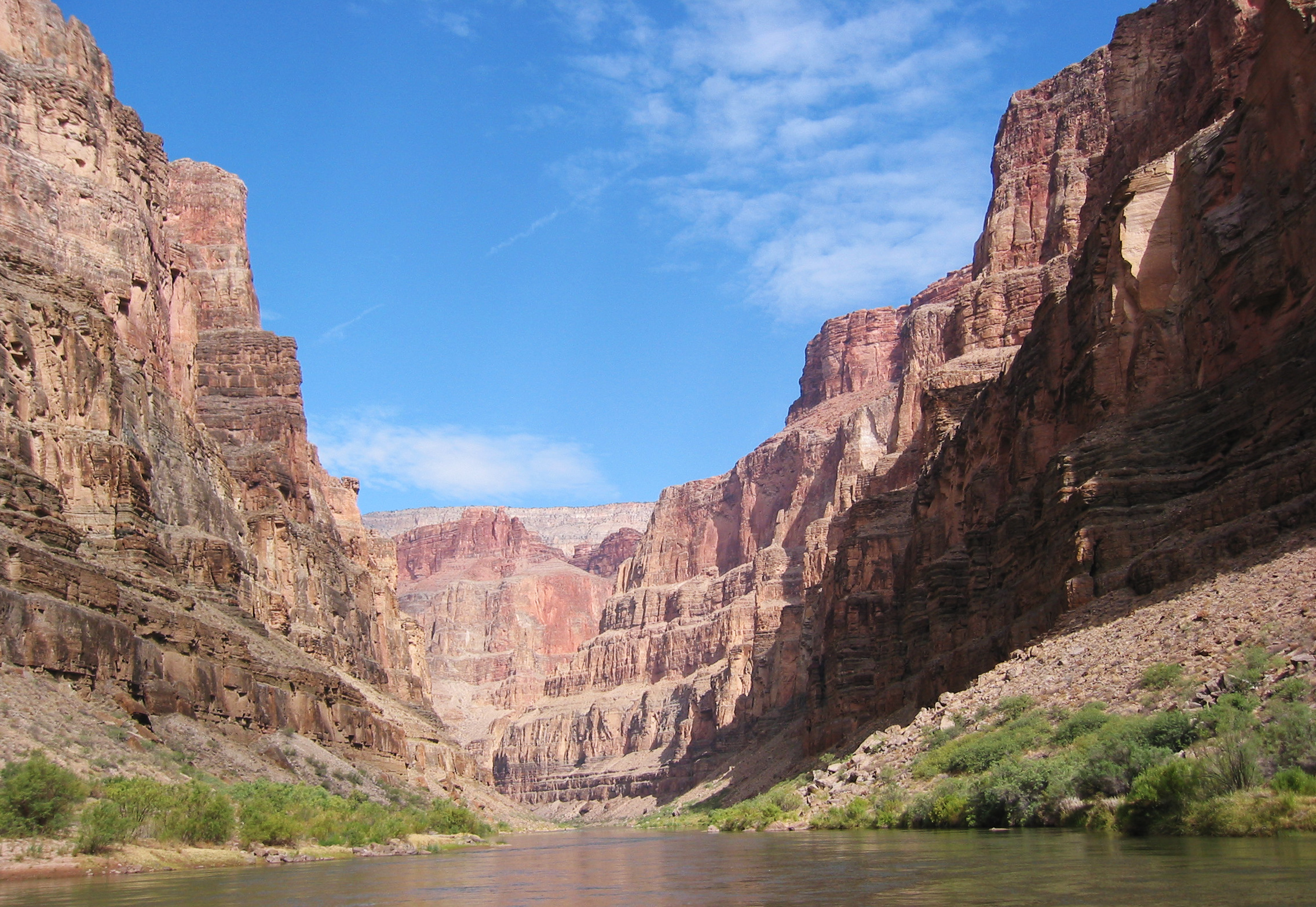
地上の様子はこちらです。
参考文献: Paolo Nespoli’s Tweet
ウェブ地球儀で地球俯瞰画像を見る: LiVEARTH
[Earthview Wonders] No.340: Marble Canyon and Colorado River🇺🇸
Astronaut Paolo Nespoli captured from ISS the Marble Canyon and Colorado River. The canyon marks the western boundary of the Navajo Nation. The name Marble Canyon is a misnomer because there is no marble there.
Marble Canyon is the section of the Colorado River canyon in northern Arizona. Starting in the central Rocky Mountains in the U.S., Colorado River flows generally southwest across the Colorado Plateau and through the Grand Canyon, enter Mexico, and reaches Gulf of California.
The local scenery on the ground is as follows.
Reference: Paolo Nespoli’s Tweet
See earthview photo gallery with web-globe: LiVEARTH
[:en][Earthview Wonders] No.340: Marble Canyon and Colorado River🇺🇸
Astronaut Paolo Nespoli captured from ISS the Marble Canyon and Colorado River. The canyon marks the western boundary of the Navajo Nation. The name Marble Canyon is a misnomer because there is no marble there.
Marble Canyon is the section of the Colorado River canyon in northern Arizona. Starting in the central Rocky Mountains in the U.S., Colorado River flows generally southwest across the Colorado Plateau and through the Grand Canyon, enter Mexico, and reaches Gulf of California.
The local scenery on the ground is as follows.
Reference: Paolo Nespoli’s Tweet
See earthview photo gallery with web-globe: LiVEARTH
[:]