[:ja]ランディ・ブレズニク宇宙飛行士がISSから撮影した、東部地中海沿岸地方レバントのゴラン高原です。イスラエル、レバノン、ヨルダンおよびシリアの国境が接する高原です。
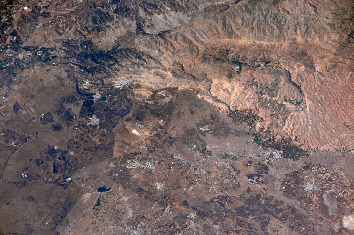
イスラエル国防軍が1967年から1981年まで占領して軍政下に置き、後にクネセトによってゴラン高原法に基づく民政下に置かれましたが、イスラエルを除く当事国、および国連のどちらもこれを認めていません。シリアおよび国際連合は同高原をクネイトラ県の一部であると考えており、複雑な領有権問題となっています。
地上の様子はこちらです。

参考文献: Randy Bresnik’s Tweet
ウェブ地球儀で地球俯瞰画像を見る: LiVEARTH
[Earthview Wonders] No.368: Golan Heights of Levant🇸🇾🇮🇱🇱🇧🇯🇴
Astronaut Randy Bresnik captured from ISS Golan Heights of Levant in the Eastern Mediterranean. The Golan Heights involves the borders of Israel, Lebanon, Jordan and Syria.
The Golan Heights, a rocky plateau in south-western Syria, has a political and strategic significance which belies its size. The Golan Heights is the area captured from Syria and occupied by Israel during the Six-Day War, territory which Israel annexed in 1981. Since then it has been an international territorial issue especially between Israel and Syria.
The local scenery on the ground is as follows.
Reference: Randy Bresnik’s Tweet
See earthview photo gallery with web-globe: LiVEARTH[:en][Earthview Wonders] No.368: Golan Heights of Levant🇸🇾🇮🇱🇱🇧🇯🇴
Astronaut Randy Bresnik captured from ISS Golan Heights of Levant in the Eastern Mediterranean. The Golan Heights involves the borders of Israel, Lebanon, Jordan and Syria.
The Golan Heights, a rocky plateau in south-western Syria, has a political and strategic significance which belies its size. The Golan Heights is the area captured from Syria and occupied by Israel during the Six-Day War, territory which Israel annexed in 1981. Since then it has been an international territorial issue especially between Israel and Syria.
The local scenery on the ground is as follows.
Reference: Randy Bresnik’s Tweet
See earthview photo gallery with web-globe: LiVEARTH[:]