[:ja]Kia Ora! トマ・ペスケ宇宙飛行士がISSから撮影したニュージーランド南島のプカキ湖です。
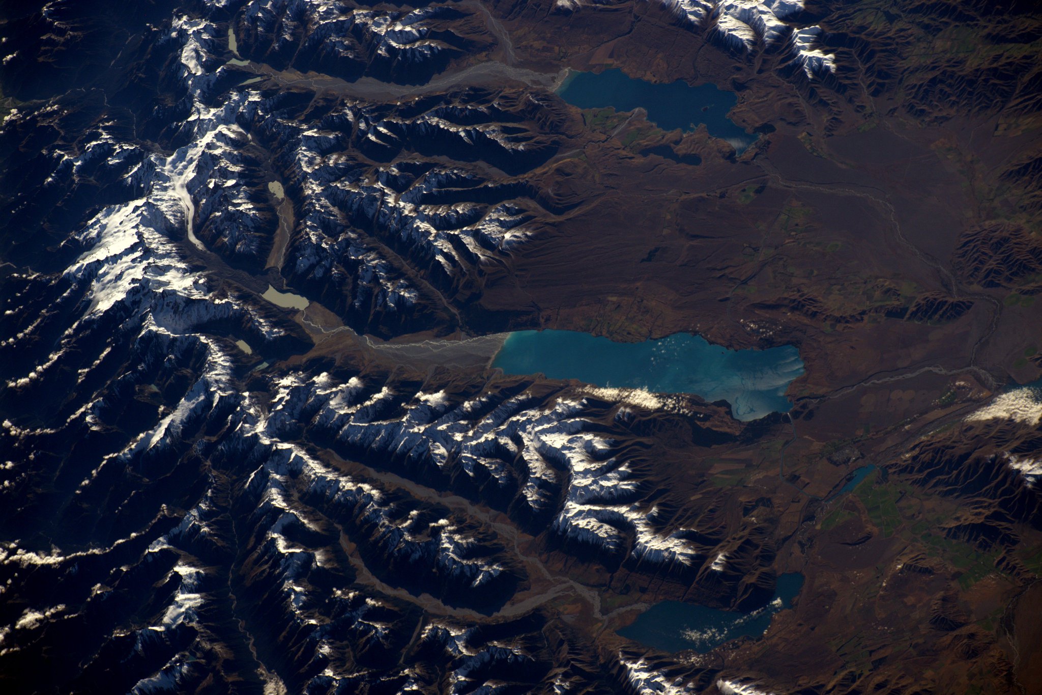
プカキ湖は、アオラキ/マウント・クックに源を発するタスマン氷河やフッカー氷河を経て、タスマン川、フッカー川によって北端から水が供給されています。氷河から供給される川の水は、これらの湖に氷河粉(氷河からの極度に細かく砕かれた岩粉)によって作り出される独特な青色をもたらしています。現在この湖は、13.8メートルの操作範囲で水面を人工的に上下させることができ、その結果、1,600GWhのエネルギー貯蔵能力を持っています。
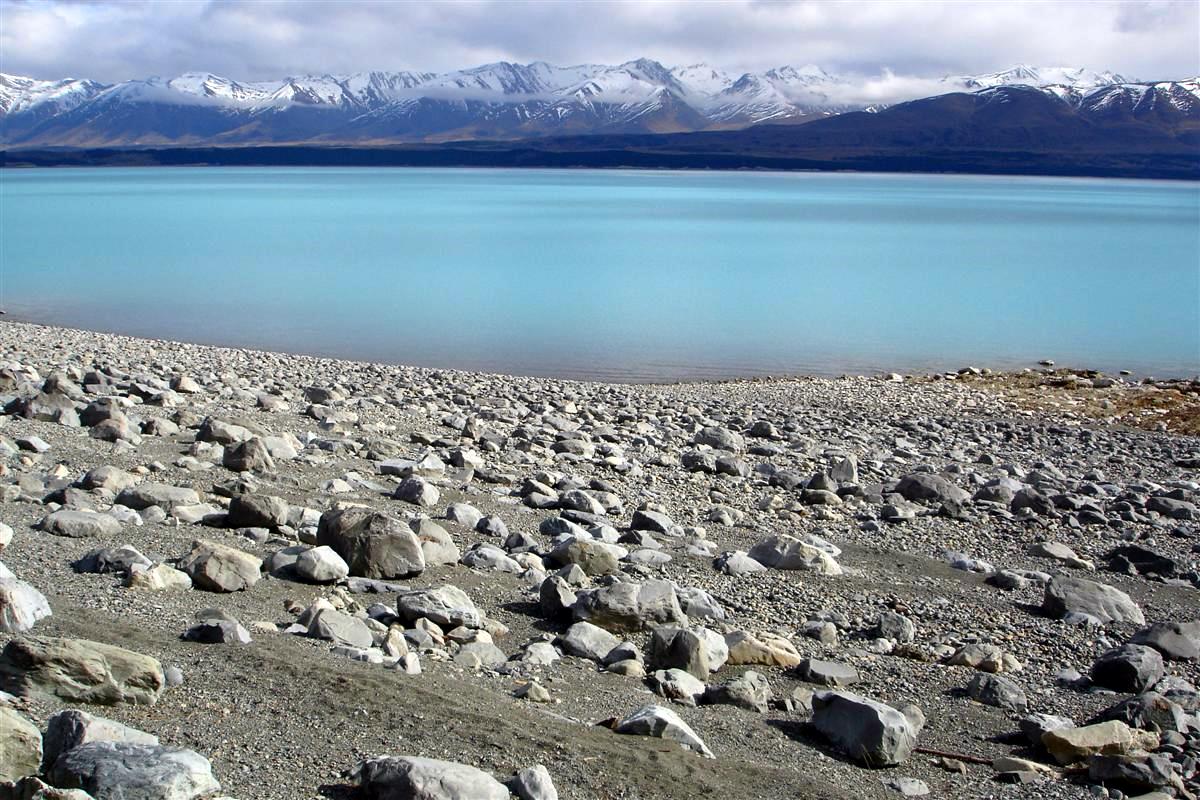
地上の様子はこちらです。
参考文献: Thomas Pesquet’s Tweet
ウェブ地球儀で地球俯瞰画像を見る: LiVEARTH
[Earthview Wonders] No.378: Lake Pukaki, New Zealand🇳🇿
Kia Ora! Astronaut Thomas Pesquet captured from ISS the Lake Pukaki of New Zealand.
Lake Pukaki is fed at its northern end by the braided Tasman River, which has its source in the Tasman and Hooker Glaciers, close to Aoraki / Mount Cook. The glacial feed to the lakes gives them a distinctive blue color, created by glacial flour, the extremely finely ground rock particles from the glaciers. The current lake has an operating range of 13.8 m (the level within which it can be artificially raised or lowered), giving it an energy storage capacity of 1,600GWh.
The local scenery on the ground is as follows.
Reference: Thomas Pesquet’s Tweet
See earthview photo gallery with web-globe: LiVEARTH[:en][Earthview Wonders] No.378: Lake Pukaki, New Zealand🇳🇿
Kia Ora! Astronaut Thomas Pesquet captured from ISS the Lake Pukaki of New Zealand.
Lake Pukaki is fed at its northern end by the braided Tasman River, which has its source in the Tasman and Hooker Glaciers, close to Aoraki / Mount Cook. The glacial feed to the lakes gives them a distinctive blue color, created by glacial flour, the extremely finely ground rock particles from the glaciers. The current lake has an operating range of 13.8 m (the level within which it can be artificially raised or lowered), giving it an energy storage capacity of 1,600GWh.
The local scenery on the ground is as follows.
Reference: Thomas Pesquet’s Tweet
See earthview photo gallery with web-globe: LiVEARTH[:]