[:ja]NASAは11月9日、有人月探査ミッション「アポロ計画」で無人飛行を行った「アポロ4号」が、50年前の1967年11月9日に撮影した地球の画像を公開しました。画像にはブラジル沿岸部、大西洋、西アフリカ、南極大陸が捉えられています。
アポロ4号は月への有人飛行ミッションのための、大気圏再突入のテストフライトでした。本画像は高度約1万5,400kmの楕円軌道の遠地点から70mmカメラで撮影されたものです。
参考文献: Earth as Viewed From 10,000 Miles
ウェブ地球儀で地球俯瞰画像を見る: LiVEARTH
[Earthview Wonders] No.379: Earth From Apollo 4
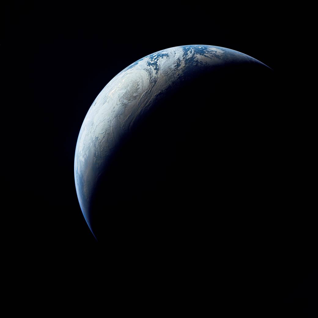
On Nov. 9 NASA released a photo of the Earth captured exactly 50 years by Apollo 4. Coastal Brazil, the Atlantic Ocean, West Africa and Antarctica are seen in the image.
Apollo 4 was the uncrewed test flight of translunar motors and high speed re-entry back from the Moon. The image was captured from high apogee at an altitude of 15,400km by 70mm camera.
Reference: Earth as Viewed From 10,000 Miles
See earthview photo gallery with web-globe: LiVEARTH
[:en][Earthview Wonders] No.379: Earth From Apollo 4
On Nov. 9 NASA released a photo of the Earth captured exactly 50 years by Apollo 4. Coastal Brazil, the Atlantic Ocean, West Africa and Antarctica are seen in the image.
Apollo 4 was the uncrewed test flight of translunar motors and high speed re-entry back from the Moon. The image was captured from high apogee at an altitude of 15,400km by 70mm camera.
Reference: Earth as Viewed From 10,000 Miles
See earthview photo gallery with web-globe: LiVEARTH
[:]