[:ja]大西卓哉宇宙飛行士がISSから撮影したインドネシアのタンボラ山です。
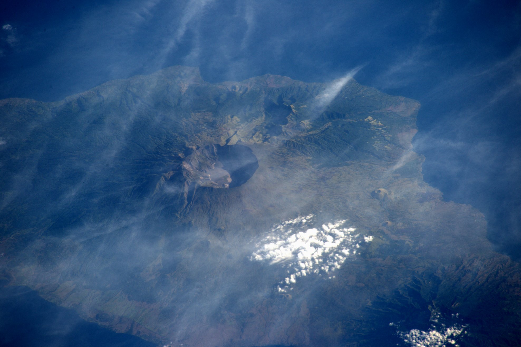
タンボラ山はインドネシア中南部、スンバワ島にある成層火山です。島の北側に突き出たサンガル半島の大部分を占めており、標高2,851mで、山頂には直径約6km、深さ約600mのカルデラがあります。1815年の大噴火は、過去2世紀に世界で記録されたもののうち最大規模でした。
地上の様子はこちらです。

参考文献: Takuya Onishi’s Post
ウェブ地球儀で地球俯瞰画像を見る: LiVEARTH
[Earthview Wonders] No.394: Mt. Tambora of Indonesia🇮🇩
Astronaut Takuya Onishi captured from ISS Mt. Tambora of Indonesia.
Mt. Tambora is an active stratovolcano and the highest mountain on the island of Sumbawa in Indonesia. After a large magma chamber inside the mountain filled, volcanic activity reached a climax with the catastrophic eruption of 1815, the second largest one in the past 2 centuries.
The local scenery on the ground is as follows.
Reference: Takuya Onishi’s Post
See earthview photo gallery with web-globe: LiVEARTH[:en][Earthview Wonders] No.394: Mt. Tambora of Indonesia🇮🇩
Astronaut Takuya Onishi captured from ISS Mt. Tambora of Indonesia.
Mt. Tambora is an active stratovolcano and the highest mountain on the island of Sumbawa in Indonesia. After a large magma chamber inside the mountain filled, volcanic activity reached a climax with the catastrophic eruption of 1815, the second largest one in the past 2 centuries.
The local scenery on the ground is as follows.
Reference: Takuya Onishi’s Post
See earthview photo gallery with web-globe: LiVEARTH[:]