[:ja]NASAの地球観測衛星Landsat 8が撮影した北カスピ海の様々な氷の様子です。
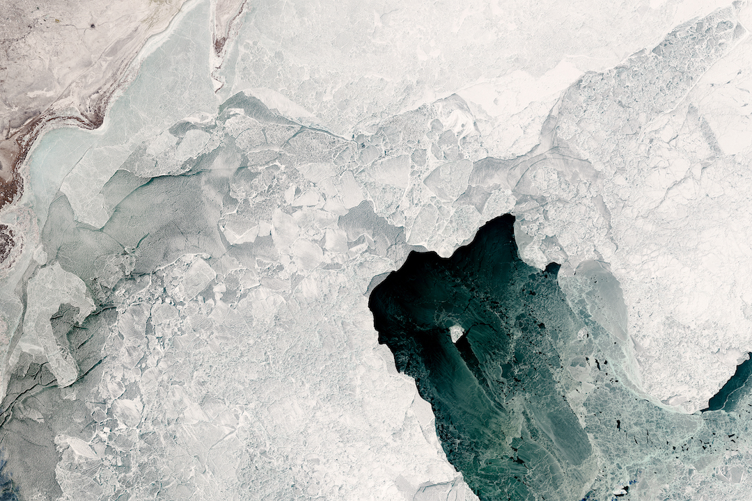
カスピ海は北のカザフスタンから南のイランまで1,000kmにも広がる塩湖で世界最大の湖です。北部の方が気温が低く、水が淡水に近く浅いため、冬期に湖が凍りやすくなっています。画像左上はカザフスタン西部です。沿岸部の氷はしっかり凍り、白く見えている一方、沖合の氷は一部が凍っているだけで、灰色がかっています。
地上の様子はこちらです。
参考文献: Grounded in the Caspian Sea
ウェブ地球儀で地球俯瞰画像を見る: LiVEARTH
[Earthview Wonders] No.411: Ice of Caspian Sea
NASA’s Landsat 8 satellite captured northern Caspian Sea where the variety of ice types can be observed.
Caspian Sea stretches about 1,000km from Kazakhstan in the north to Iran in the south. Temperatures are colder in the northern Caspian, and the water is fresher (less saline) and shallower. As a result, northern areas are more prone to freezing in wintertime.
The image shows a well-developed expanse of consolidated ice appears white just offshore while a large field of old, hummocked, white and gray-white ice has detached farther offshore.
The local scenery on the ground is as follows.
Reference: Grounded in the Caspian Sea
See earthview photo gallery with web-globe: LiVEARTH[:en][Earthview Wonders] No.411: Ice of Caspian Sea
NASA’s Landsat 8 satellite captured northern Caspian Sea where the variety of ice types can be observed.
Caspian Sea stretches about 1,000km from Kazakhstan in the north to Iran in the south. Temperatures are colder in the northern Caspian, and the water is fresher (less saline) and shallower. As a result, northern areas are more prone to freezing in wintertime.
The image shows a well-developed expanse of consolidated ice appears white just offshore while a large field of old, hummocked, white and gray-white ice has detached farther offshore.
The local scenery on the ground is as follows.
Reference: Grounded in the Caspian Sea
See earthview photo gallery with web-globe: LiVEARTH[:]